QUICK-LOOK FORECAST:
- Heat Advisory until 8pm
- Passing shower or storm today
- Dry and less humid weekend
>>TRACK THE LATEST CONDITIONS: Live Doppler 7 Radar
DETAILED FORECAST:
TONIGHT: Some isolated showers and downpours will be possible tonight as a front moves through, according to Storm Center 7 Meteorologist Kirstie Zontini.
A few storms can produce very heavy rain and gusty winds. This activity will die down after sunset.
Lows tonight will drop into the 70s overnight.
>> Dangerous heat: Do’s and don’ts for car safety during scorching temperatures
FRIDAY: We could see clouds and showers south of Dayton to start but will clear out for sunshine and not as muggy. Highs will be in the upper 80s.

SATURDAY: A big break from the humidity! Highs are expected to reach the upper 70s with sunshine and a few clouds.
SUNDAY: A great day with highs in the low 80s. It will be mostly sunny and dry. There is a very low chance of a shower at night.
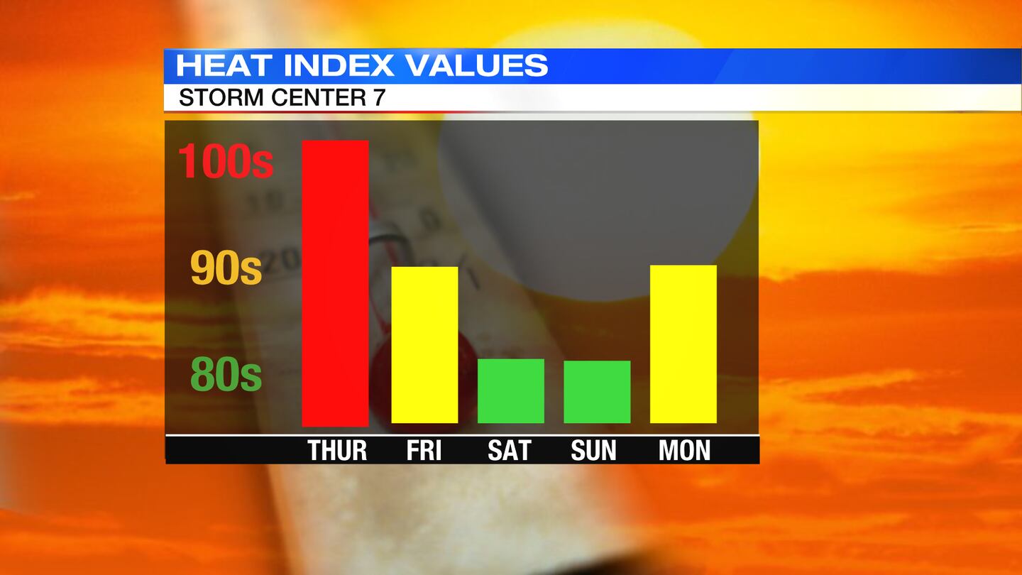
MONDAY: Another overall nice day but it will begin to warm up again. Highs will be 90. We could see a passing shower north but most spots will stay dry.
TUESDAY: Hot and humid again with highs in the low 90s. It will be very muggy again; we will see sunshine and a few clouds.
WEDNESDAY: Another hot one with highs in the middle 90s. There will be sunshine early then some afternoon clouds and the chance for a passing thunderstorm.
©2022 Cox Media Group