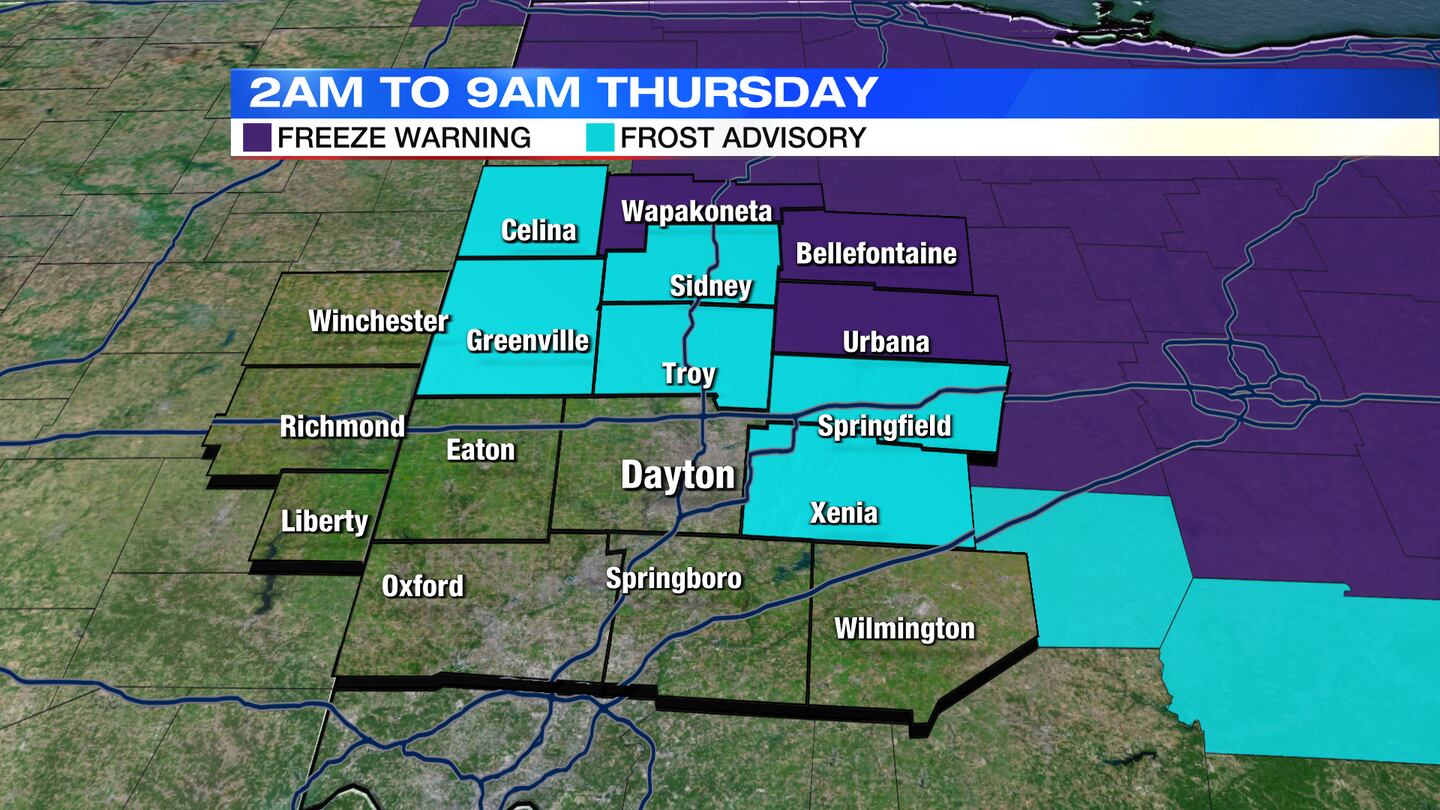
A Freeze Warning has been issued for Auglaize, Logan and Champaign counties from 2 a.m. to 9 a.m. Thursday.
A Frost Advisory has been issued for Clark, Darke, Greene, Miami, Mercer and Shelby counties from 2 a.m. to 9 a.m. Thursday.
QUICK-LOOK FORECAST:
- Frost Advisory/Freeze Warning for some tonight
- Gradual warm-up ahead
- Few showers possible this weekend
>> TRACK THE CONDITIONS: Live Doppler 7 Radar
DETAILED FORECAST:
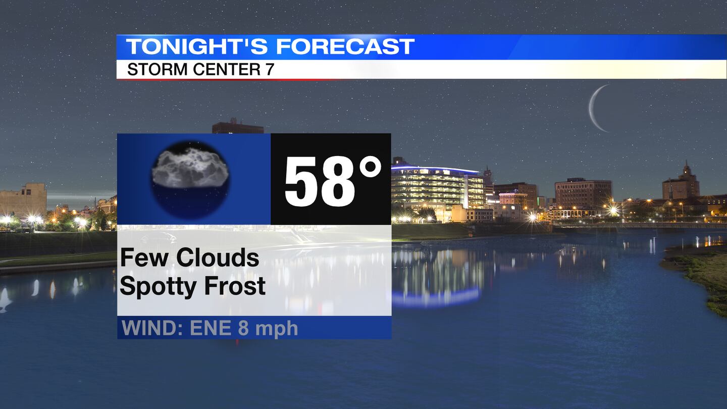
TODAY: A few clouds arrive tonight but staying dry. Temperatures will fall back into the lower 30s with patchy frost possible by morning.
>> Frost Advisory vs. Freeze Watch vs. Freeze Warning: What’s the difference?
THURSDAY: Another cold morning with a round of patchy frost possible. A few more clouds around for Thursday, but the weather stays mostly dry. A stray shower is possible late day. Still cooler than normal with a high in the upper 50s.
FRIDAY: Partly sunny and mild for Friday with highs in the lower 60s. Chance of a few showers southwest Friday night.
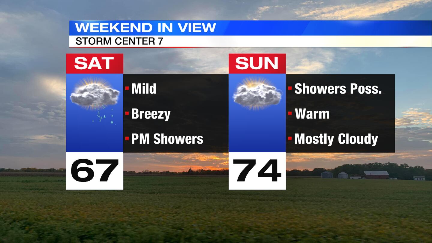
SATURDAY: Clouds increase quickly on Saturday with some showers developing by late afternoon into Saturday night. Highs for the day reach the middle to upper 60s.
SUNDAY: Mostly cloudy with a few showers or thunderstorms possible on Sunday. It will be a warmer day with highs in the lower 70s.
MONDAY: Mostly cloudy with a few showers and thunderstorms returning, mainly late day into Monday night. Highs in the lower 70s.
TUESDAY: Mostly cloudy with a few showers and storms. Highs in the lower 70s.
WEDNESDAY: Mostly cloudy and seasonable. Chance of a few showers. Highs in the upper 60s.
©2022 Cox Media Group


