
DAYTON — High pressure has set up just to the west of the Miami Valley allowing for more of a northwest wind. This keeps us dry and the air not as humid. Not only that, but temperatures will remain below average throughout the rest of the week and into the next. The temperature drop isn’t just a result of a northerly wind shift, but a reinforcing cold front.
[DOWNLOAD: Free Storm Center 7 Weather app for alerts as news breaks]
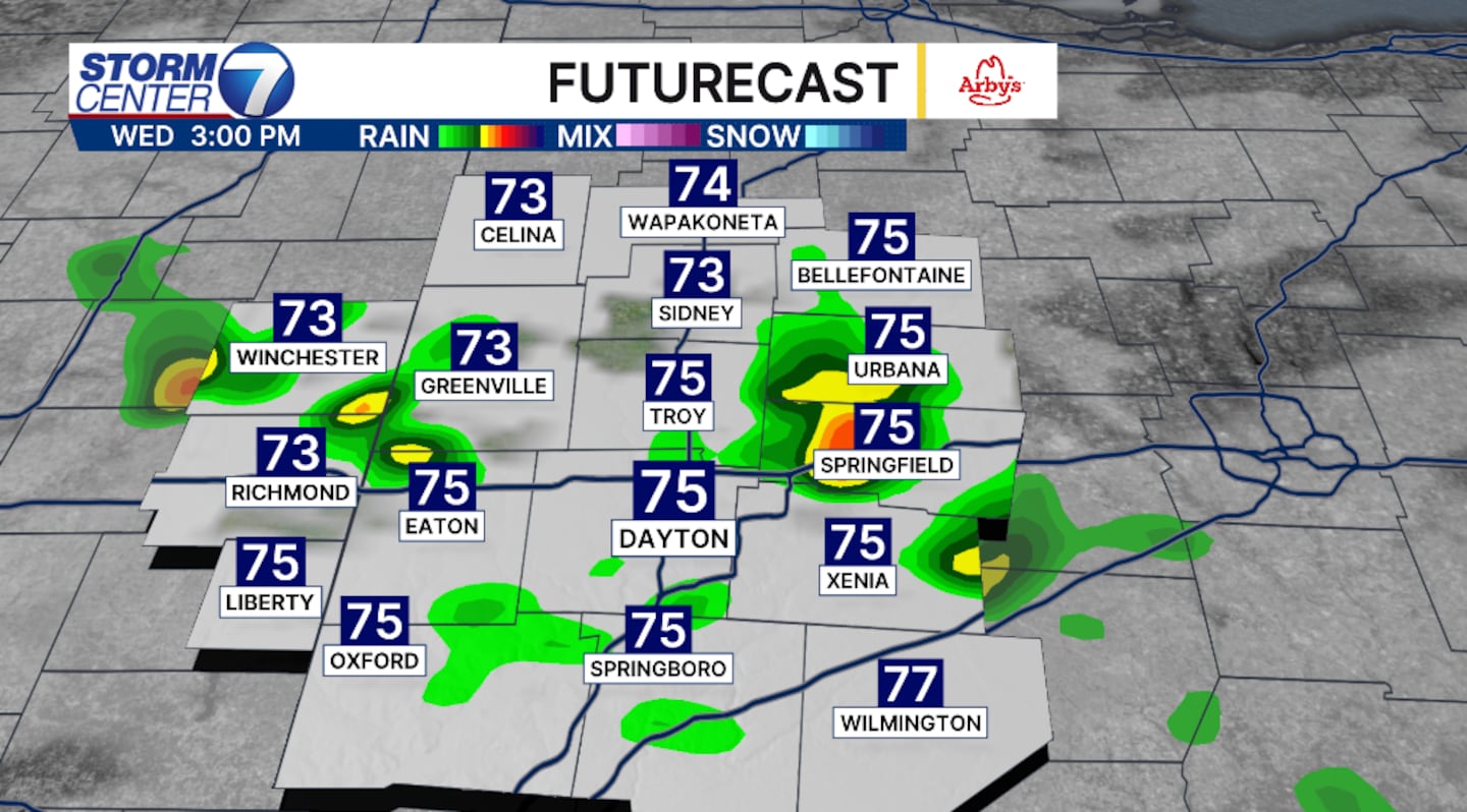
The next cold front will also increase the chance for rain. The rain and storm chance will arrive Wednesday. While there is a slight chance for a few showers early Wednesday north of I70, most will stay dry until late afternoon and early evening. The storm chances are very scattered. This will not be anything like the Valley experienced last week.
[WATCH Storm Center 7 Weather on the following devices]
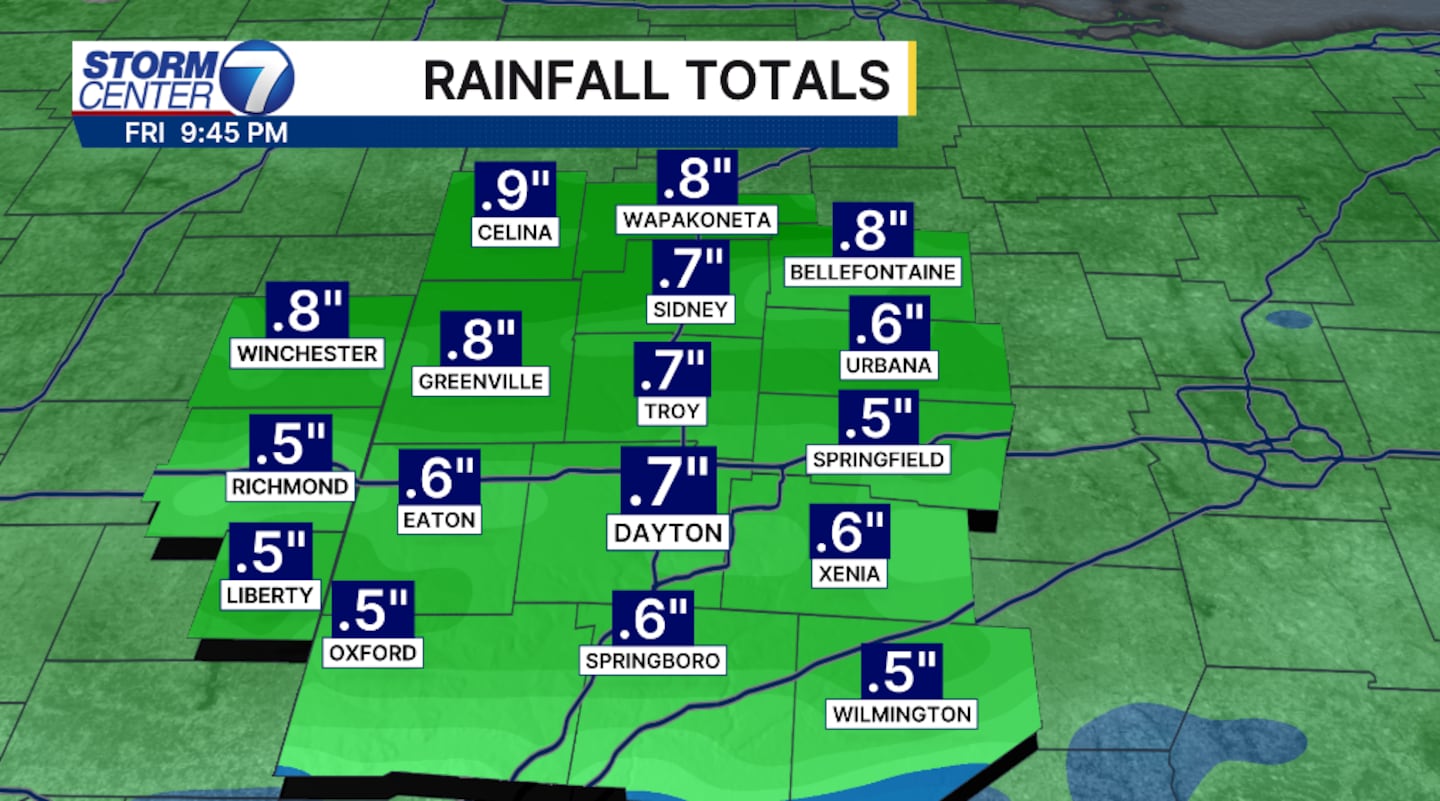
Severe weather chances are low, but a few storms have the potential to bring gusty winds. Rainfall totals will amount to roughly a half an inch to an inch through Thursday. Additional rainfall is forecast throughout the weekend.
©2026 Cox Media Group


