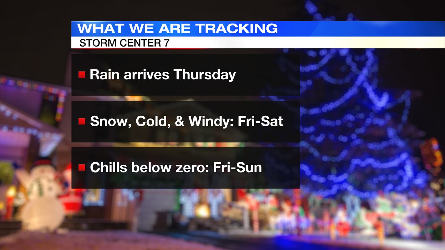
QUICK-LOOK FORECAST:
- Rain arrives on Thursday
- Cold, snowy & windy Friday - Saturday
- Wind chills below zero Friday - Sunday
>> TRACK THE CONDITIONS WITH LIVE DOPPLER 7
DETAILED FORECAST:
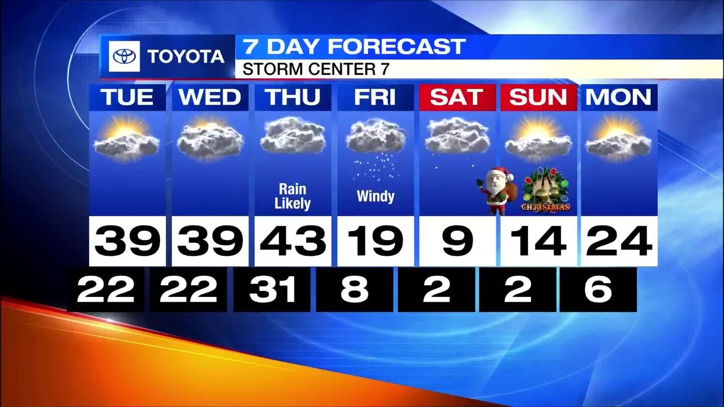
TONIGHT: Storm Center 7 Meteorologist McCall Vrydaghs says it will be mostly cloudy, but dry. Temperatures will fall to the lower 20s.
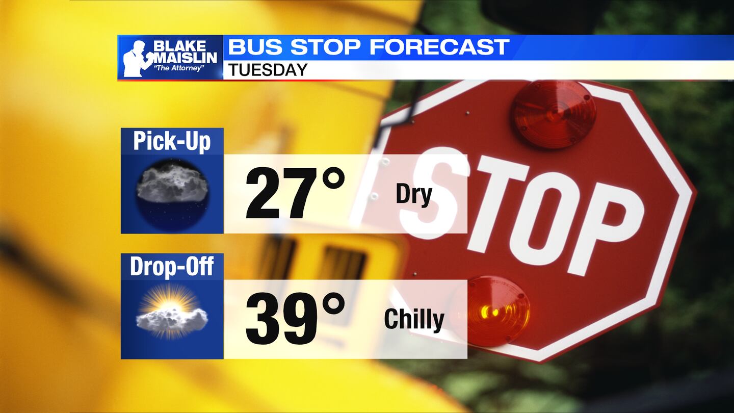
TOMORROW: Another quiet day with a mix of sun and clouds. Highs expected in the upper 30s. Mostly cloudy and chilly again Tuesday night with a low back into the lower 20s.
WEDNESDAY: Cold morning in the lower 20s. Clouds increase through the day. Highs in the upper 30s.
THURSDAY: Cloudy with occasional showers. Becoming breezy, too. Highs reach the upper 40s.
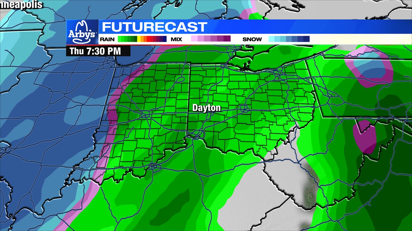
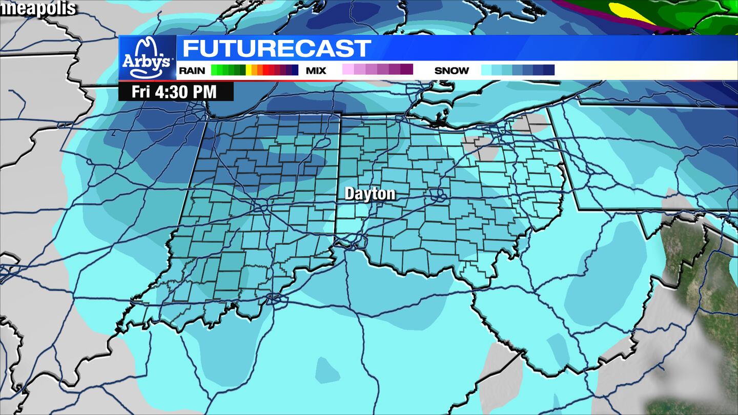
Rain changes to snow Thursday night as frigid air arrives with some gusty winds. Temperatures will fall to the single digits by Friday morning.
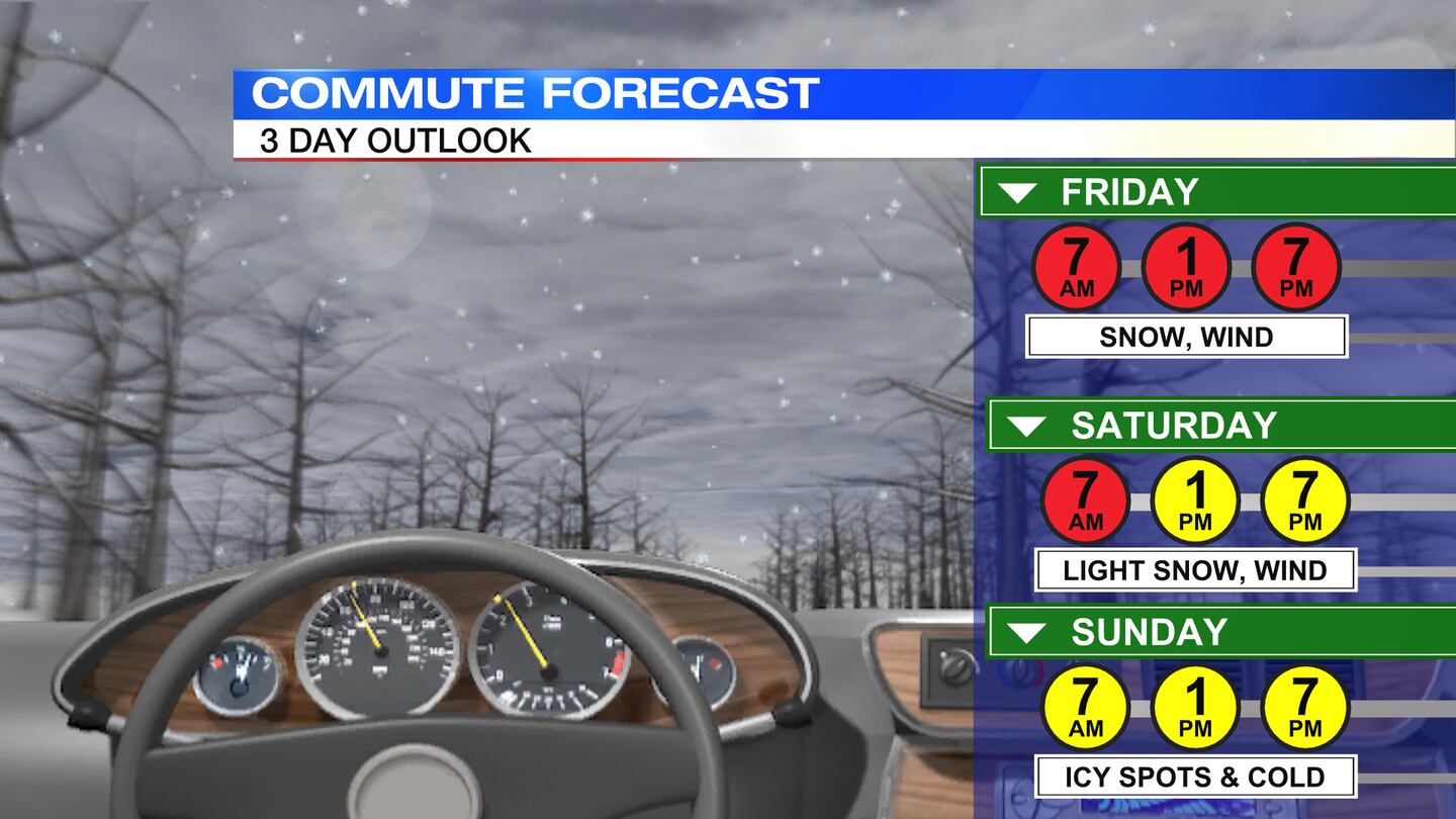
FRIDAY: Scattered snow showers likely throughout the day. While snow accumulation will be light, slick spots are possible.
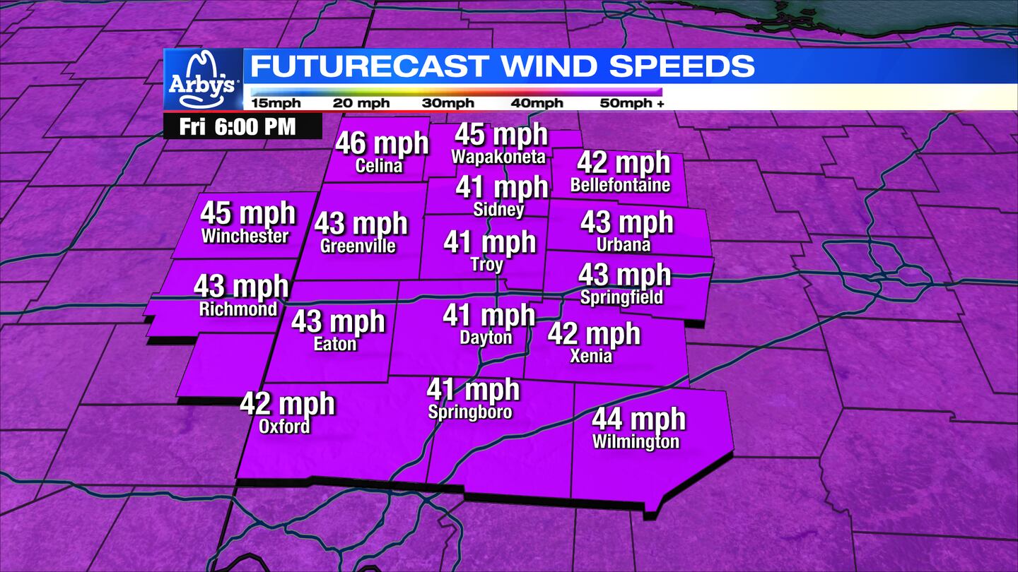
Winds may gusts up to 40 to 50 mph. These winds will create blowing and drifting snow that will keep roads snow covered in spots and cause visibility to drop at times.
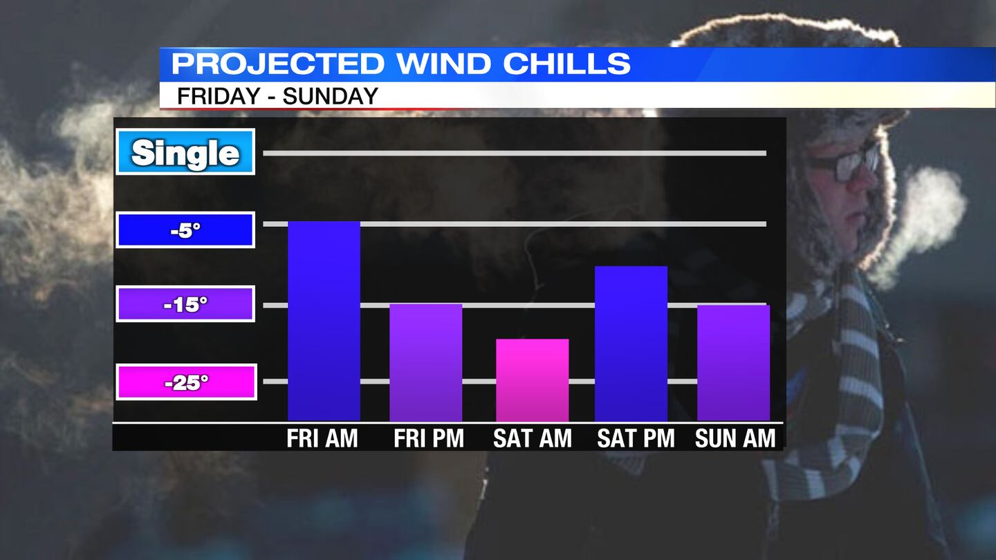
Temperatures will be very cold in the single digits and teens, but will feel much colder due to the winds. In fact, wind chills will fall below zero and stay there all day.
CHRISTMAS EVE: Mostly cloudy, still windy, and cold. A few more flurries or snow showers will be possible. Temperatures will be in the single digits with wind chills below zero.
CHRISTMAS: A frigid Christmas this year. Lows around 2 degrees and highs in the middle teens. Wind chills will dip below freezing again, especially early and again at night.
MONDAY: A very cold morning in the single digits. Not as frigid as winds relax. Highs on Monday will climb to the lower to middle 20s with partly cloudy skies.

©2022 Cox Media Group