
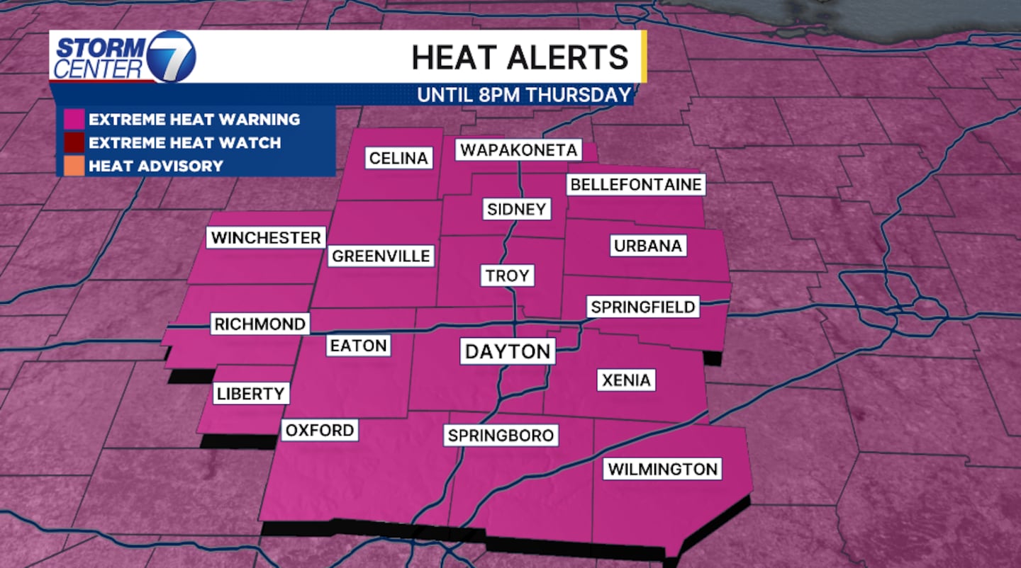
DAYTON — High temperatures remain above normal with forecast highs pushing into the low to middle 90s into Saturday. Dew point temperatures will hold in to the low to middle 90s.
[DOWNLOAD: Free Storm Center 7 Weather app for alerts as news breaks]
The heat index takes into consideration the amount of sunshine, relative humidity and actual air temperature. These parameters are thown into a long equation and the “feels like” temperatures is generated. With temperatures forecast near 95 degrees over the next two days, your heat index is forecast near 110 degrees.
Don’t go outside if you don’t have too!
Air quality will suffer as a result of the thick stagnant air. Those of us with asthma or COPD will have a difficult time breathing.
[WATCH Storm Center 7 Weather on the following devices]
The weekend will show some cooling, but it comes with the chance for rain. Right now, Friday shows a very scattered chance late afternoon and evening. Another chances and unfortunately a high chance for stronger storms arrives Saturday late afternoon and evening.
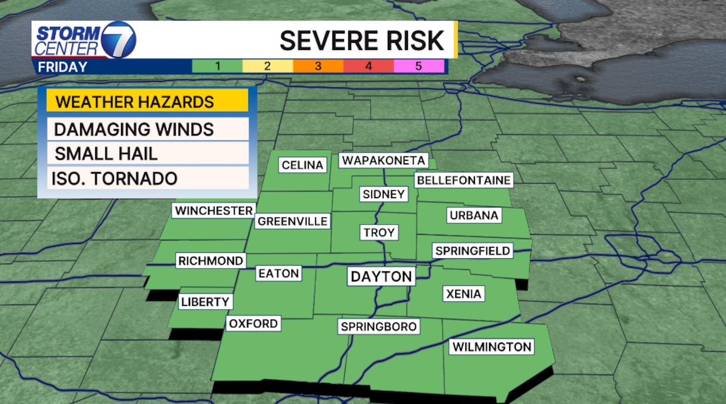
The Storm Predicition Center (SPC) has a marginal risk for severe storms. Wind will be the priamry threat with the scattered storms. Isolated tornadoes can’t be ruled out, but the threat is low.
©2026 Cox Media Group


