
DAYTON — Good late evening, everyone! Meteorologist Nick Dunn here with you on a bitterly cold Sunday night! Temperatures have already dropped into the lower single digits. So far, as of 10:30 PM, nobody has officially hit or dropped below zero!
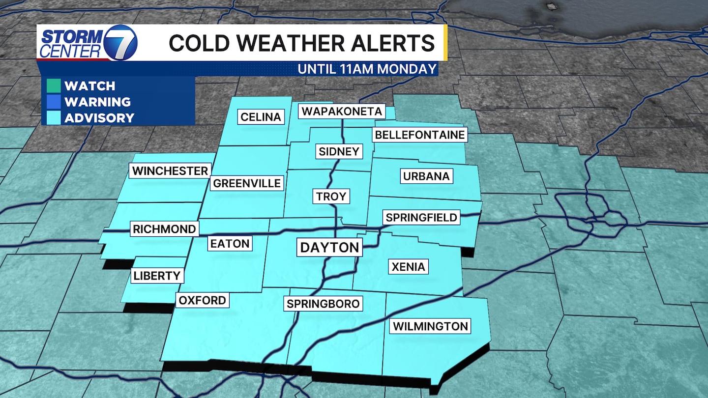
A Cold Weather Advisory continues through 11:00 AM Monday morning. Wind chills of -10 degrees or colder can be expected before we see some modest improvement into the afternoon on Monday.
[DOWNLOAD: Free Storm Center 7 Weather app for alerts as news breaks]

Expect the wind chills to hover around -10 to -15 through mid-morning. We should see wind chills climb just above zero by early afternoon. The biggest concern is the frostbite can set in within 30 minutes if you are not properly equipped for the weather conditions!
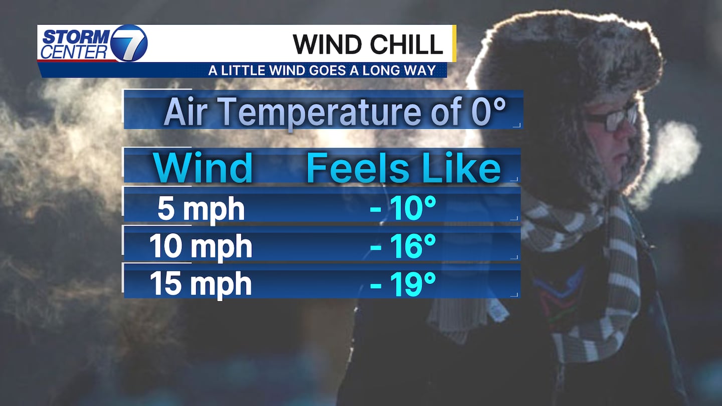
When we drop to zero degrees, a little wind goes a long way to making the conditions that much more dangerous. Even a 5 mile per hour wind takes the wind chill down to -10 degrees.
The wind chill is viewed as a more improtant number this time of year as that is what it feels like to your exposed skin. Our bodies lose heat through convection and when the wind is blowing that layer of heat around us is broken up.
[WATCH Storm Center 7 Weather on the following devices]
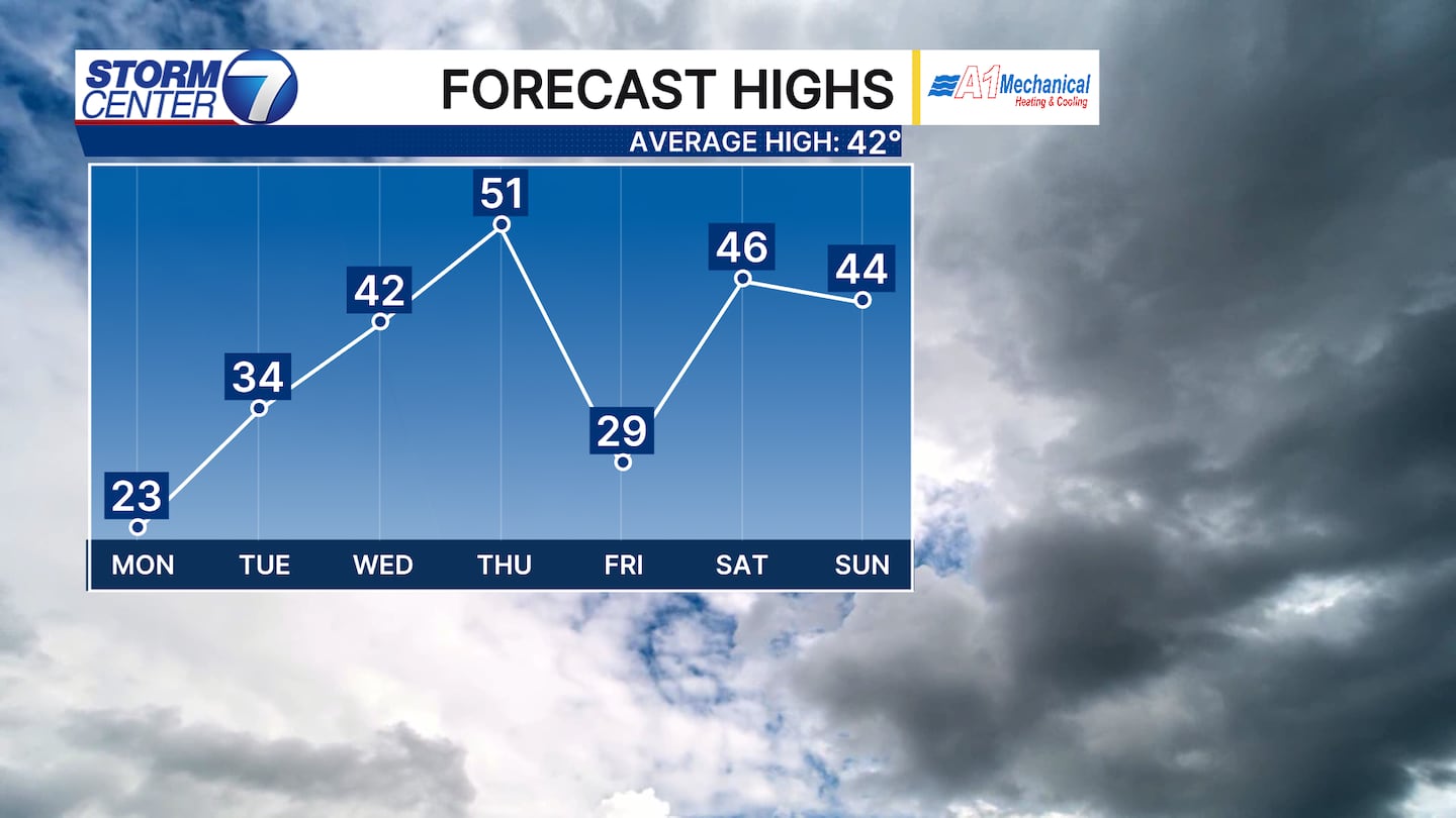
We have a solid thawing out period ahead for us as highs climb by 10 or so degrees each day through Thursday! That snow will become a distant memory by then!
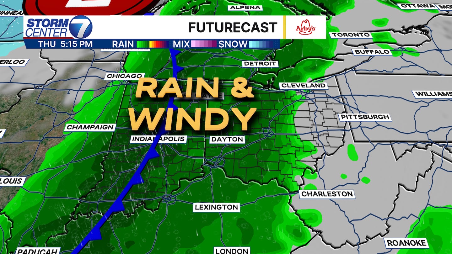
Our next system on Thursday with highs around 50 will bring rain showers and windy conditions! While temperatures tumble briefly behind this front, I am happy to report no extreme cold exists on the horizon after tonight! Stay warm and safe, everyone!


