
DAYTON — Ingredients are coming together for the potential for severe weather late week and into the weekend.
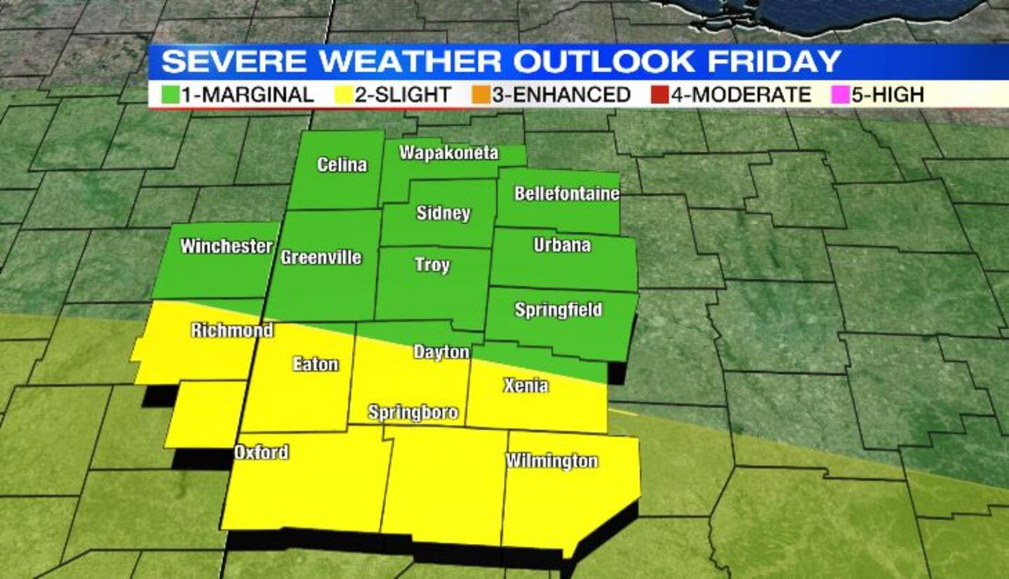
The Storm Prediction Center (SPC) has the Miami Valley under a marginal (Level 1 of 5) risk for Thursday into Friday and a slight chance (level 2 or 5) for Friday into Saturday.
Timing for the severe weather seems to be all over the place with the weather model, but what we can say is that the strongest of the storms could arrive late Thursday into Friday and again late Friday into Saturday.
As of now, Thursday into Friday’s risk is very low. The greater risk for severe weather will likely fall Friday into Saturday. Most models agree with that scenario. The severity for late Friday is all dependent on the first round of storms that will linger into the morning on Friday.
If the atmosphere can rebound, and see enough sunshine, there could be enough energy to produce severe storms late Friday afternoon and into the evening hours.
>> Download Storm Center 7 Weather App
The National Weather Service (NWS) out of Wilmington has issued a hazardous weather statement because of the threat of damaging winds and small hail. However, isolated tornadoes can’t be ruled out.
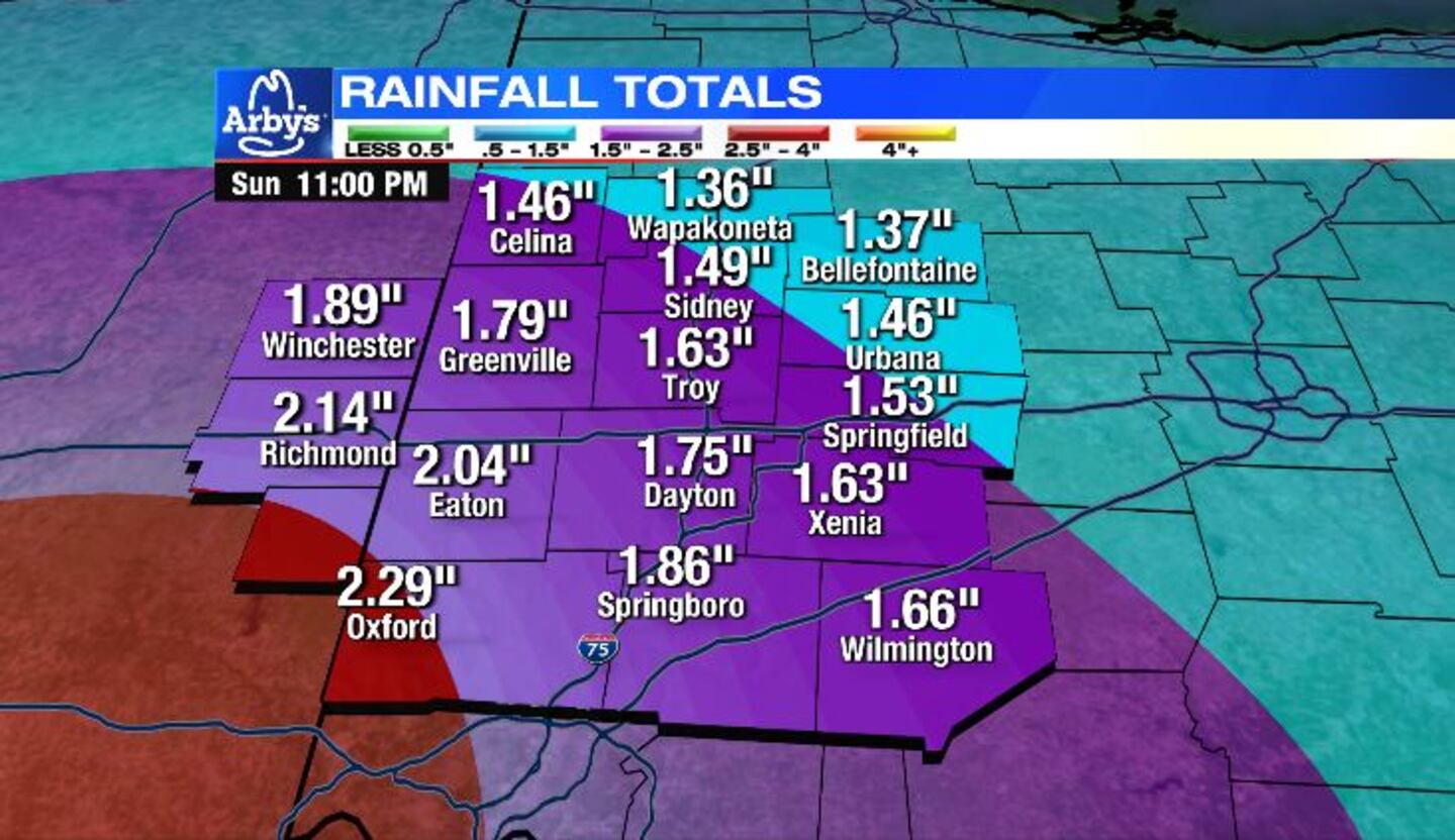
With the threat of potential severe weather late week, we also have the threat of isolated flash flooding. Heavy, steady rain becomes more likely Friday into Saturday.
The Miami Valley is expected to receive 1 to 2 inches of rain between now through Sunday. There are some areas that could see over two inches of rain.
© 2023 Cox Media Group


