>> Chief Meteorologist McCall Vrydaghs interviews first black woman astronaut
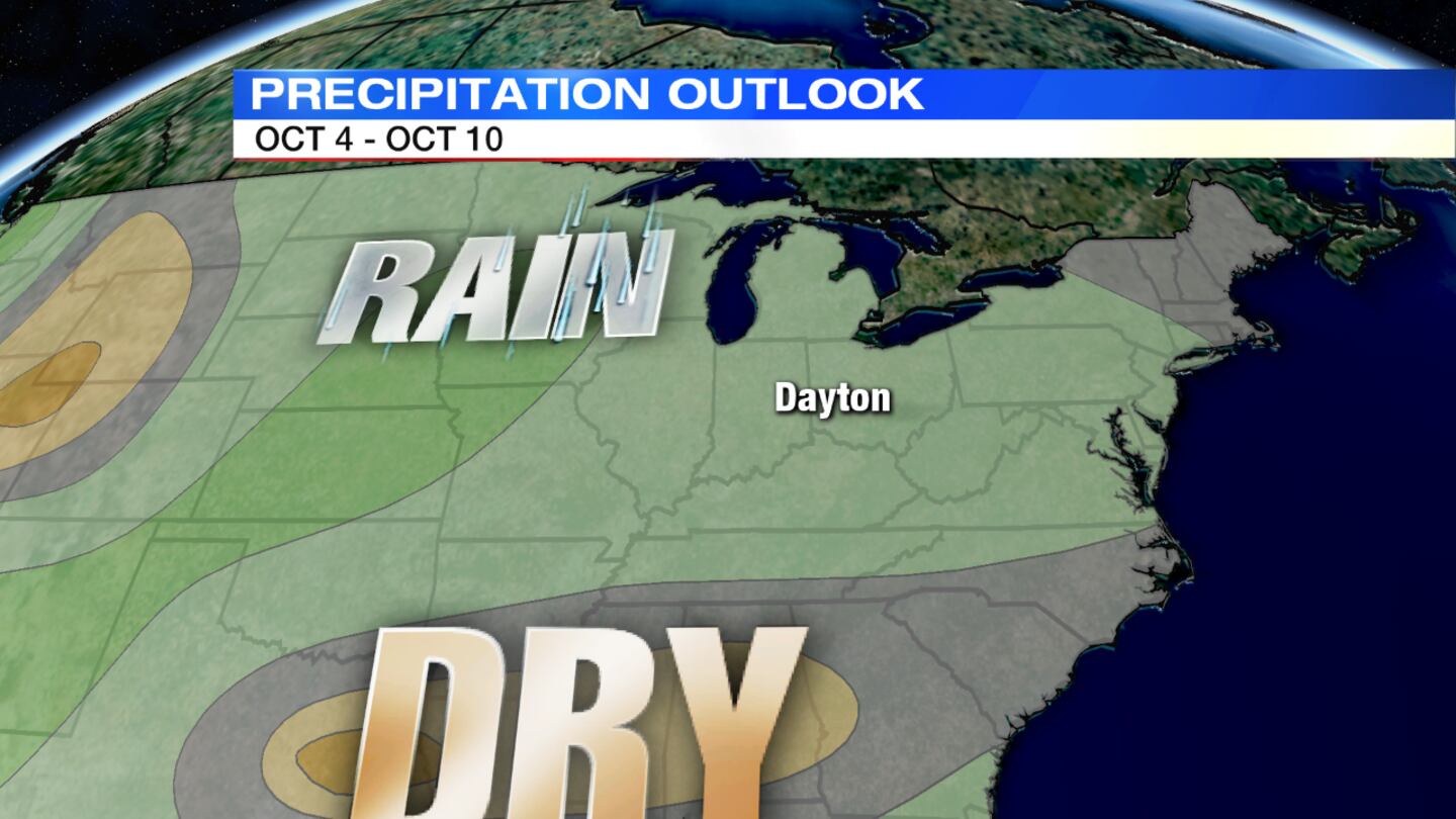
QUICK-LOOK FORECAST
- Isolated/passing shower possible tonight
- Possible record breaking highs next week
- Low chances for rain
>> Touchdown 7 Forecast: Week 5
DETAILED FORECAST
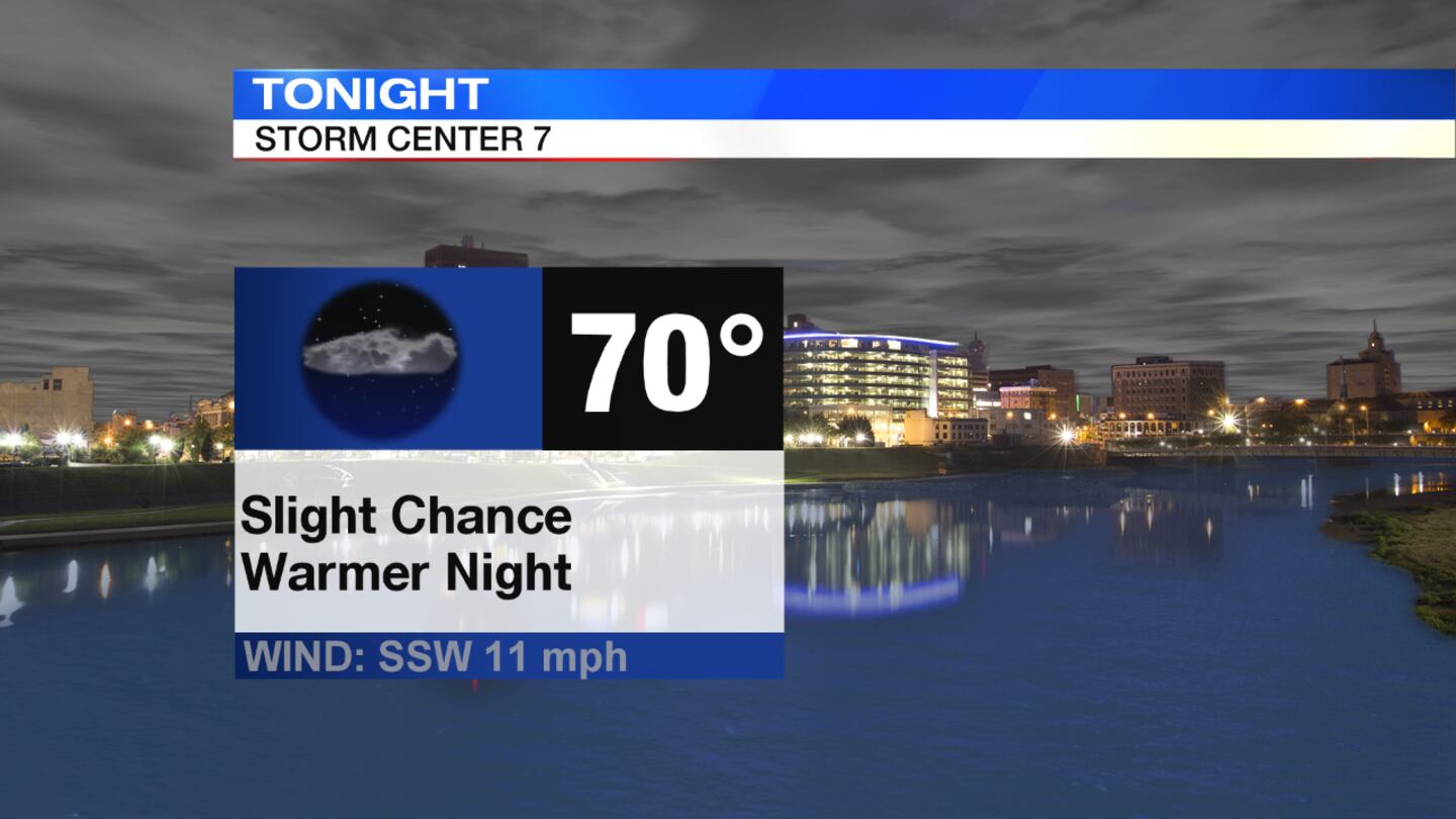
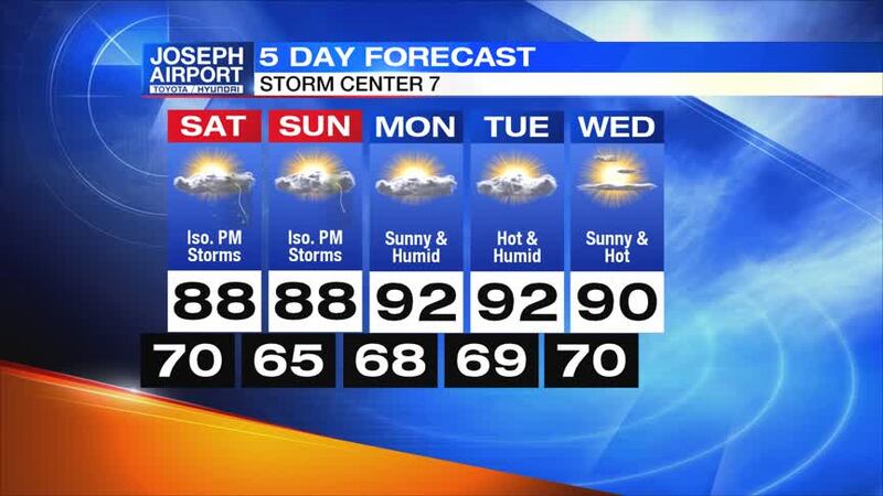
This evening/overnight: It will be partly cloudy, warm and breezy this evening with temperatures in the 80s. A few isolated passing showers are possible across the northwest, and a slightly better chance for a few showers may work through the area in the north overnight. Little to no rain is expected in most areas south, but temperatures will still stay on the warmer side near 70 degrees for the low.
>> Live Doppler 7 Interactive Radar
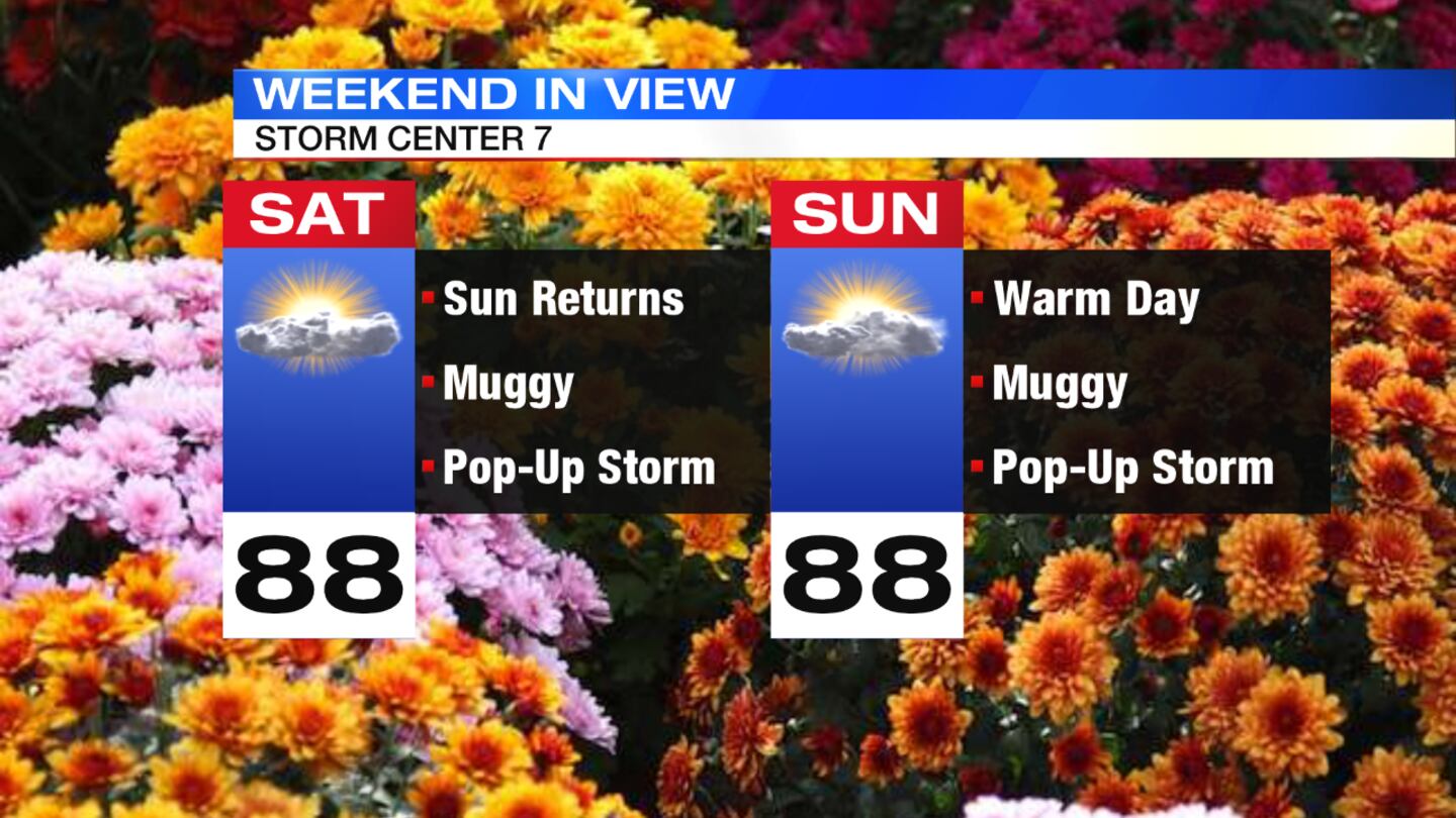
Saturday: It will be hot and to start the weekend with highs in the upper 80. It will also be muggy with sunshine and a few clouds. We could see a pop up downpour towards evening. It will be mild overnight as a few clouds will linger with highs in the middle 60s.
Sunday: We will have another hot, humid and muggy day in the upper 80s. It will stay dry with only a slight chance of a shower or storm.
>> September hasn’t started this warm in 80 years: What to know
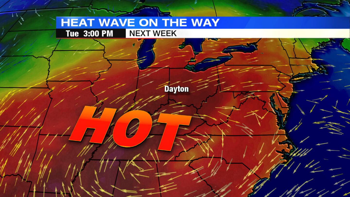
Monday and Tuesday: Highs will soar to 90 which is close to the record for both days. It will stay dry and be muggy so the heat index will reach the low to mid 90s.
Wednesday: It will be mostly sunny, hot and humid as the third consecutive day in the 90s, making this a heat wave. It will be a bit windy at times with heat index values in the lower to middle 90s again.


