QUICK-LOOK FORECAST:
- Milder the next few days
- Stray shower Thursday night
- Much cooler end to the week
>> TRACK THE CONDITIONS WITH LIVE DOPPLER 7
DETAILED FORECAST:
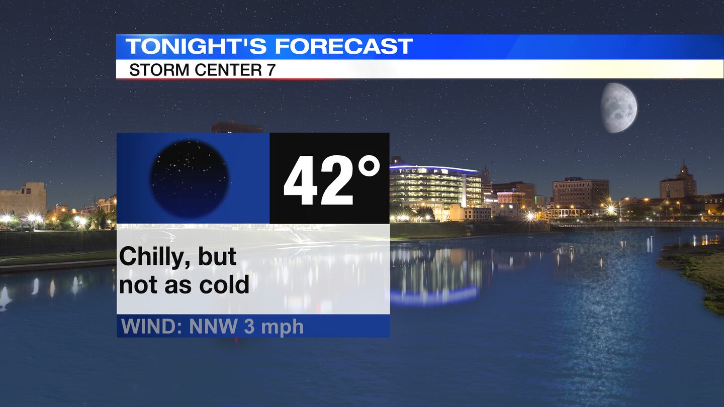
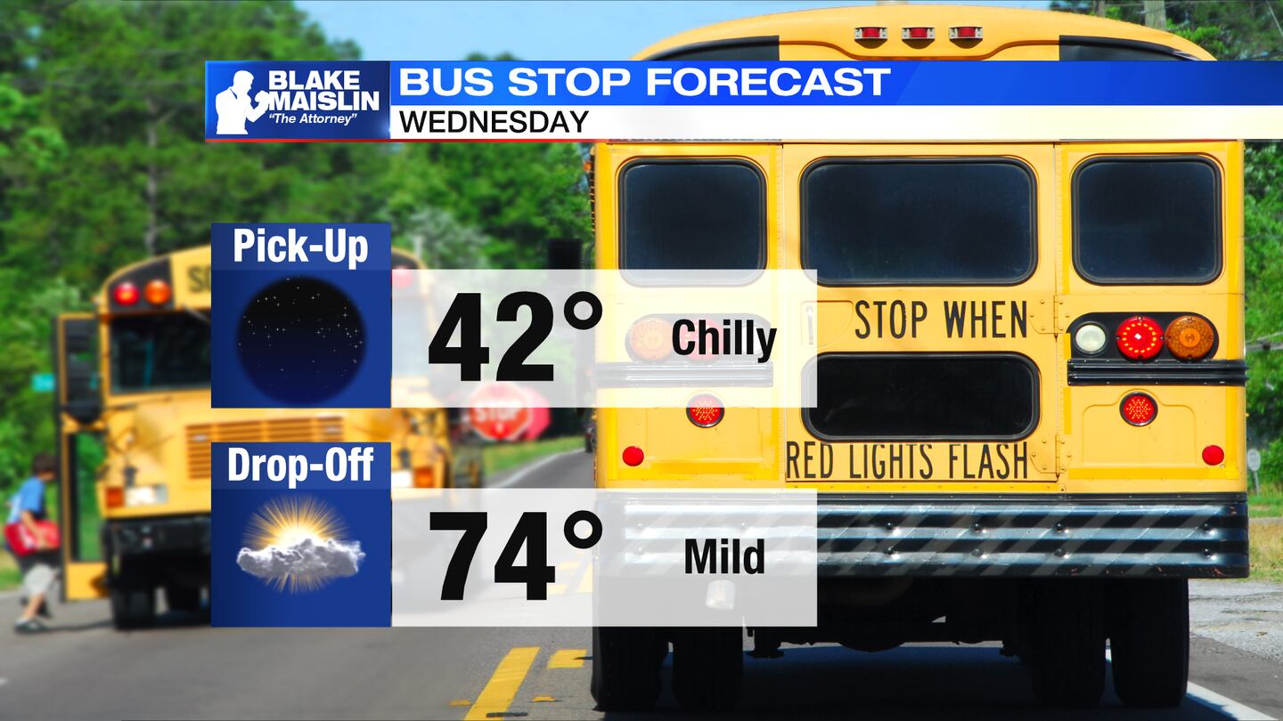
OVERNIGHT: Clear skies and chilly, but not as cold as last night . Overnight temperatures will fall to the lower 40s with some spots north possibly dipping into the upper 30s, according to Storm Center 7 Chief Meteorologist McCall Vrydaghs.
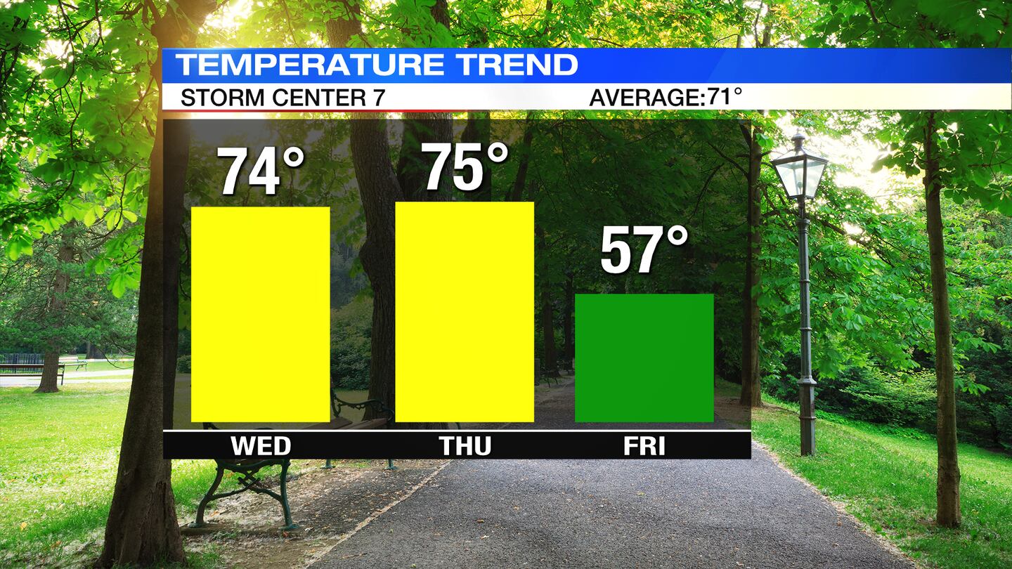
WEDNESDAY: A chilly start to the day, but dry with lots of sunshine. Afternoon temperatures will be quite nice, with highs expected near the mid-70s. A few clouds arrive Wednesday night, but staying dry. Lows near 50 degrees.
THURSDAY: Clouds increase from northwest to southeast through the day as a cold front approaches. Temperatures will rise to a high in the mid-70s, then drop drastically into the night as the front passes. A stray shower or sprinkle is possible with the front into early Friday.
FRIDAY: Waking up to clouds and a possible stray sprinkle, along with temperatures in the 40s. A slight bump in temperatures is expected in the afternoon with a high reaching only the middle to upper 50s. It will feel even cooler as it will be a bit breezy at times. Skies clear for Friday night and temperatures will fall into the 30s.
SATURDAY: A frosty morning for Saturday with temperatures in the lower to middle 30s. It will be a sunny, but chilly afternoon with highs in the upper 50s.
SUNDAY: Another cold morning with patchy frost and temperatures in the 30s. A touch milder for the afternoon with highs in the lower 60s.
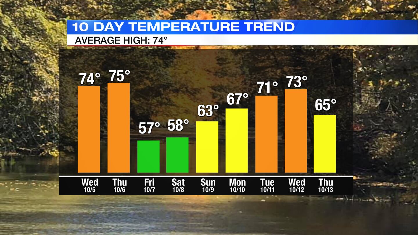
MONDAY: Sun and a few clouds, a few showers possible. Highs are around 70.
TUESDAY: Partly sunny and mild with highs in the lower 70s. Slight chance of a stray shower.

©2022 Cox Media Group


