
Good afternoon to you on this Friday. Meteorologist Nick Dunn checking in with you after what was a very wet start to the morning for some.
Areas north of I-70 got anywhere from 0.5 to 3 inches of rain. We have more opportunities for rain into the weekend.
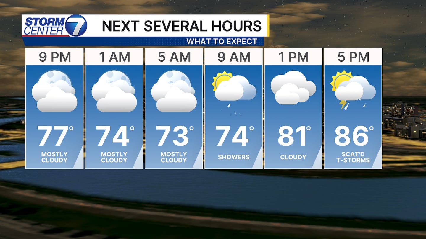
Tonight features lots of dry time, and some chances for patchy fog overnight. It stays warm and muggy with lows near 70 degrees.
[DOWNLOAD: Free Storm Center 7 Weather app for alerts as news breaks]
Moving into the weekend, there are some questions about exactly how widespread and intense the storms will be.
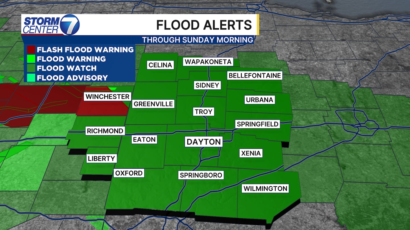
An area of low pressure sliding into the region will combine with a favorable atmosphere for showers and storms. A Flood Watch has been reissued for all of us through Sunday morning.
Additionally, a few strong to severe storms with damaging winds and a brief tornado are possible. The ceiling for this event, or worst case, is that we see widespread storms with heavy rain in most areas.
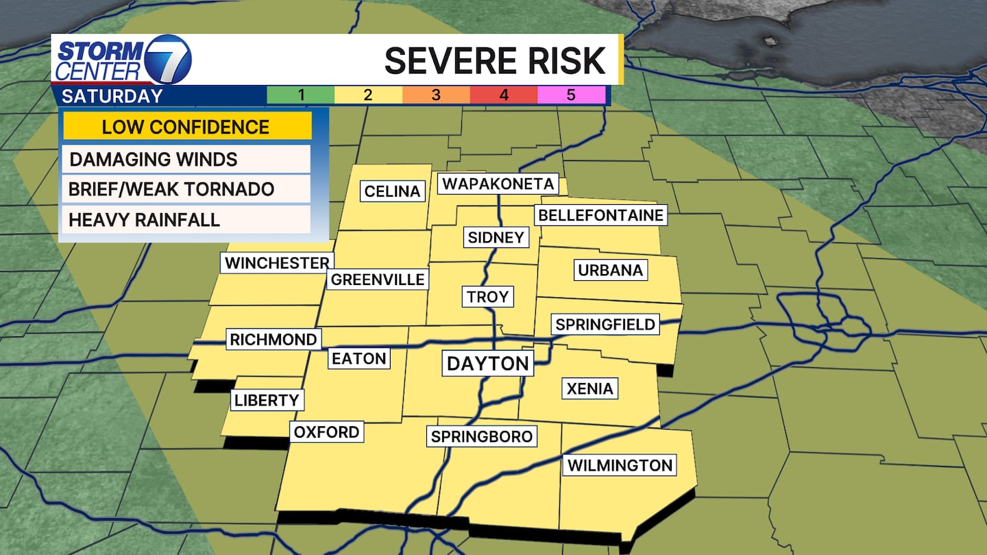
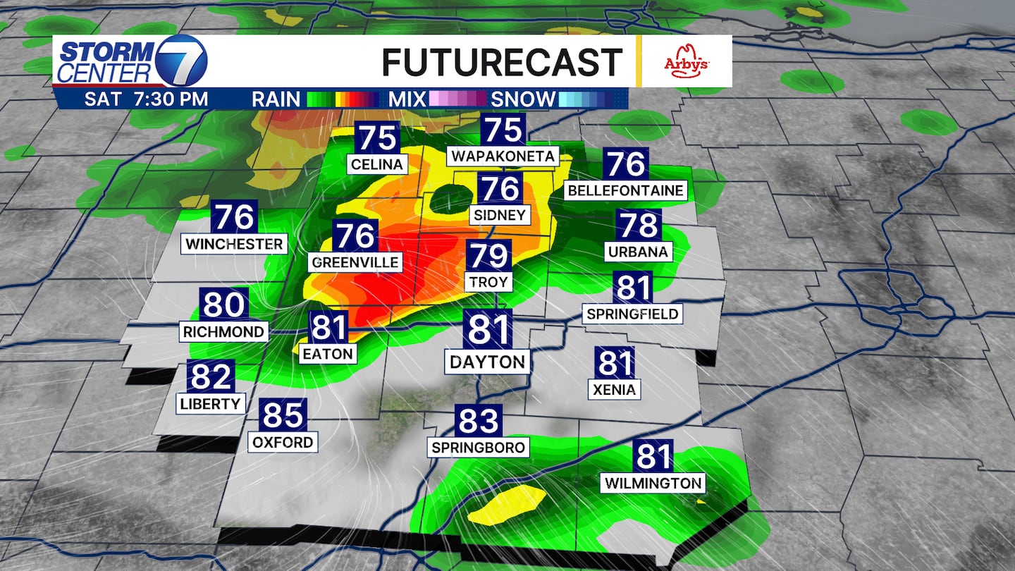
I do not think that is how things go as of now. The forecast will need to be watched, but scattered strong storms are possible. The best chances for severe weather will be the afternoon and evening hours.
[WATCH Storm Center 7 Weather on the following devices]
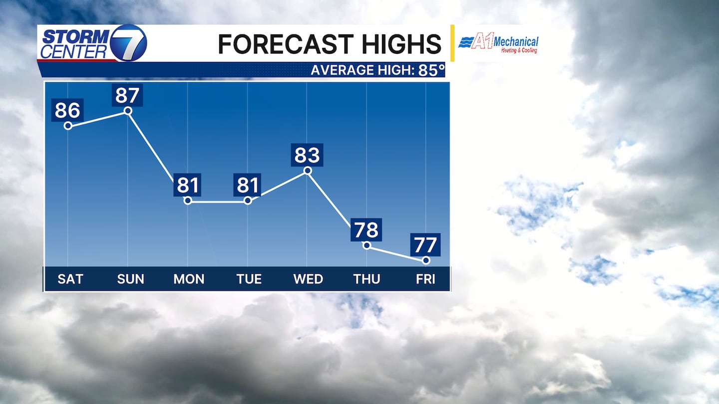
A few lingering storms are possible for Sunday, but we should see less coverage as a much-needed pattern change arrives into early next week. Highs look to fall below average for at least a few days with drier-than-average conditions as well.
©2026 Cox Media Group


