QUICK-LOOK FORECAST:
- Rainy at times through Saturday
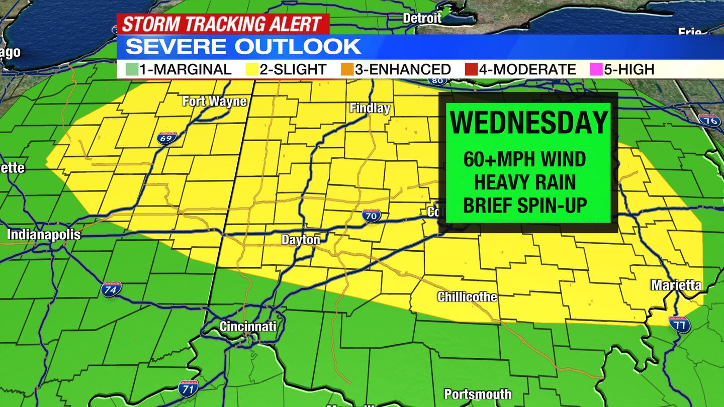
- Strong/severe storms Wednesday afternoon
- Cooler over the weekend
>> TRACK THE CONDITIONS: Live Doppler 7 Radar
DETAILED FORECAST:
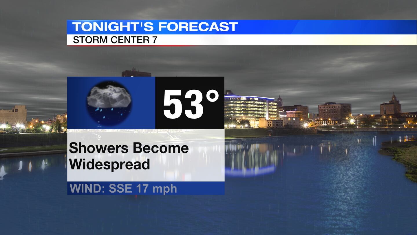
TODAY: Cloudy skies with chances for on and off showers. A steadier round of showers pass through overnight. Winds increase through the night, too. Temperatures dip to the lower 50s and hold steady through the night.
WEDNESDAY: Cloudy with showers Wednesday morning, followed by partly sunny skies with scattered showers and a few thunderstorms Wednesday afternoon.
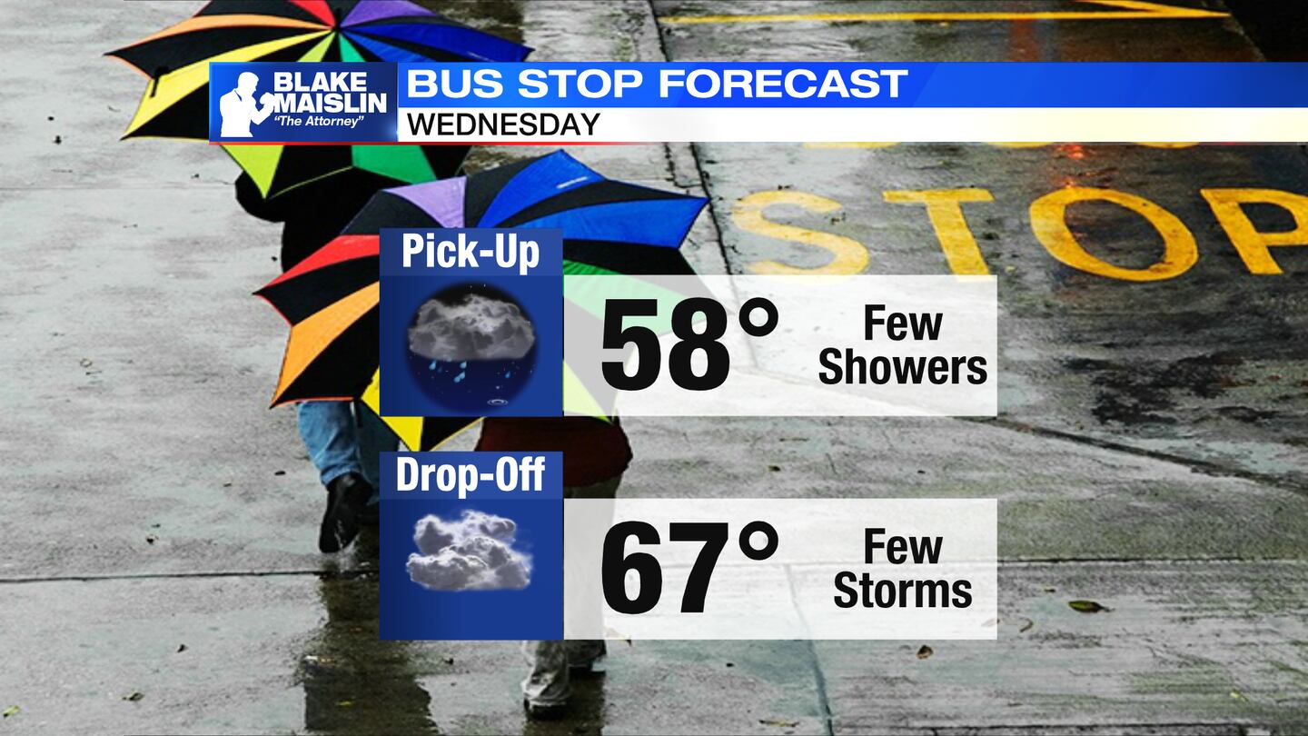
There is the potential for an isolated strong storm Wednesday afternoon as a low pressure passing overhead. Damaging winds, hail, heavy rain are the primary threats with those storms, but an isolated spin-up is possible, too. It will be another warmer than normal day with highs in the upper 60s.
THURSDAY: Mostly cloudy with the slight chance of light showers and seasonable temperatures. Highs in the lower 50s.
FRIDAY: Partly to mostly cloudy with a few showers, highs near 50 degrees.

SATURDAY: Mostly cloudy with a chance for showers. These rain showers could be mixed with a few snowflakes early in the day. Cool with temperatures only in the lower to middle 40s during the afternoon.
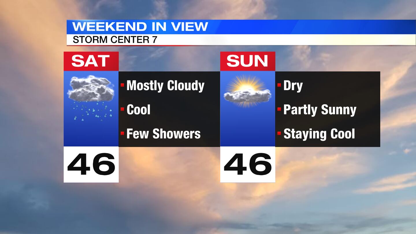
SUNDAY: Partly cloudy in the morning, turning mostly sunny in the afternoon. Cool with highs in the lower to middle 40s.
MONDAY: Partly sunny and milder. Highs in the lower 50s.
TUESDAY: Mostly cloudy with a few passing showers on Tuesday. It will be a milder day with highs near 60 degrees.
©2022 Cox Media Group


