QUICK-LOOK FORECAST:
- Brief warm-up mid-week
- Passing sprinkle or flurry Wednesday
- Staying below freezing Thursday through Sunday
>>TRACK THE CONDITIONS: Live Doppler 7 Radar
DETAILED FORECAST:
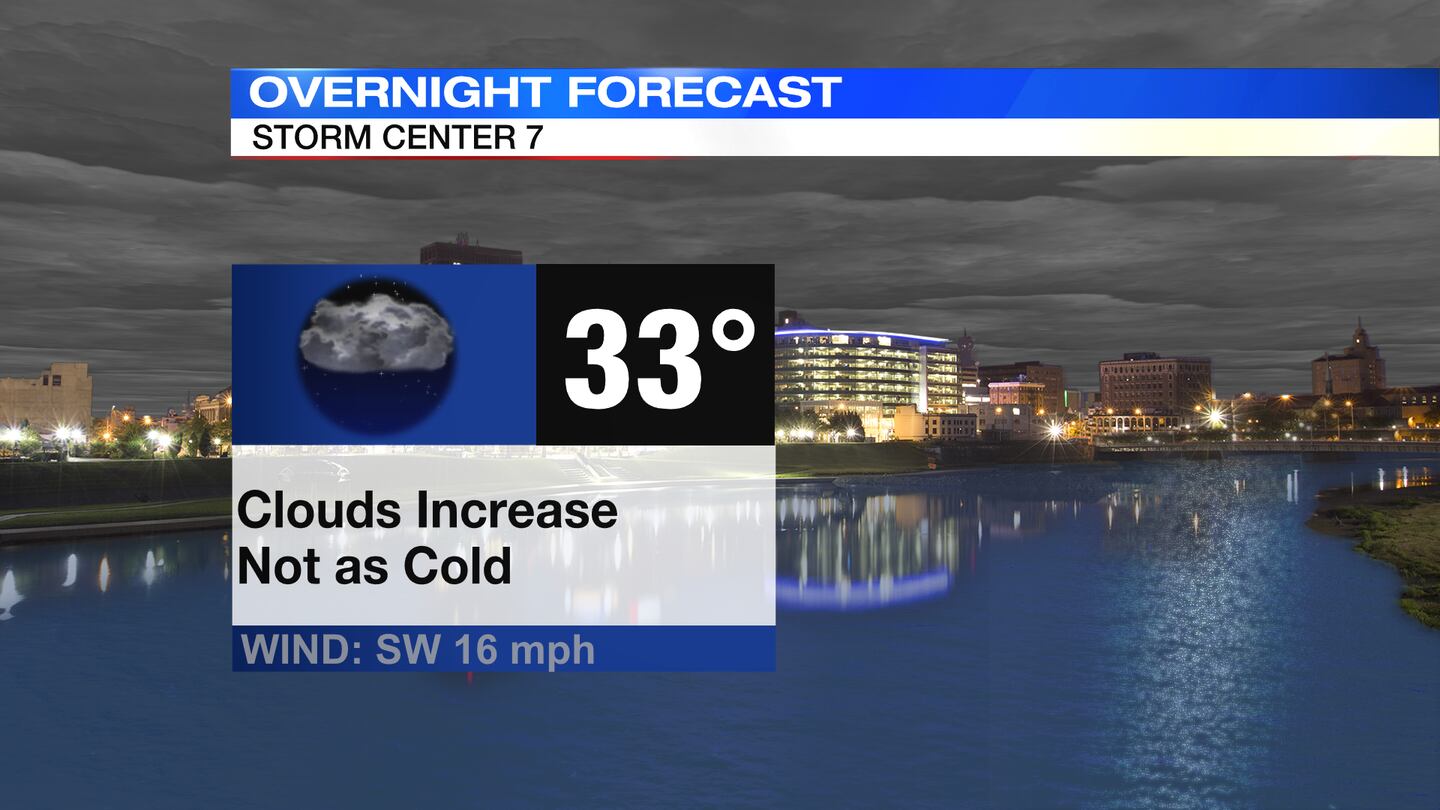
TODAY: Mostly cloudy to cloudy skies tonight. Temperatures will be holding steady in the 30s all night long. Breezy through the night, too.
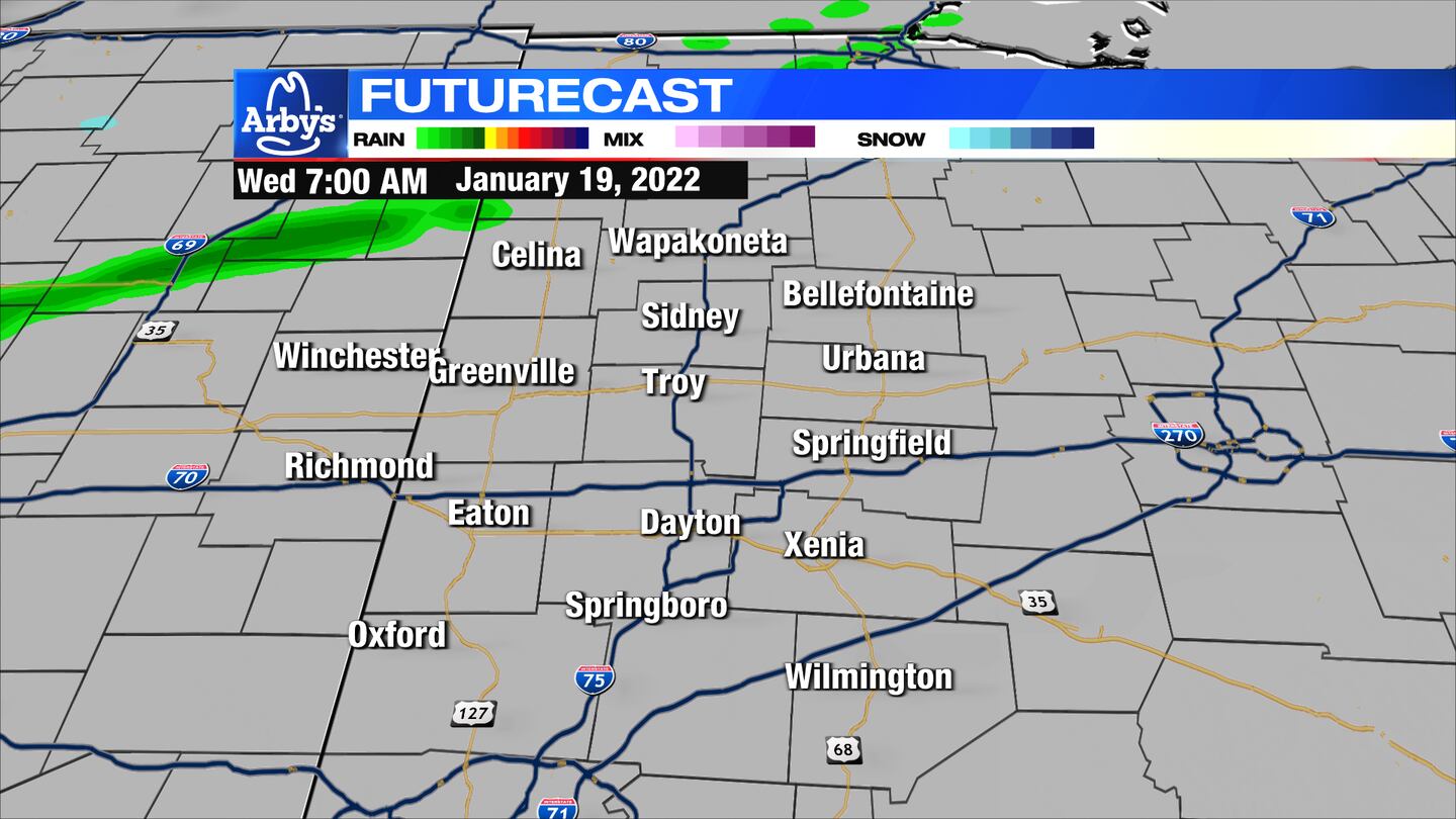
WEDNESDAY: Clouds return for Wednesday. A cold front will swing through bringing the slight chance of a stray rain or snow shower into the afternoon. Highs near 40 degrees by midday then falling. Clouds decrease Wednesday night and much colder with lows in the upper teens.
THURSDAY: Some clouds early give way to mostly sunny skies. It will be a colder ay with highs in the middle 20s.
FRIDAY: Mostly sunny skies for Friday. Highs in the middle 20s.
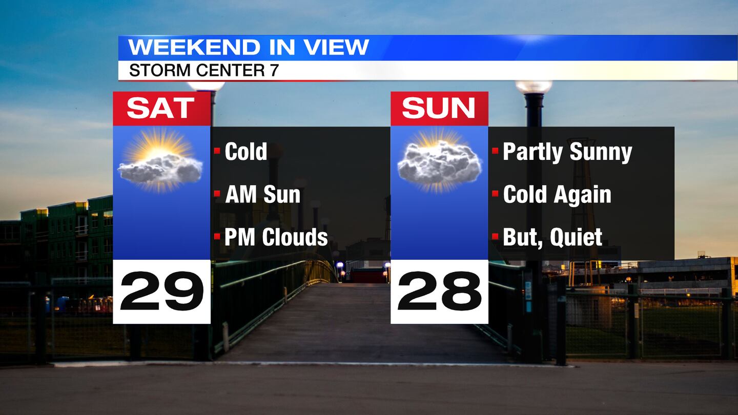
SATURDAY: Partly sunny skies expected Saturday. Cold with a high near 30 degrees.
SUNDAY: Mostly cloudy and cold again. Highs near 30 degrees.
MONDAY: Mostly cloudy. Slight chance of a snow shower. Highs near freezing.
TUESDAY: Mostly cloudy and cold. Slight chance of a snow shower. Highs in the upper 20s.
©2022 Cox Media Group


