‘Tis that time of year when you’ll start hearing the phrase “Polar Vortex”, and the possibility of cold weather outbreaks. In fact, over the past few days, you may have heard those two words being used in reference to what might happen later this month.
Before I tell you when and how cold it will get, let’s define what polar vortex actually means.
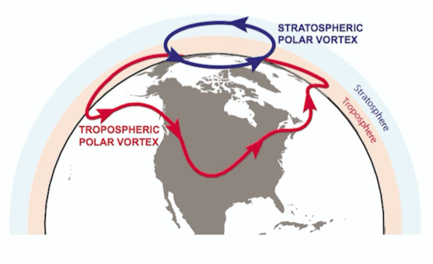
What’s a Polar Vortex?
According to the National Weather Service, the polar vortex is a large area of low pressure and cold air surrounding both of the Earth’s poles. It ALWAYS exists near the poles but is strongest during the winter months.
The term “vortex” refers to the counter-clockwise flow of air that helps keep the colder air near the Poles. These winds are located in the stratosphere, about 6 to 30 miles above the ground.
When the polar vortex is strong, ironically, the colder air remains near the poles, but as it weakens this cold air can plunge south into North America or Europe. This occurs fairly regularly during wintertime, but some cold outbreaks are more extreme than others.
You may remember the arctic cold associated with a polar vortex in early January 2014. Columbus, Cincinnati, and Dayton all broke records for coldest daily low temperatures combined with spending more than 20 consecutive hours below zero.
It wasn’t just the cold, but more the wind chills that made that outbreak so extreme. Some of the coldest wind chill readings surpassed 40 below zero.
When can we expect it?
In December there was sudden stratospheric warming (SSW) that occurred over the North Pole. This warming quickly weakened the polar vortex, forcing it to shift out of place.
Long-range models show this disruption in the polar vortex and the potential for pieces of the vortex to dip south away from the North Pole.
There are two other global patterns that could help this along; the Arctic Oscillation (AO) and the North Atlantic Oscillation (NAO).
For cold and snow lovers, seeing the AO and the NAO in a negative phase is what you want. When in a negative phase, the possibility of a cold outbreak increases due to the weakening of the polar jet stream and a blocking high over Greenland that allows cold air to spill southward into the United States.
When last checked, both the AO and the NAO are negative and look to remain that way at least for the next few weeks.
So, what does that mean? A cold air outbreak looks likely, but will it be in Ohio is too soon to say.
Regardless, we are entering a time of year when cold and snow chances increase, so don’t give up hope quite yet!
Cox Media Group


