QUICK-LOOK FORECAST:
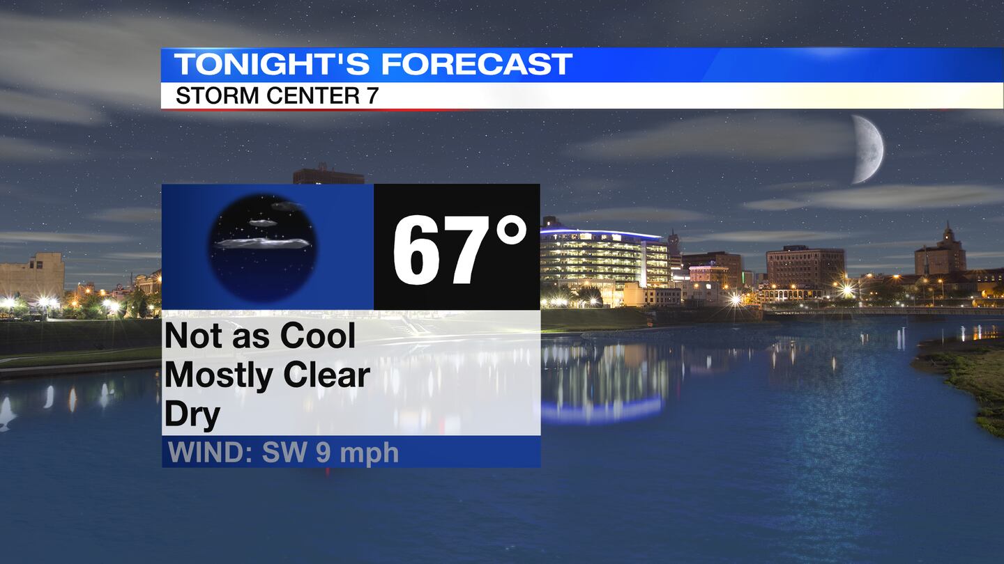
- Warm, Quiet & Dry Tonight
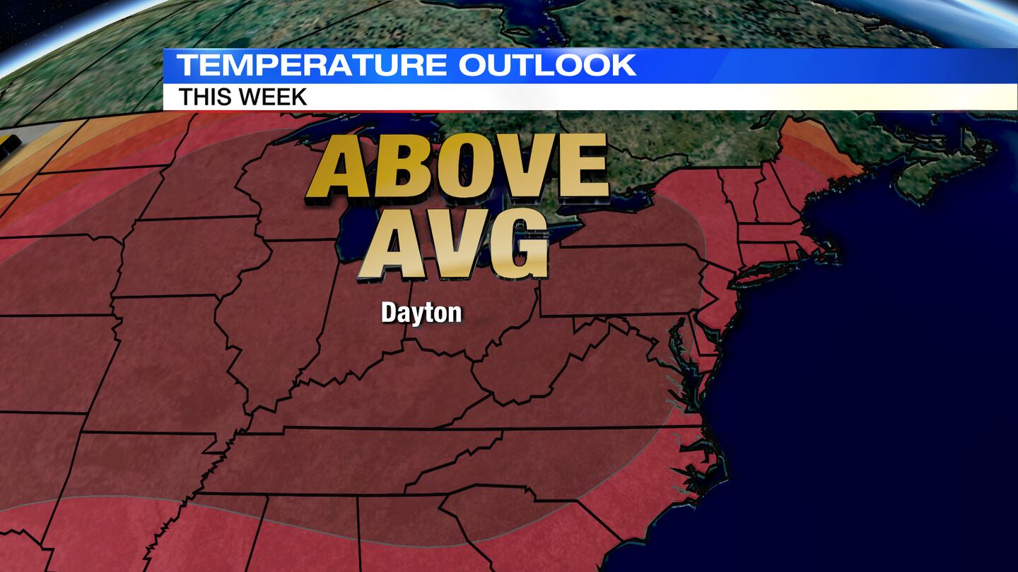
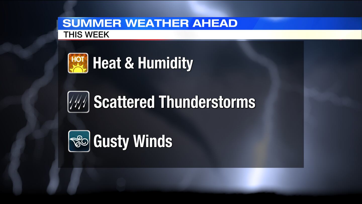
- Summer-like Heat Through Tuesday
- Rain/Storms Return Mid-Week
>> TRACK THE CONDITIONS: Live Doppler 7 Radar
DETAILED FORECAST:
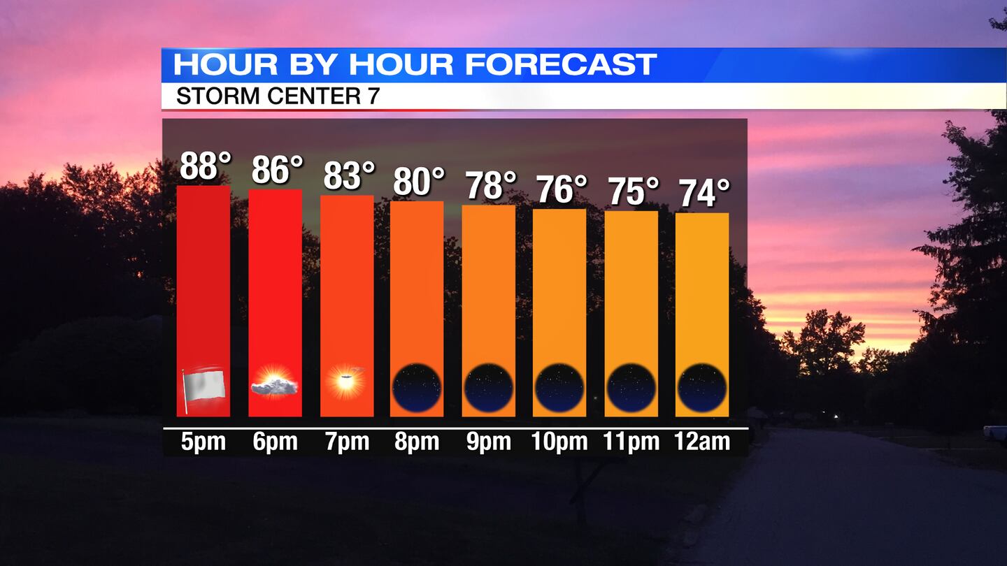
TODAY: Hazy sunshine early, breezy and warm with temps in the 80s then falling through the 70s late. Wind gusts up to 30 mph.
Overnight, mostly clear, breezy and warm with lows in the mid 60s.
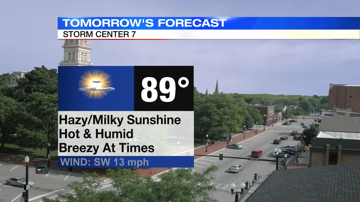
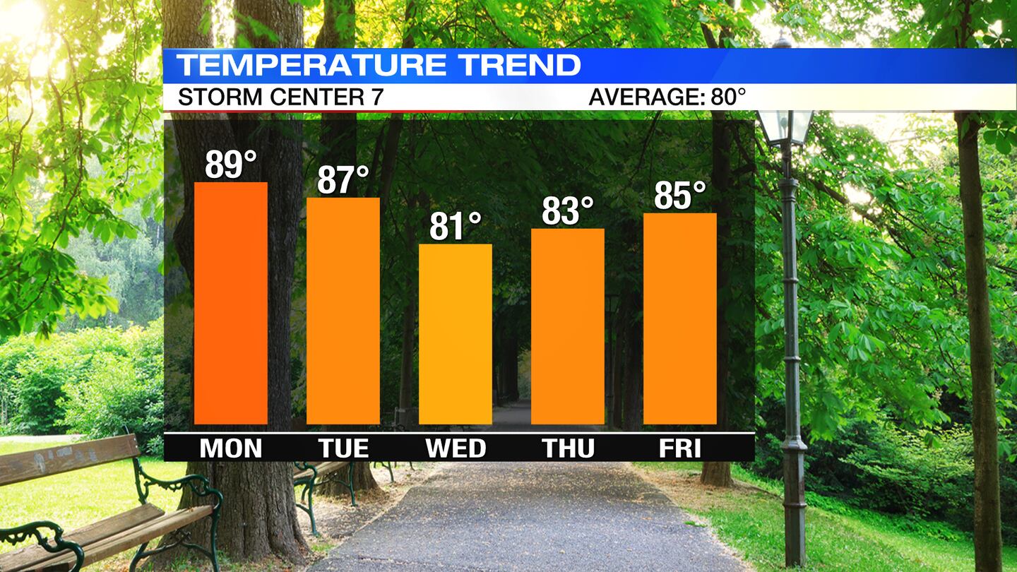
MONDAY: Mostly sunny, hazy/milky skies. Hot and more humid. High temperatures topping out in the upper 80s to 90 degrees. Not as breezy as Tuesday, but could still see some gusts to 15MPH.
TUESDAY: Scattered clouds expected on Tuesday. Warm and muggy again in the upper 80s. An isolated shower possible in the afternoon/evening. Better chance of scat’d rain overnight Tuesday.
WEDNESDAY: Mostly cloudy with scattered showers and storms. Still breezy. Not as warm, but seasonable with highs in the lower 80s.
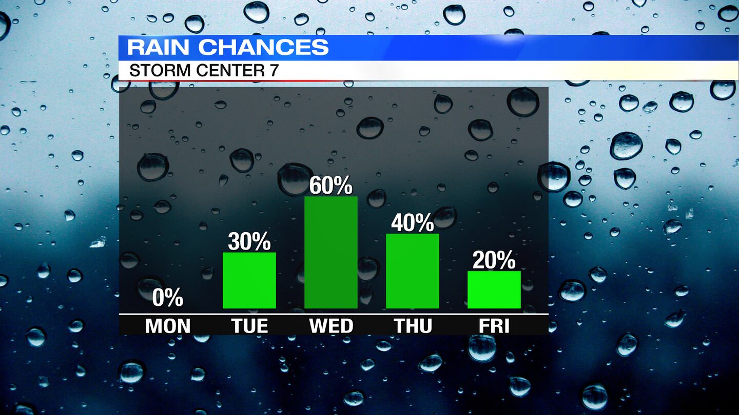
THURSDAY: Partly cloudy skies. A chance of a few more showers and isolated storms. Temps are staying warm, in the mid 80s.
FRIDAY: Partly cloudy skies, trending dry but staying warm with highs in the mid 80s.
SATURDAY: Partly cloudy skies. Can’t rule out a few showers and storms. Highs in the middle 80s.
SUNDAY: Partly cloudy skies with an isolated passing shower or two with temps staying warm, in the mid 80s.
©2021 Cox Media Group