
DAYTON — An area of low pressure will develop and mature over the next two days. The low is forecast to slide over the Great Lakes and the warm front will lift over the Valley. This allows for warm, moist air to push in and fuel the potential for strong to severe storms.
[DOWNLOAD: Free Storm Center 7 Weather app for alerts as news breaks]
Tuesday afternoon and early evening a few storms have the potential to fire ahead of the main event. The storms have the potential to become strong with gusty winds as the main threat.
Wednesday late afternoon and evening a few storms are possible ahead of the main severe weather threat.
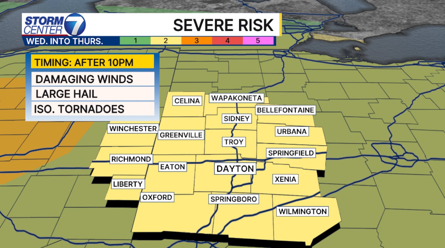
Timing of the strongest storms will be after midnight into Thursday morning. The storms have the potential to weaken upon approach, but still bring the chance of all hazards.

[WATCH Storm Center 7 Weather on the following devices]
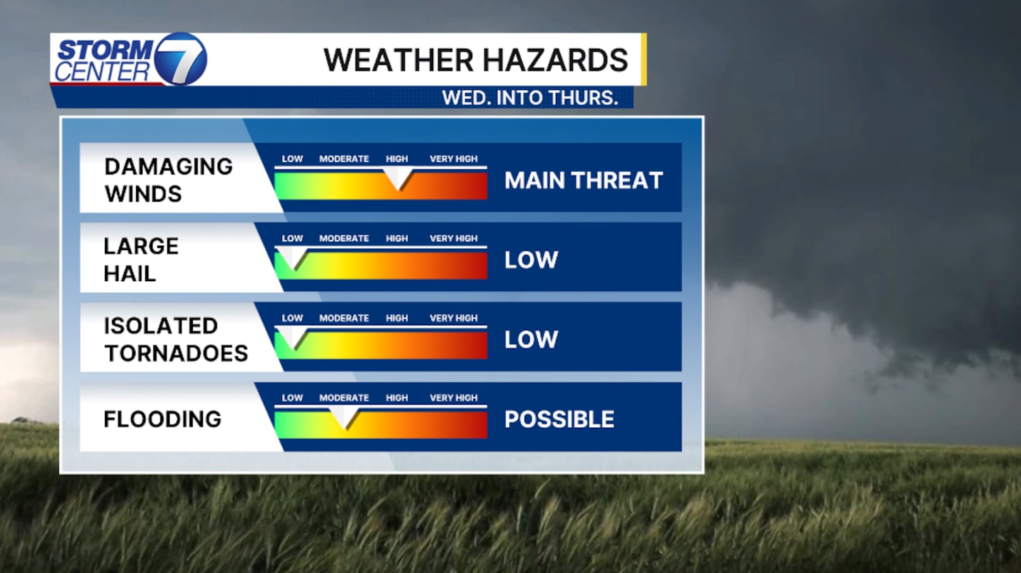
Wind is our main threat with gusts reaching over 60 MPH. Large hail an inch in diameter and isolated tornadoes are both possible, but the threats are low. Flooding is possible with heavier rain rates.
©2026 Cox Media Group


