
DAYTON — Good afternoon to you on this Sunday. Meteorologist Nick Dunn here with you on what has been a little bit of a smoky day. Some wildfire smoke has brought air quality down a bit today. This lingers into Monday as well. Air quality alerts continue into Monday.
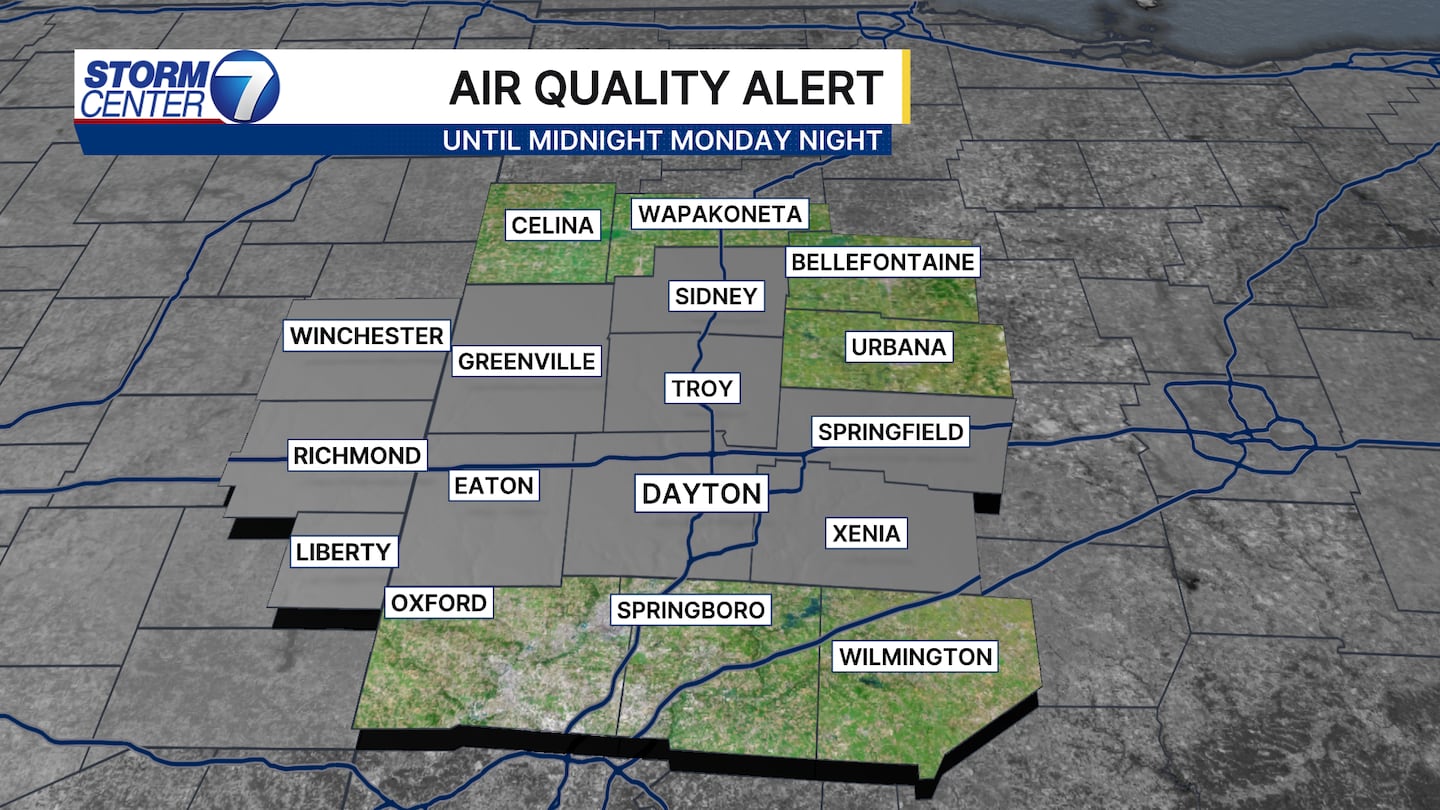
For tonight, lows will be in the lower 60s, and a few upper 50s are possible north and east of Dayton. Monday will be a dry day with highs in the lower to middle 80s. The next item of interest is a risk of severe weather on Tuesday.
[DOWNLOAD: Free Storm Center 7 Weather app for alerts as news breaks]
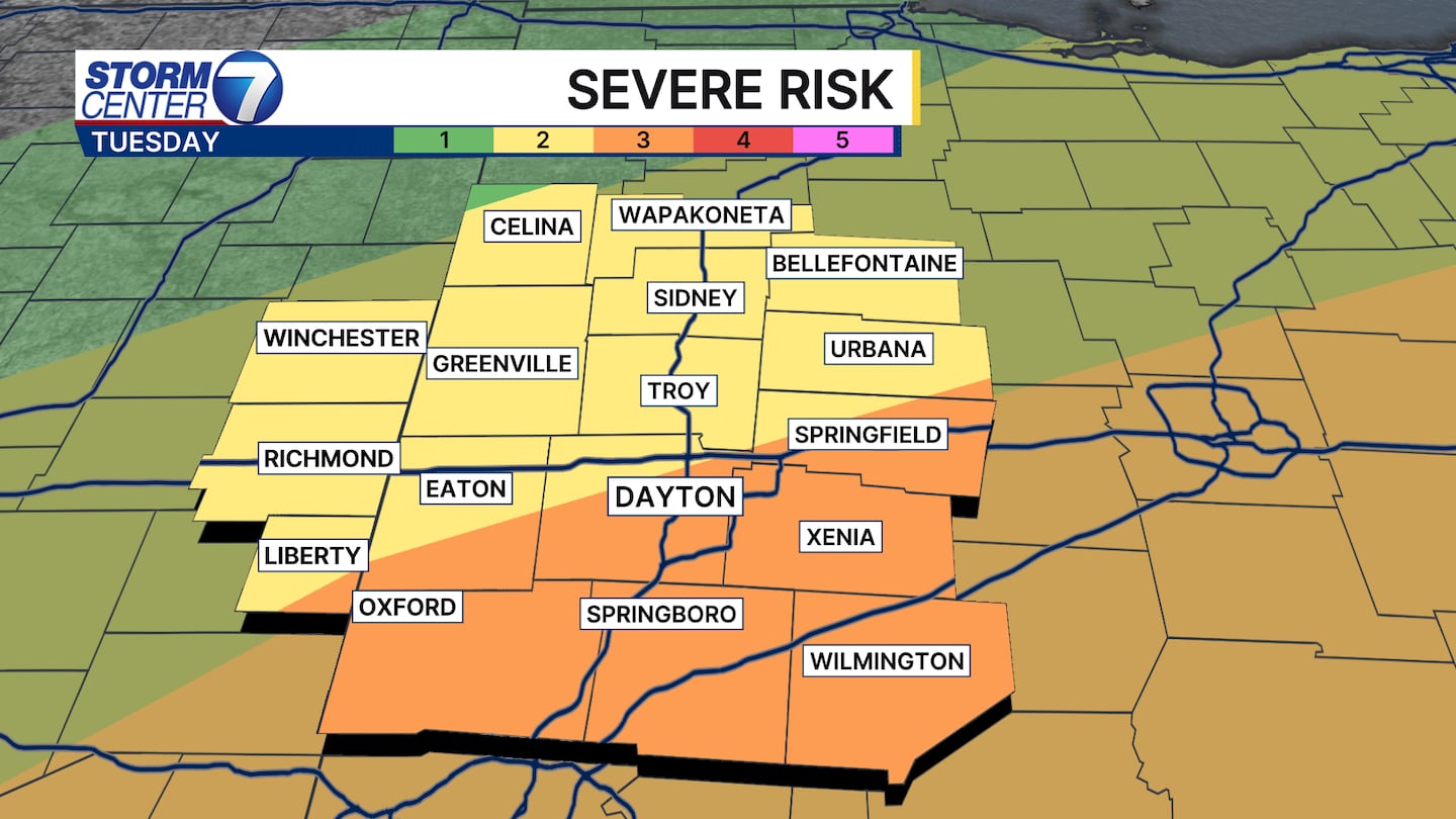
The Storm Prediction Center has placed about half of us in a Level 2 (Slight) Risk and the other half in a Level 3 (Enhanced) Risk for severe storms on Tuesday. There are some questions about how it will play out, however, ingredients support the potential for a couple rounds of severe storms.
[WATCH Storm Center 7 Weather on the following devices]
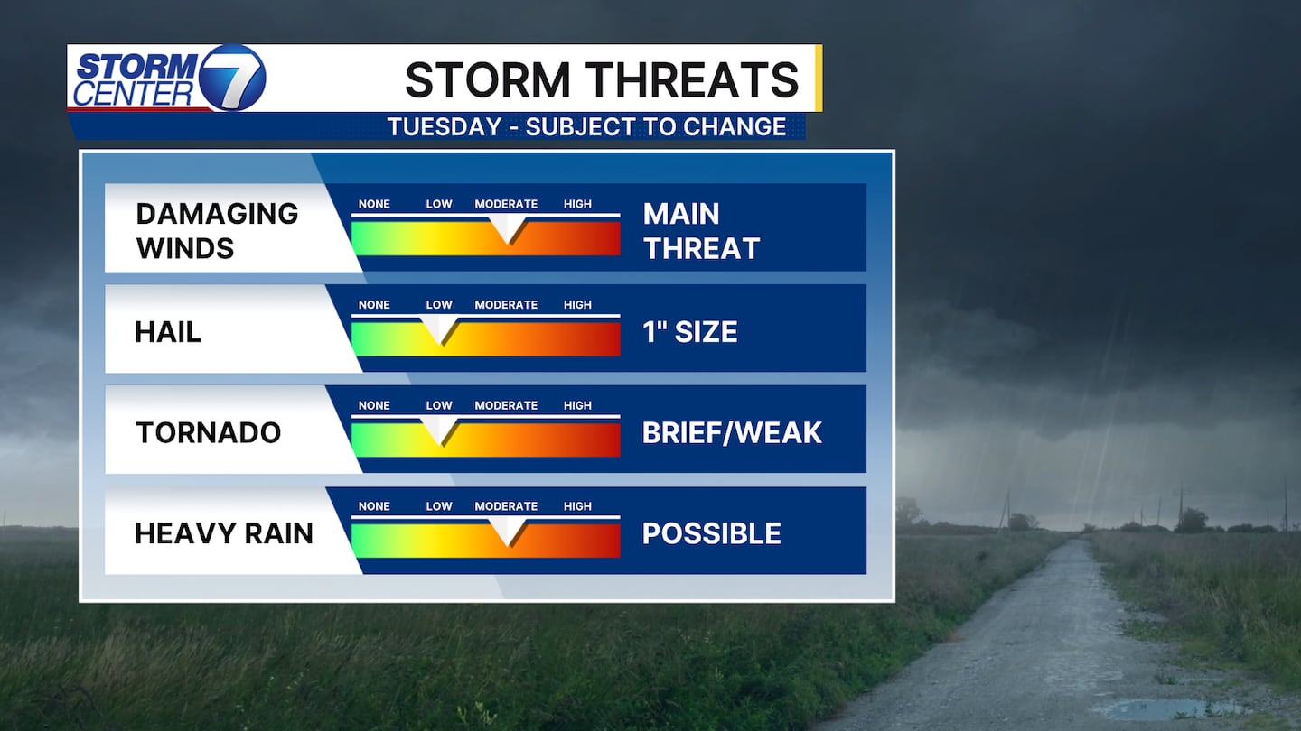
The main threat right now will be from damaging wind gusts, however, some hail and perhaps a tornado are lower and secondary threats to watch.
An earlier arrival of storms in the morning would hopefully limit additional storms in the afternoon. On the flip side, a later arrival of storms in the peak heating of the day could allow us to have extra storm fuel to play with for severe storms. You will want to monitor the forecast for updates.
©2026 Cox Media Group


