QUICK-LOOK FORECAST:
- Few flurries fade away this evening
- Mostly cloudy and cold overnight
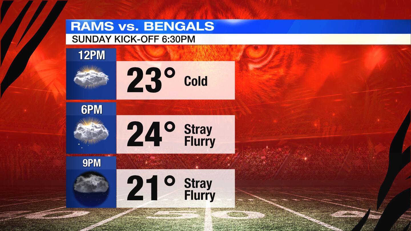
- Snow showers possible Sunday evening
>>TRACK THE CONDITIONS: Live Doppler 7 Radar

DETAILED FORECAST:
TONIGHT: What flurries remain should fade away, with mostly cloudy skies remaining and a cold night with lows in the teens.
SUNDAY: Mostly cloudy and it looks like there’s a chance for some snow showers later Sunday evening, with some light accumulation possible. Could pose a minor hazard for Superbowl travelers.
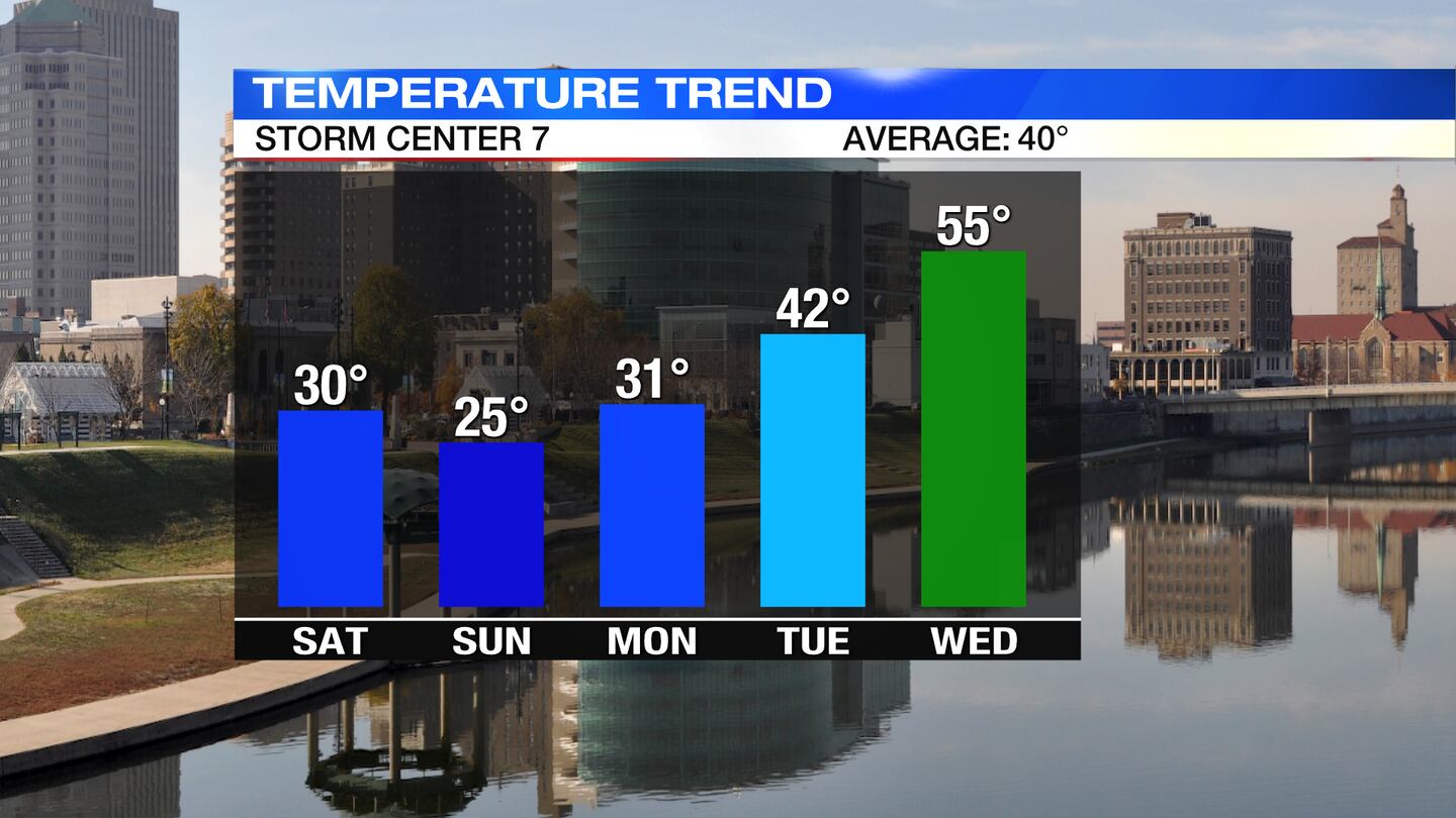
Cold with highs only reaching the mid-20s.
MONDAY: Mostly cloudy to partly sunny skies on Monday. It will be a bit breezy, too. Highs in the lower 30s.
TUESDAY: Mostly sunny and chilly. Highs rebound to the lower 40s.
WEDNESDAY: Partly sunny skies for Wednesday and becoming windy. An increase in cloud cover is expected by Wednesday evening. It will be a mild day with high temperatures in the middle 50s.
THURSDAY: Rain likely on Thursday and windy, with highs in the middle to upper 50s. A few rumbles of thunder will be possible.
FRIDAY: Gradually decreasing clouds and much colder with highs barely reaching 30. It will be a windy day, so it will feel even colder.
©2022 Cox Media Group