
QUICK-LOOK FORECAST:
- Not as cold tonight
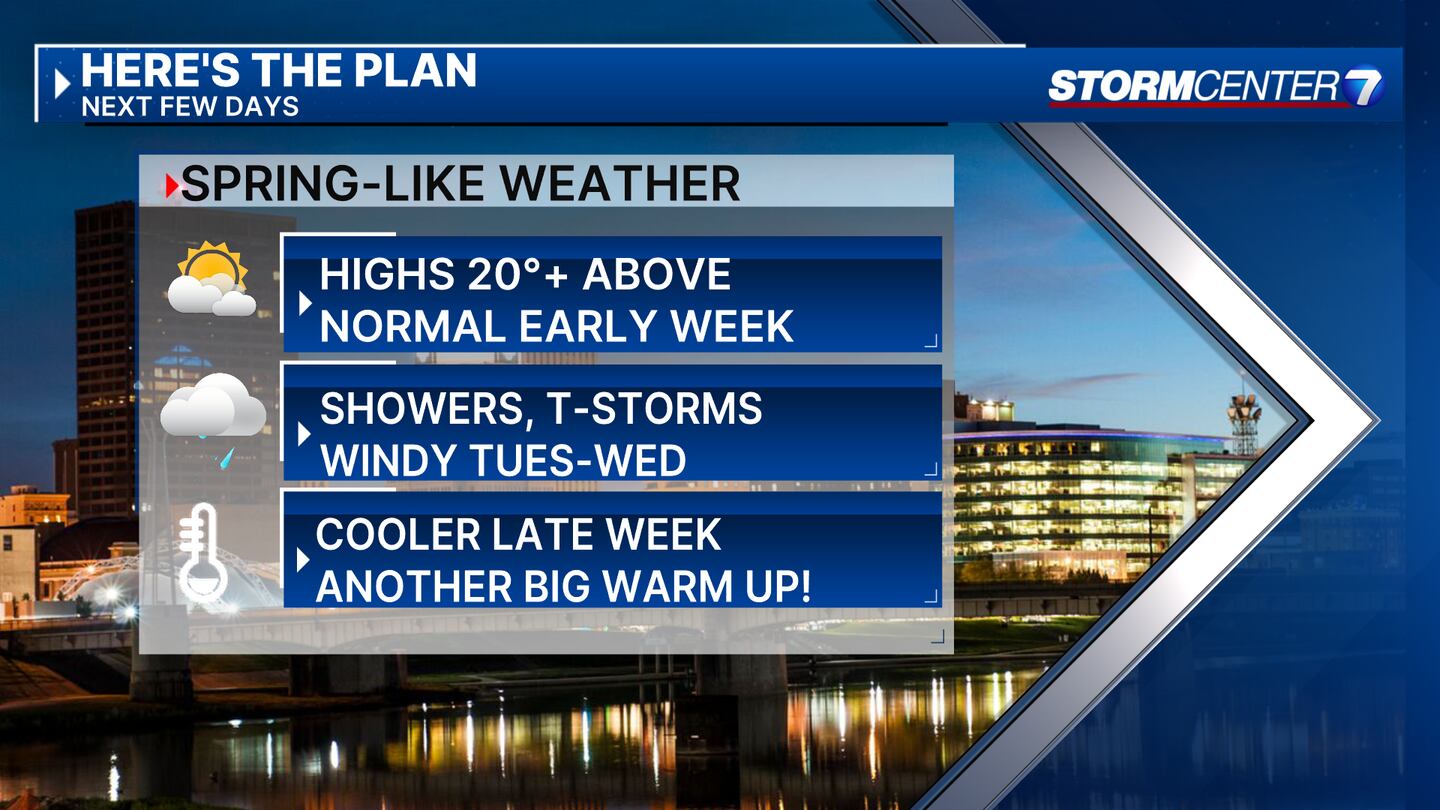
- Unseasonably warm early this week
- Rain, wind, thunderstorms Tuesday into Wednesday
>> TRACK THE LATEST CONDITIONS: Live Doppler 7 Radar
DETAILED FORECAST:
SUNDAY: Not as cold or breezy with a few passing clouds. Lows in the middle to upper 30s.
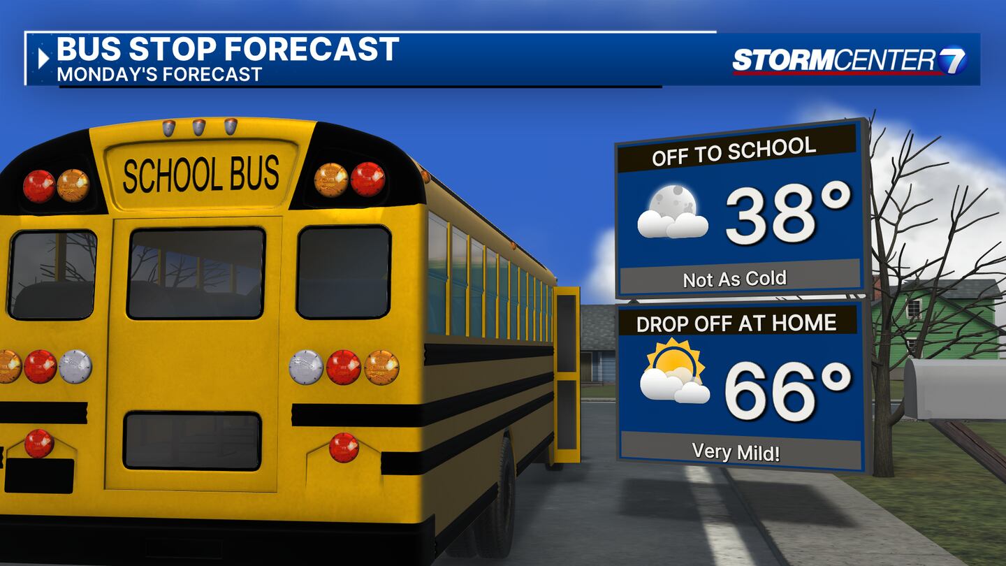
MONDAY: Even milder with a mix of clouds and sunshine. Staying dry. Highs in the middle 60s.
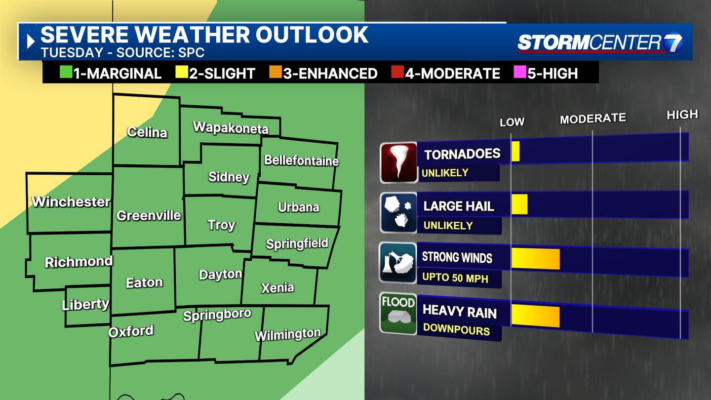
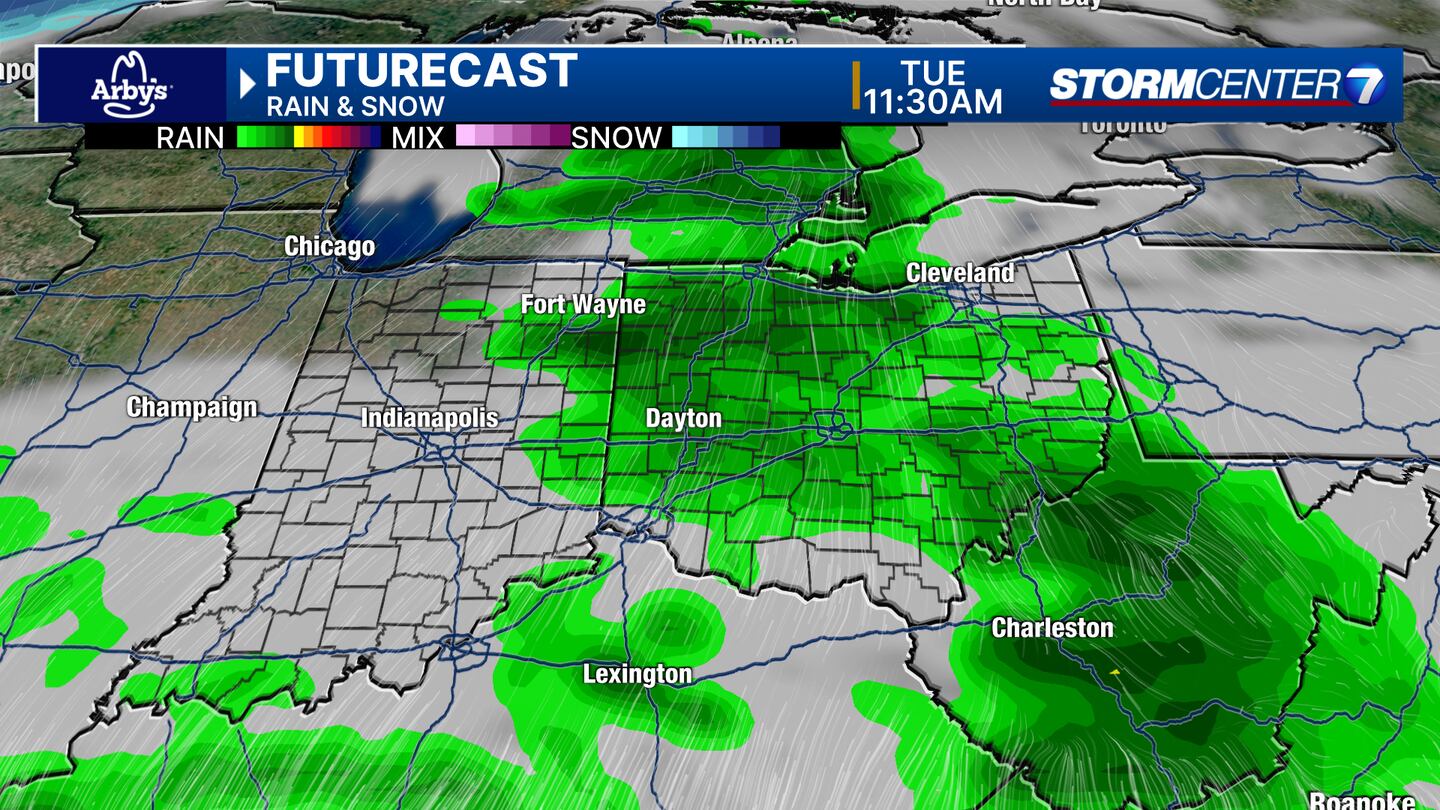
TUESDAY: Cloudy and breezy with a chance for showers and thunderstorms. Very warm for this time of year. Highs in the mid-60s. A stray strong storm with gusty winds is possible later in the day into the overnight, but confidence remains low as we work to resolve timing issues and just how much energy will be available for us.
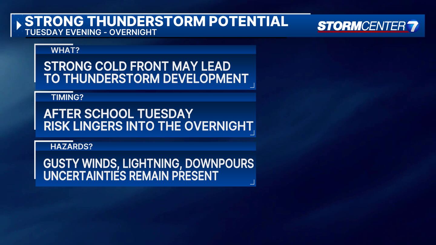
However, anytime we have a push of milder air like this with a strong cold front, a couple of gusty storms are possible. The Storm Prediction Center has highlighted the Miami Valley as a Level 1 (Marginal Risk) of a stray strong storm.
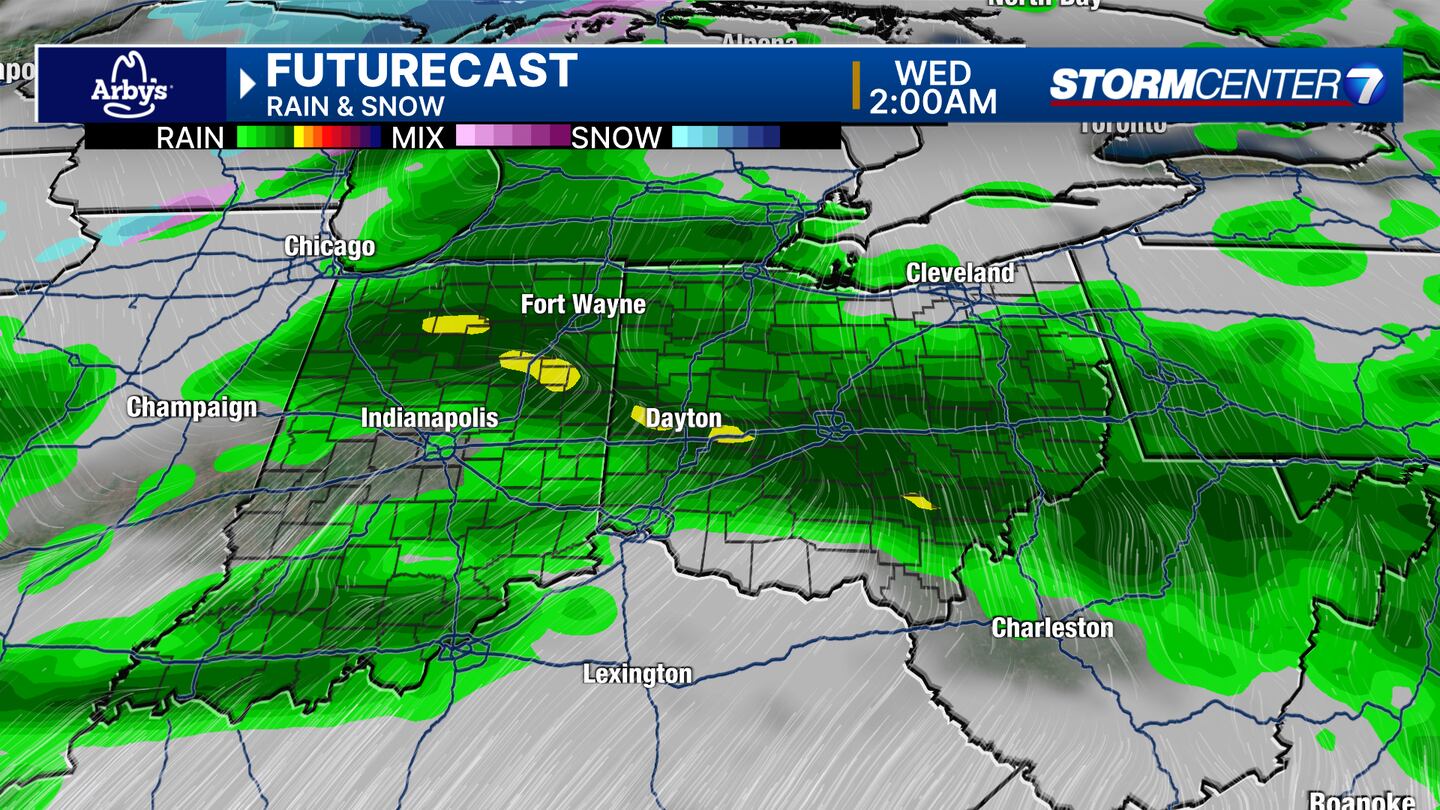
WEDNESDAY: Cloudy with rain likely as a cold front passes during the daytime hours. A rumble of thunder is possible. Breezy. Mild again with highs around 60 before Noon. Quickly falling temperatures Wednesday afternoon. A brief mixofh snow may occur Wednesday evening or Wednesday night as precipitation comes to an end. Colder with temperatures falling into the 20s overnight.

THURSDAY: Continued clearing behind the Wednesday cold front. Cooler with highs in the upper 30s to lower 40s.
FRIDAY: Mostly sunny skies. Seasonably mild with highs back to around 50 degrees.
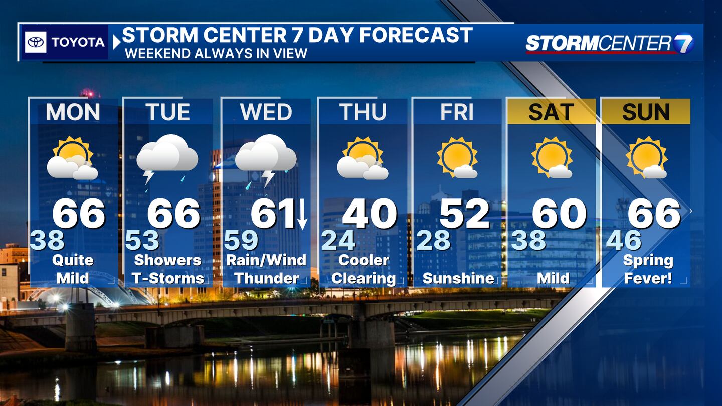
SATURDAY: Quite mild again and sunny with highs nearing 60.
SUNDAY: Spring-like weather is back with highs in the middle 60s and sunny skies.
©2024 Cox Media Group