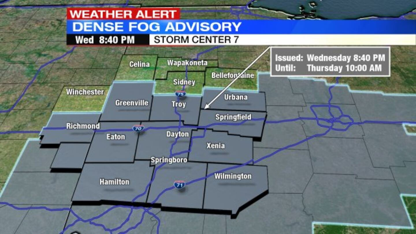
A Dense Fog Advisory remains in effect until 10 a.m. Thursday, National Weather Service forecasters in Wilmington said.
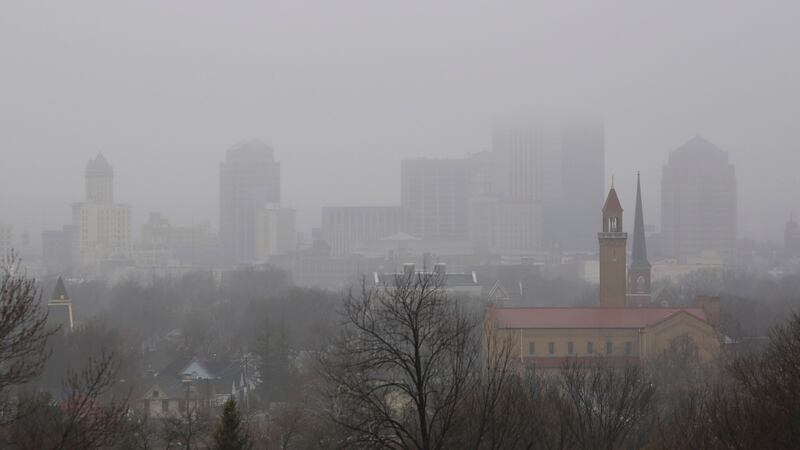
Visibility is down to a quarter-mile or less at times. The poor visibility will result in hazardous travel conditions, NWS officials said.
QUICK-LOOK FORECAST
- Visibility less than a quarter-mile at times overnight
- Steady rain returns Thursday
- Chance of passing flurries early Friday, early on Easter
>> WHIO Doppler 7 Interactive Radar
DETAILED FORECAST
Overnight: Areas of fog and drizzle likely. Temperatures will hold in the upper 40s for most.
>> Tips for safe driving in foggy conditions
Thursday: Rain likely, steady and may be heavy at times. Outside of that, expect drizzle and some fog. A few thunderstorms may develop, mainly south of I-70. Temperatures will rise to the upper 50s.
Friday: Colder air will arrive and a few flurries are possible early morning. Clouds should break some in the afternoon. It will be breezy and cool with highs in the upper 40s.
Saturday: Clouds will increase with showers developing by late afternoon or evening. Highs will rebound into the middle 50s with gusty winds at times in the afternoon.
EASTER: Colder air returns and a few flurries or a quick snow shower will be possible early in the morning. Sunrise will be at 7:21 a.m. Clouds will linger through the day with blustery conditions and highs in the lower 40s.
Monday: Expect a sun-cloud mix. Cool, with highs in the upper 40s.


