QUICK-LOOK FORECAST
- Increasing clouds, snow showers develop late tonight
- Snow squalls, strong winds Tuesday
- Falling temperatures, bitter wind chills into midweek
>> WHIO Doppler 7 HD Interactive Radar
DETAILED FORECAST
This evening: Increasing clouds and chilly. temperatures hovering in the 30s.
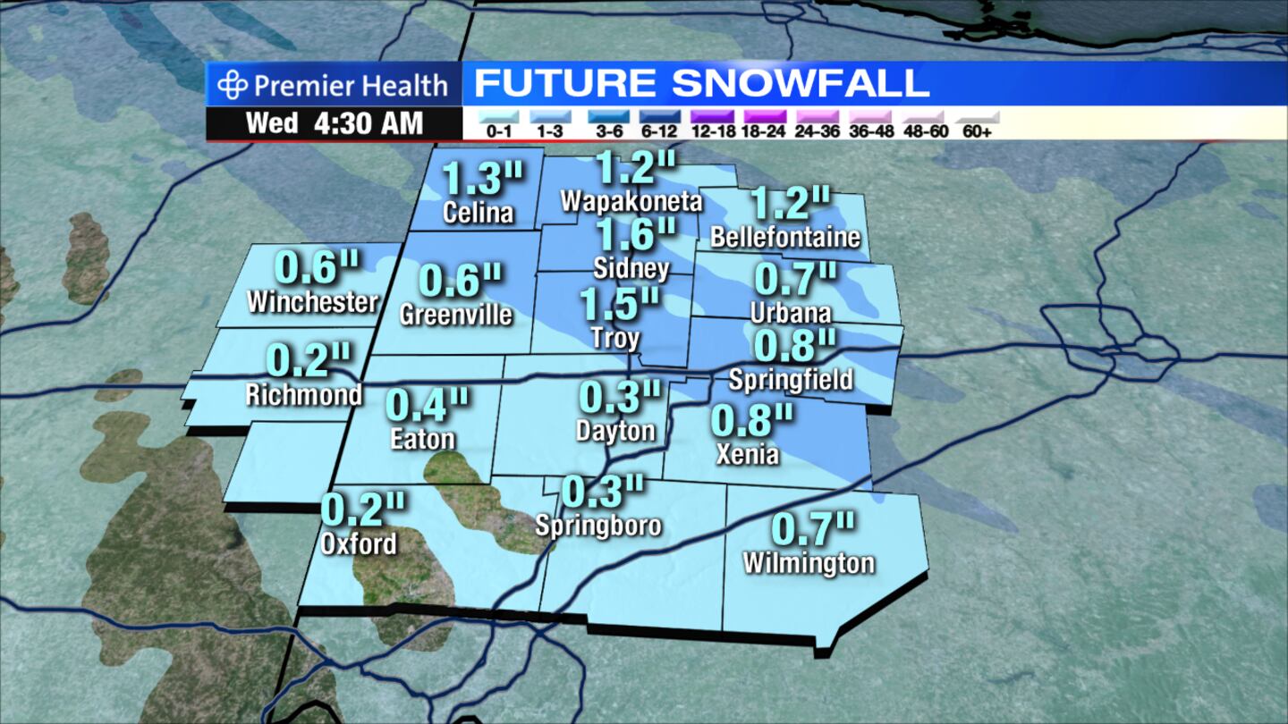
Tonight: Snow showers developing late with gusty winds developing. Snow accumulation by morning up to a half-inch. Temperatures dropping into the upper 20s.
>> Winter Weather Awareness: What to have in your car kit
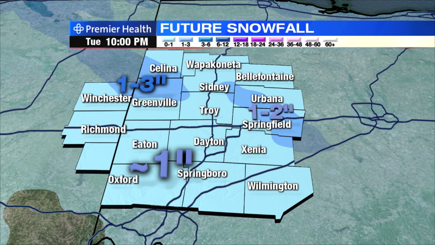
Tuesday: Snow showers and squalls likely, especially early in the day. Expect rapidly changing visibility with near white-out conditions possible where snow squalls occur. Total snow accumulations of around an inch are expected with higher amounts, up to 3 inches possible where snow squalls occur.
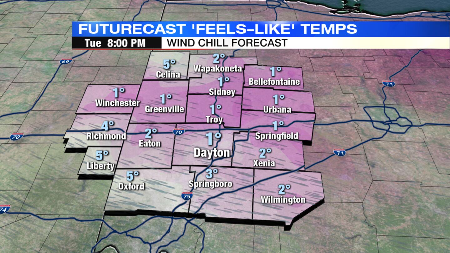
Higher accumulations will generally be across the northwestern Miami Valley. It will be windy and cold with temperatures falling through the 20s. Wind chills will fall into the single digits by evening as snow tapers.
>> Winter weather traffic information
>> What are the chances for a White Christmas?
Wednesday: Expect a mix of sun and clouds during the day with increasing clouds late. Scattered snow showers will develop in the afternoon and continue into the evening. Some accumulation is possible, which could create hazardous travel for the evening commute. Highs will only reach into the middle 20s with wind chills in the teens.
Thursday: Expect lingering clouds and chilly temperatures. Highs will be near 30 degrees.
Friday: Expect a mix of sun and clouds. A few flurries or snow showers will be possible. Highs will be near 30 degrees.
Saturday: Temperatures will moderate with a bit more sunshine expected to start the weekend. Highs will rebound to near 40 degrees.
>> Winter Weather Awareness: How does salt help melt ice on roads?
>> YOU NEED THIS: WHIO Weather App


