Snow is expected to move through overnight, but with temperatures close to and even a little above freezing, some rain could mix in as well, Storm Center 7 Meteorologist Brett Collar said. By daybreak everything changes over to snow.
QUICK-LOOK FORECAST
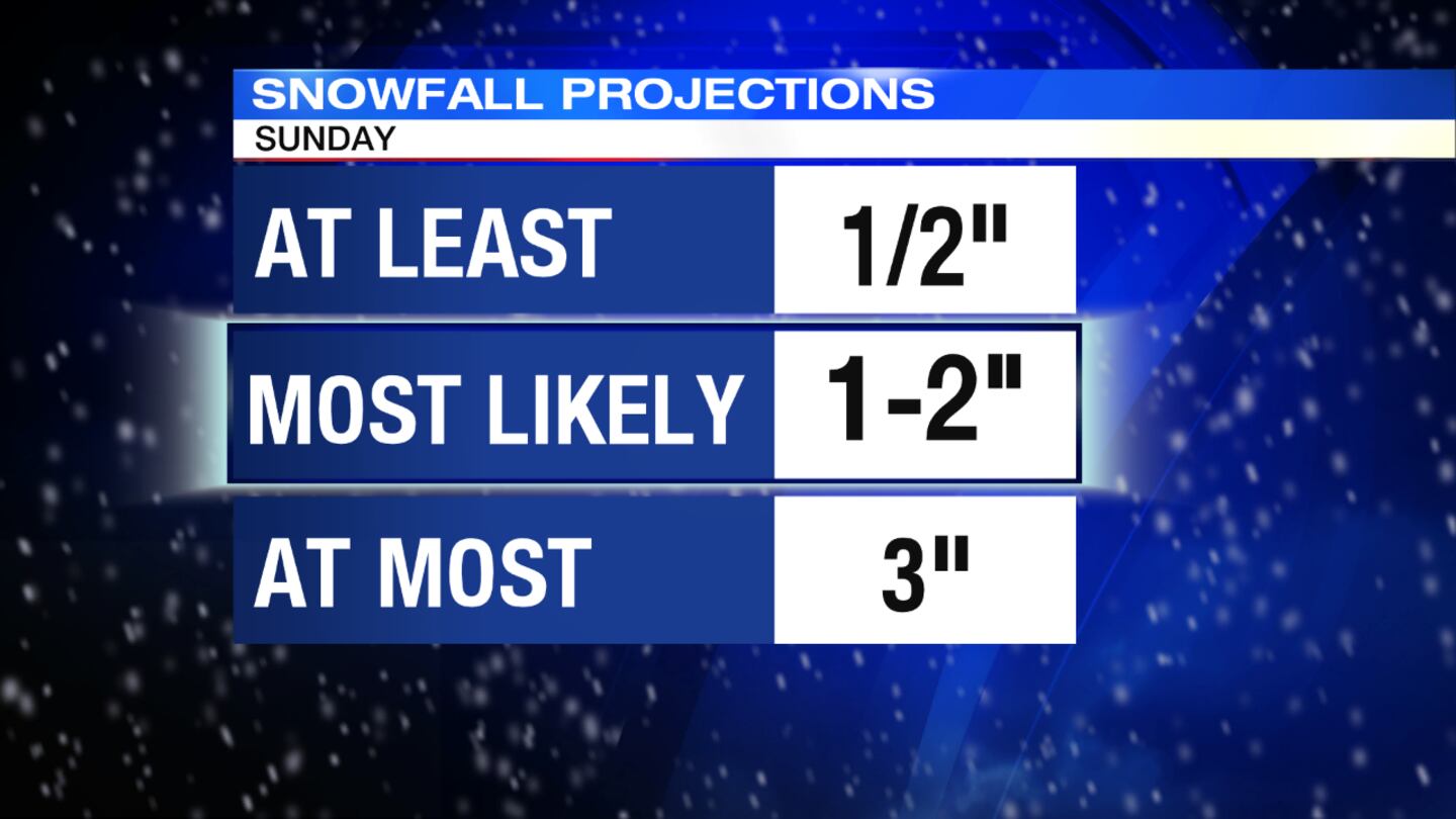
- 1 to 2 inches of snow likely tonight through Saturday
- May mix with rain overnight
- More snow is expected Tuesday
DETAILED FORECAST
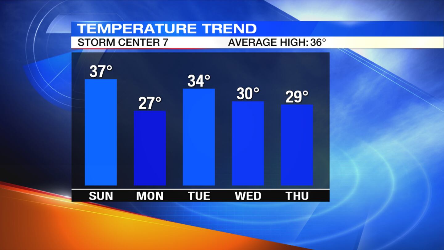
Sunday: Snow showers are expected, with the best chance for the accumulating snow earlier in the day. Temperatures will slowly fall through the day, starting in the middle to upper 30s, ending in the 20s. More snow is expected at times in the afternoon and the evening, but is not expected to be as widespread. Most will receive 1 to 2 inches total snowfall; however, some areas could get up to 3 inches.
Super Bowl forecast: How will rain and snow impact your travel plans?
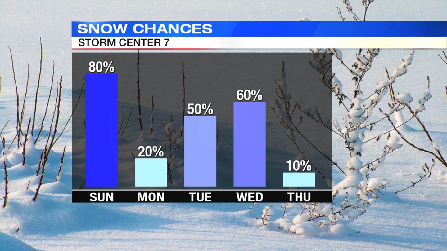
Monday: A cold day is expected and it should be a dry day. Partly cloudy skies are on tap with highs in the upper 20s.
Tuesday: The chance for more snow returns. Highs will be in the lower to middle 30s.
Wednesday: More snow is likely, especially for the first part of the day. Highs will be near 30 degrees.
Thursday: Partly cloudy skies and colder conditions are expected with highs in the upper 20s.