QUICK-LOOK FORECAST
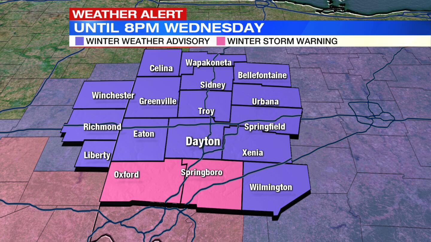
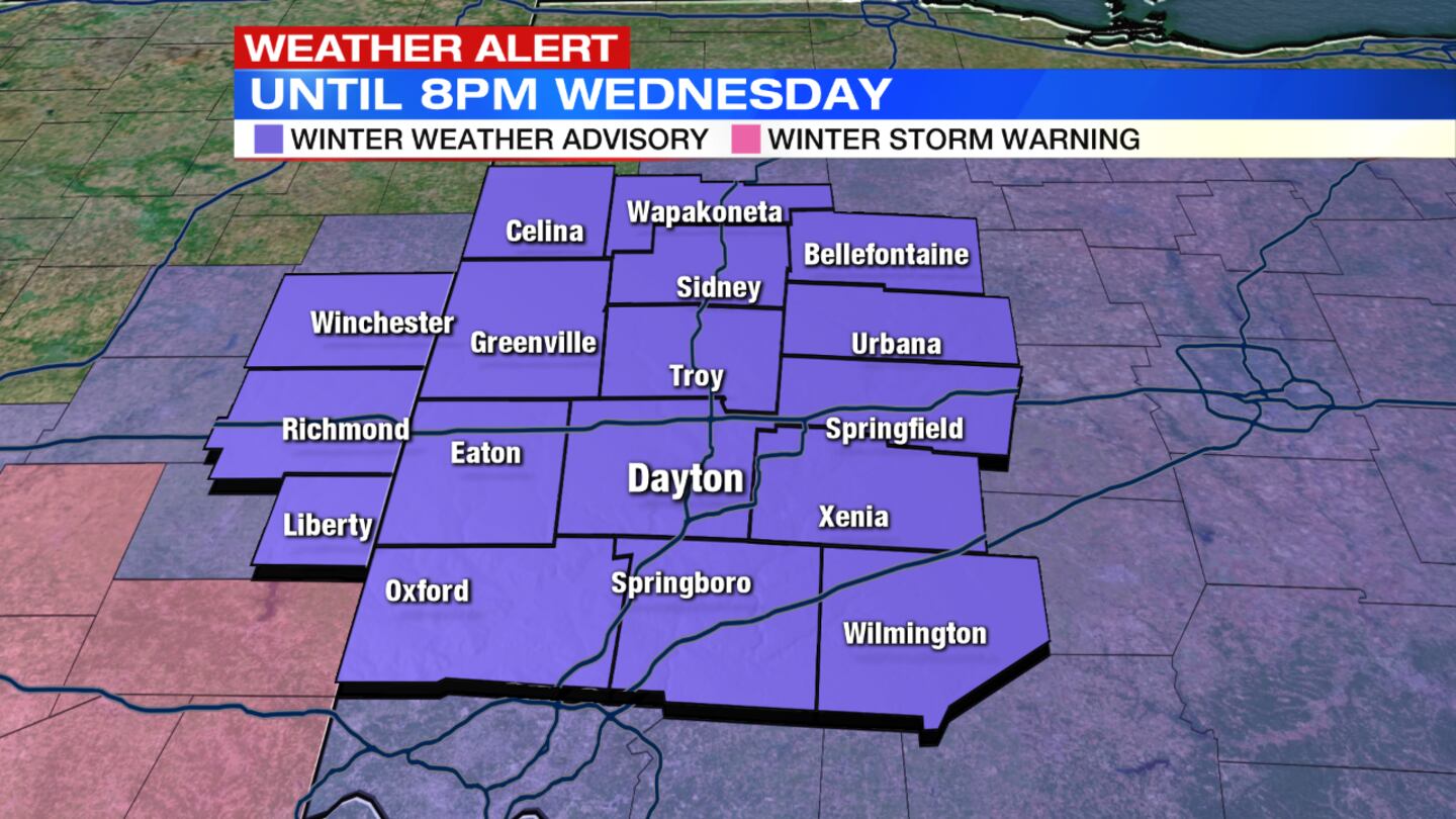
- Winter Weather Advisory continues until 8 p.m. Wednesday for all
- Winter Storm Warning issued for Butler and Warren Counties
- Mix of rain and snow changing to snow overnight
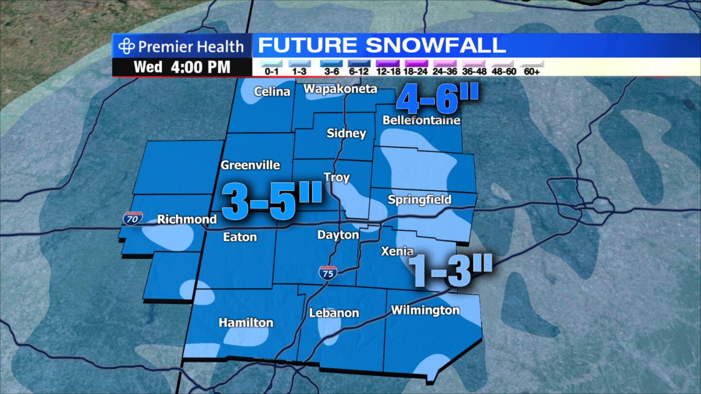
- 3 to 5 inches possible through this morning
>>Track the latest conditions with Live Doppler 7 Radar
>>UPDATING: School and business delays and closings
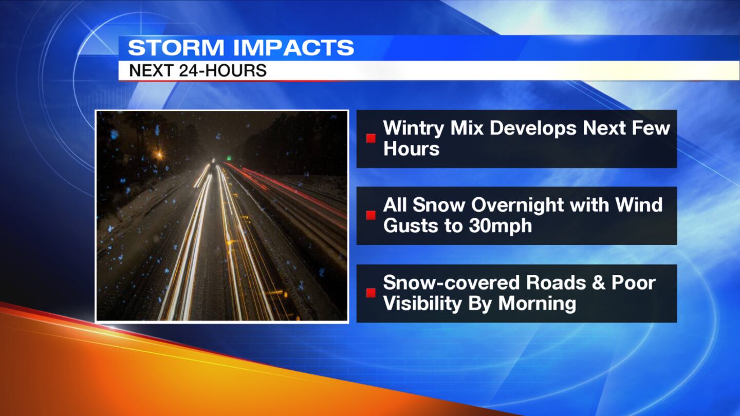
DETAILED FORECAST
TODAY: The Winter Weather Advisory continues for all until 8 p.m. Wednesday. A Winter Storm Warning has been issued for Butler and Warren Counties until 8 p.m. Wednesday as well
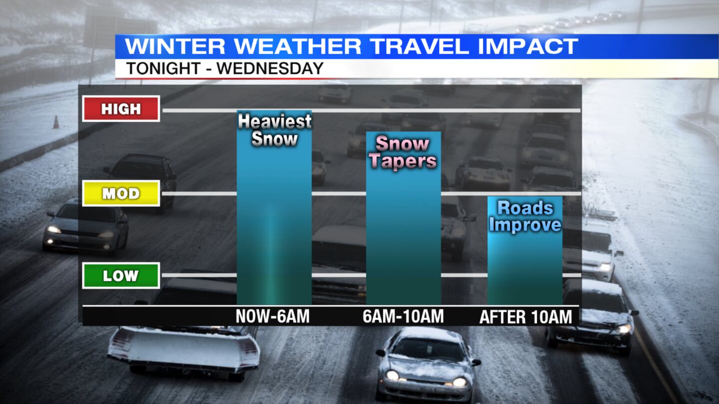
Snow is falling steady enough that roads are covered and will continue to take on new snow through the night. "Snow stays pretty widespread with some pockets of intensity through the morning drive", said Storm Center 7 Meteorologist Kirstie Zontini.
Moisture pulls away with this system and some showers should begin to fizzle out towards lunch.
Winds will be gusty especially north of I-70 early this morning. 20 to 30 mph gusts are possible late this afternoon everywhere once snow stops, which can keep the threat for blowing and drifting.
RELATED: Commutes on Tuesday, Wednesday will be messy: What you need to know
>> Don't deflate tires to drive on ice, snow
THURSDAY: Skies will become mostly sunny, with high temperatures in the low 40s.
>> Remember these things when driving in snow
FRIDAY: Sunny skies to start the day. Clouds will increase in the afternoon. Highs in the low 40s.
SATURDAY: There is a chance of snow in the morning, possibly mixed with rain. A wintry mix or rain will linger into the afternoon. Highs will top out near 40.
>> WHIO Doppler 7 Interactive Radar
SUNDAY: Skies are expected to clear, with highs in the lower 40s.


