A clipper-type system will push through southwest Ohio this weekend, but it’s too early to tell the storm’s track.
Snow is expected Saturday, with a good chance for accumulation.
“At this point it’s safe to assume areas southwest of Dayton will see the highest snowfall totals, but the exact amount is still in question”, according to Storm Center 7 Meteorologist Brett Collar.
>> Live Doppler 7 Interactive Radar
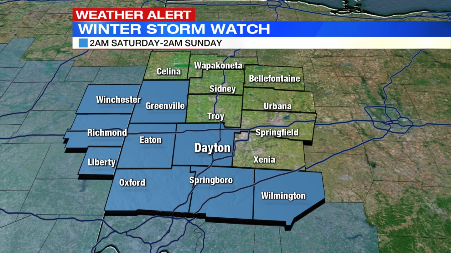
With this storm having a sharp gradient between a lot of snow and no snow, there's still some tweaking needed over the next day or so.
INITIAL REPORT:
A line of winter weather is expected to blast through southwest Ohio on Saturday, but it’s too early to say who will get the most punishing hit.
“Here’s the bottom line: It’s an intense system and someone is going to see a lot of snow, we just don’t know where it’s going yet,” said Storm Center 7 Chief Meteorologist Eric Elwell. “Right now, it looks like either Dayton or Cincinnati will get nailed.”
Elwell said it looks like there could be a “sharp cut-off” for who gets snow, and who doesn’t.
“It’s very possible that Cincinnati could get 6-plus inches of snow, and Dayton gets an inch or less. That’s how sharp we expect it to be,” Elwell said.
Right now, Oxford, Hamilton and Middletown appear to be in the direct track of the storm.
“We believe between Dayton and Cincinnati will see a lot of snow,” Elwell said. “But any small deviation in the track will play a huge role in who see’s what.”
Sunday is expected to be a pleasant end to the weekend with highs in the mid 40s and clear skies. Monday brings warm temperatures to start the new week with sunshine and highs in the low 50s.


