Some clouds will arrive late, but it will remain dry. Temperatures will fall to near zero overnight, Storm Center 7 Chief Meteorologist Eric Elwell said.
QUICK-LOOK FORECAST
- Temperatures back to near zero tonight
- Chance for snow returns to end the week
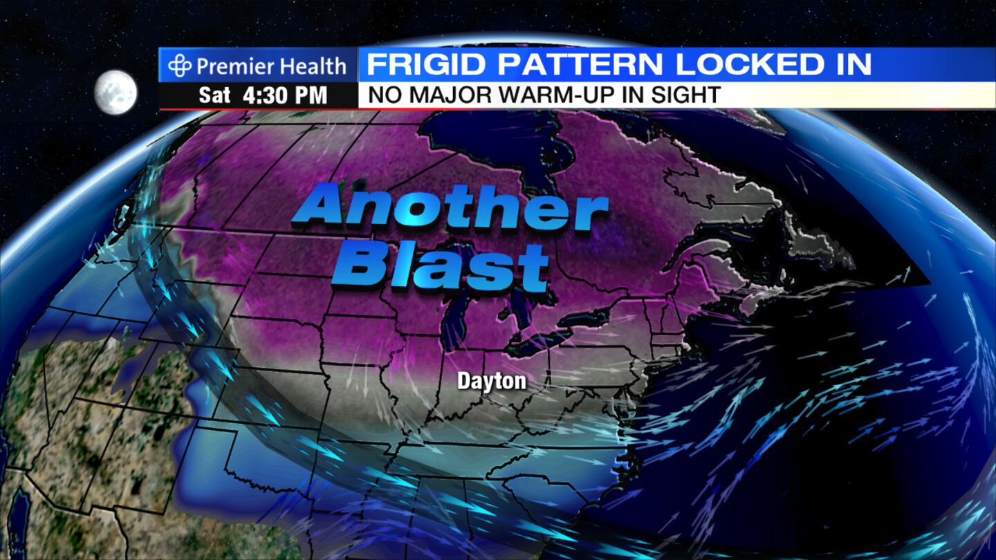
- Another blast of arctic air for the New Year
>> Bundle up: New blast of arctic air, snow on the way
DETAILED FORECAST
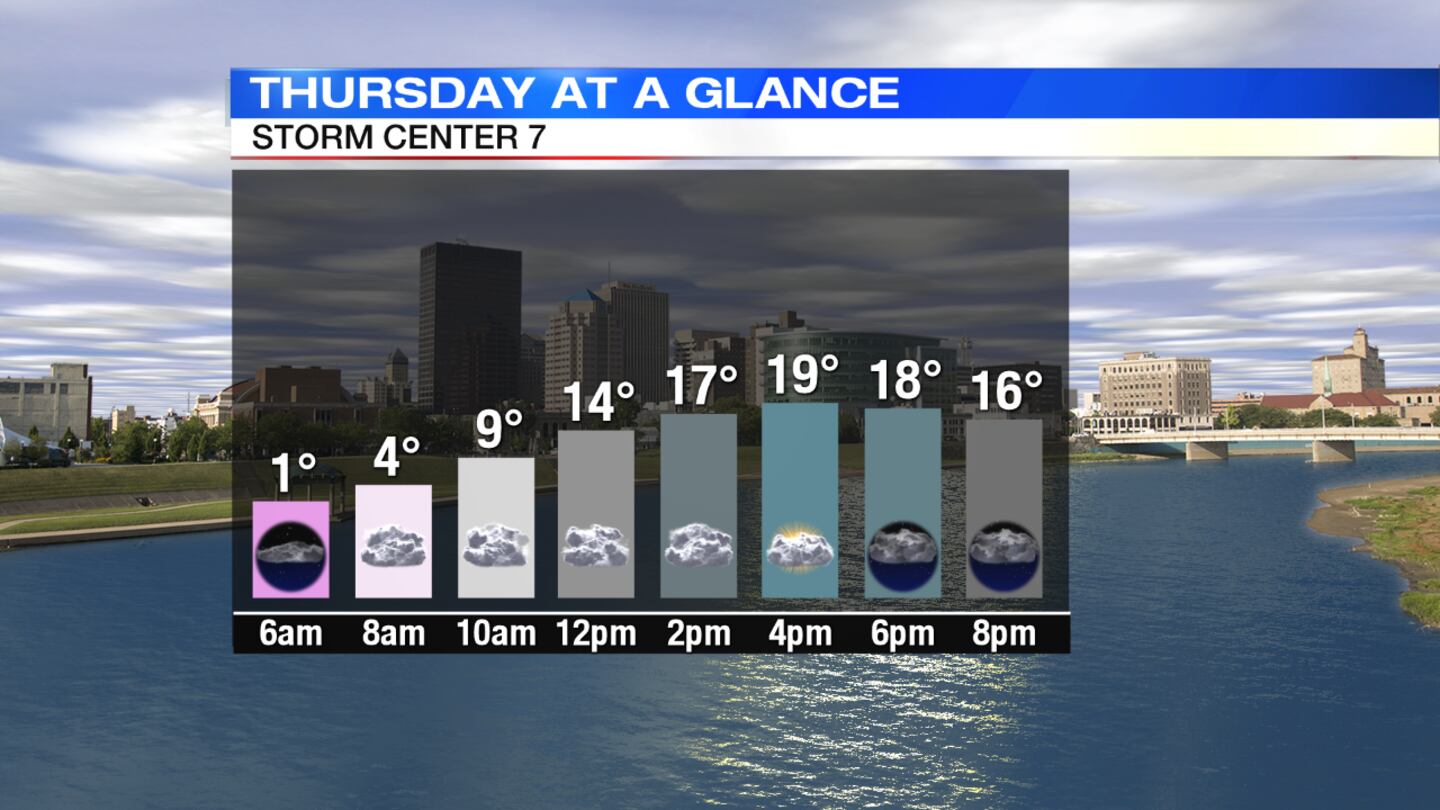
Thursday: Skies will be mostly cloudy through the day. It will remain cold with highs in the upper teens to near 20 degrees.
>> Pets need protection from dangerously low temperatures, too
Friday: Expect cloudy skies with a chance for flurries or snow showers, mainly north and more likely toward evening. Temperatures will rise into the middle 20s, and it will become blustery.
>> Cold keeps AAA crews busy, mainly for dead batteries; Is your car ready?
Saturday: Scattered snow showers are expected, mainly early in the day. Snow accumulation of around 1" will be possible. It will be blustery and colder again with highs only in the middle teens and wind chills falling back below zero.
RELATED: 5-Day Forecast
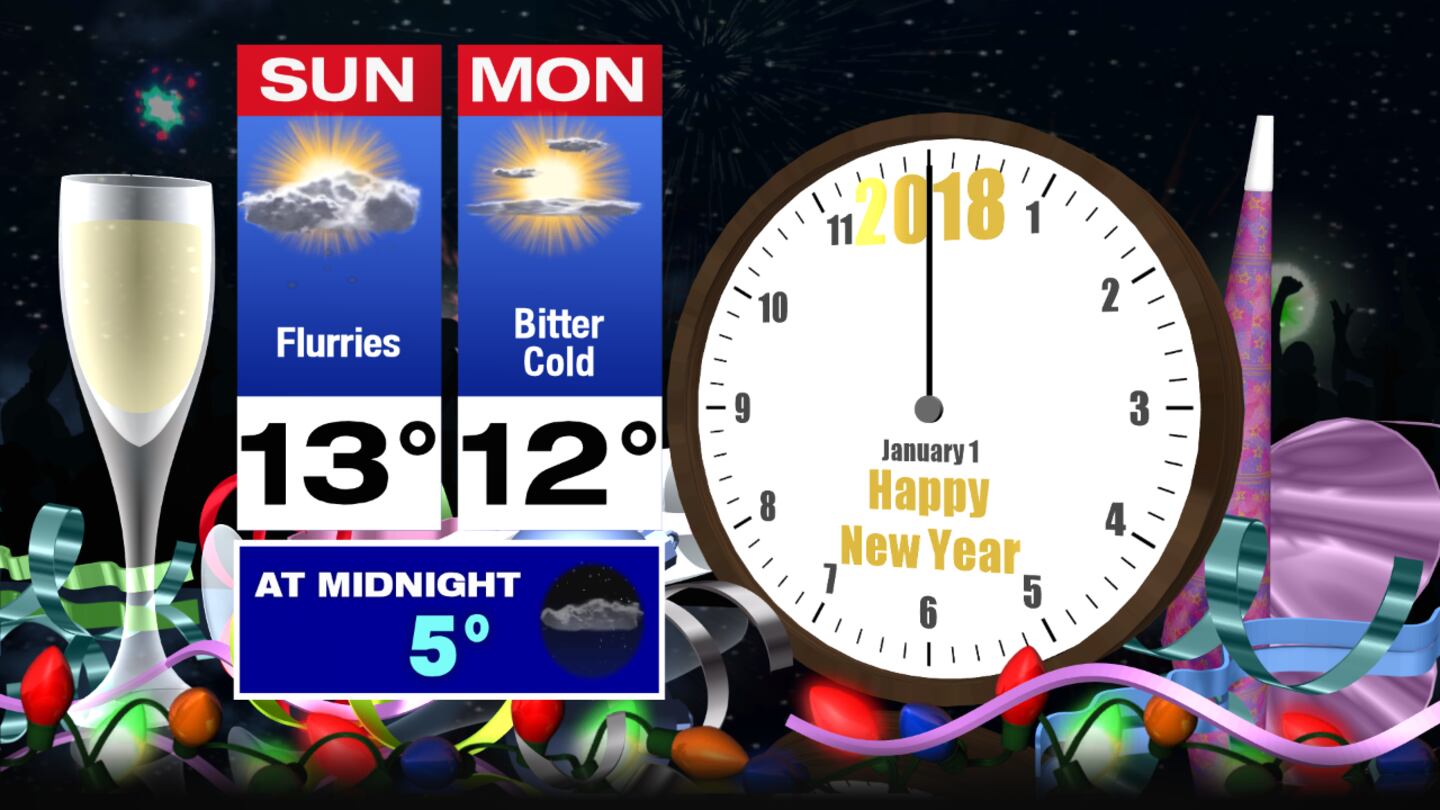
New Year's Eve: A mix of sun and clouds is expected Sunday with high temperatures only in the lower teens. There will be a chance for some passing flurries. Temperatures at night will fall back into the single digits to near zero.
>> WHIO Doppler 7 HD Interactive Radar
New Year's Day: Temperatures will start near or below zero on Monday with highs only in the lower teens despite mostly sunny skies.


