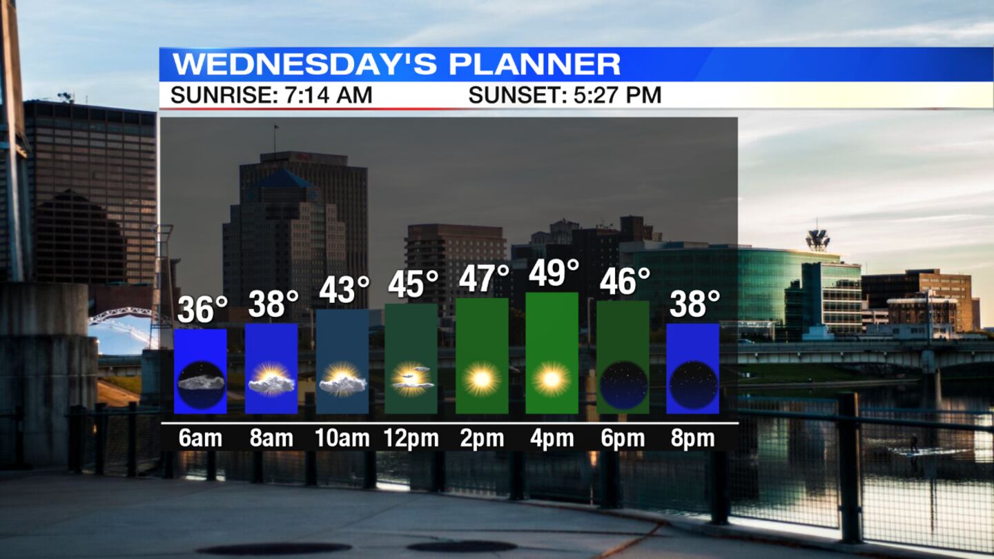
Skies gradually clear with lows falling into the middle 30s, Storm Center 7 Chief Meteorologist Eric Elwell said.
RELATED: Dayton Interactive Radar - WHIO Doppler 7
QUICK-LOOK FORECAST
- Below normal temperatures through weekend
- Chills in the teens Friday, Saturday mornings
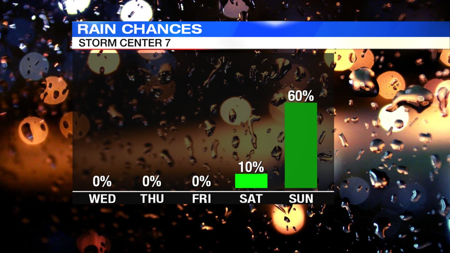
- Showers return on Sunday
- Flood warning until 5:15 a.m. Wednesday for Little Miami River in northeast Warren County and southwest Greene County
DETAILED FORECAST
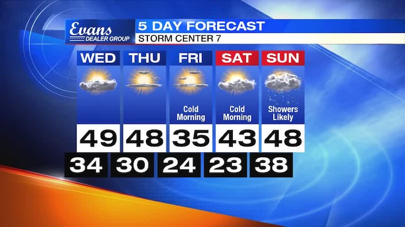
sunshine. Highs only reach the upper 40s, about 10 degrees below normal. Skies but cold at night with lows aroud 30 degrees.
Thursday: A cold morning with temperatures climbing through the 30s to start. A dry day with sunshine and a few afternoon clouds and highs reaching the upper 40s.
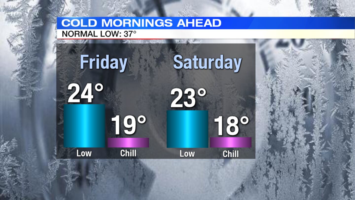
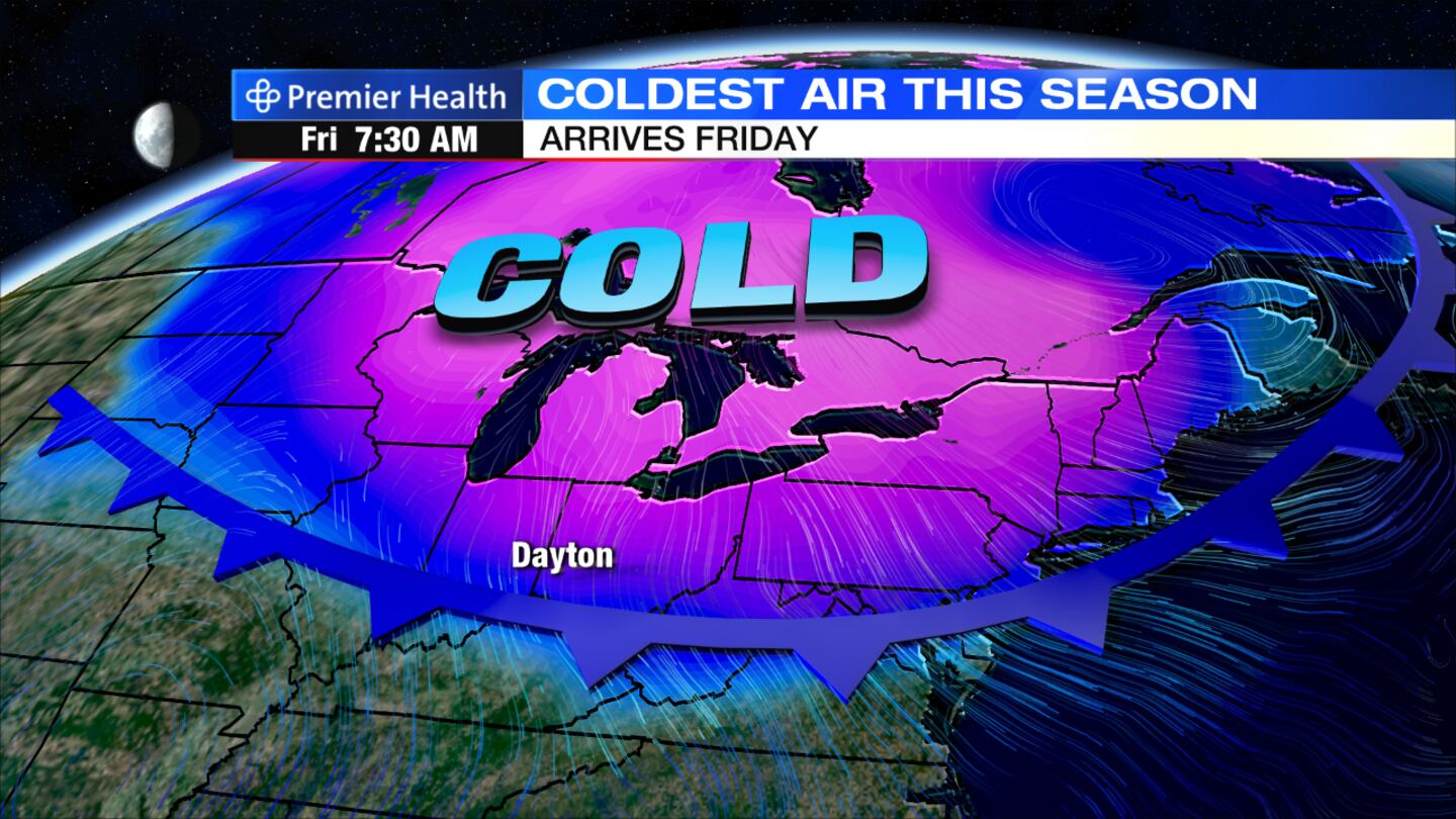
Friday: Morning temperatures will be below freezing in the 20s, but it will feel even colder with wind chills in the teens. The afternoon will be sunny and cold with highs in the middle 30s.
Saturday: Another morning with temperatures in the 20s and wind chills in the teens is expected. Clouds will increase through the day, which will be chilly with afternoon highs in the lower 40s.
Sunday: A cold front will arrive and bring scattered showers. A breezy and chilly day with highs in the upper 40s.