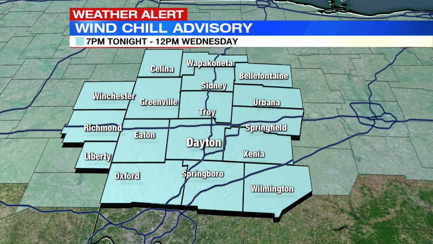
A Wind Chill Advisory is in effect with mainly clear skies and bitter cold. “Wind chills are expected to fall below minus 10 degrees with some as low as 20 below zero by morning,” Storm Center 7 Meteorologist McCall Vrydaghs said. The advisory is in effect until noon Wednesday for the entire region, except for Randolph County, Indiana, where the advisory ends at 7 a.m. Wednesday.
>> What does wind chill mean and how is it calculated?
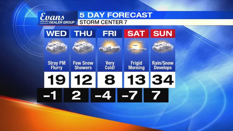
QUICK-LOOK FORECAST
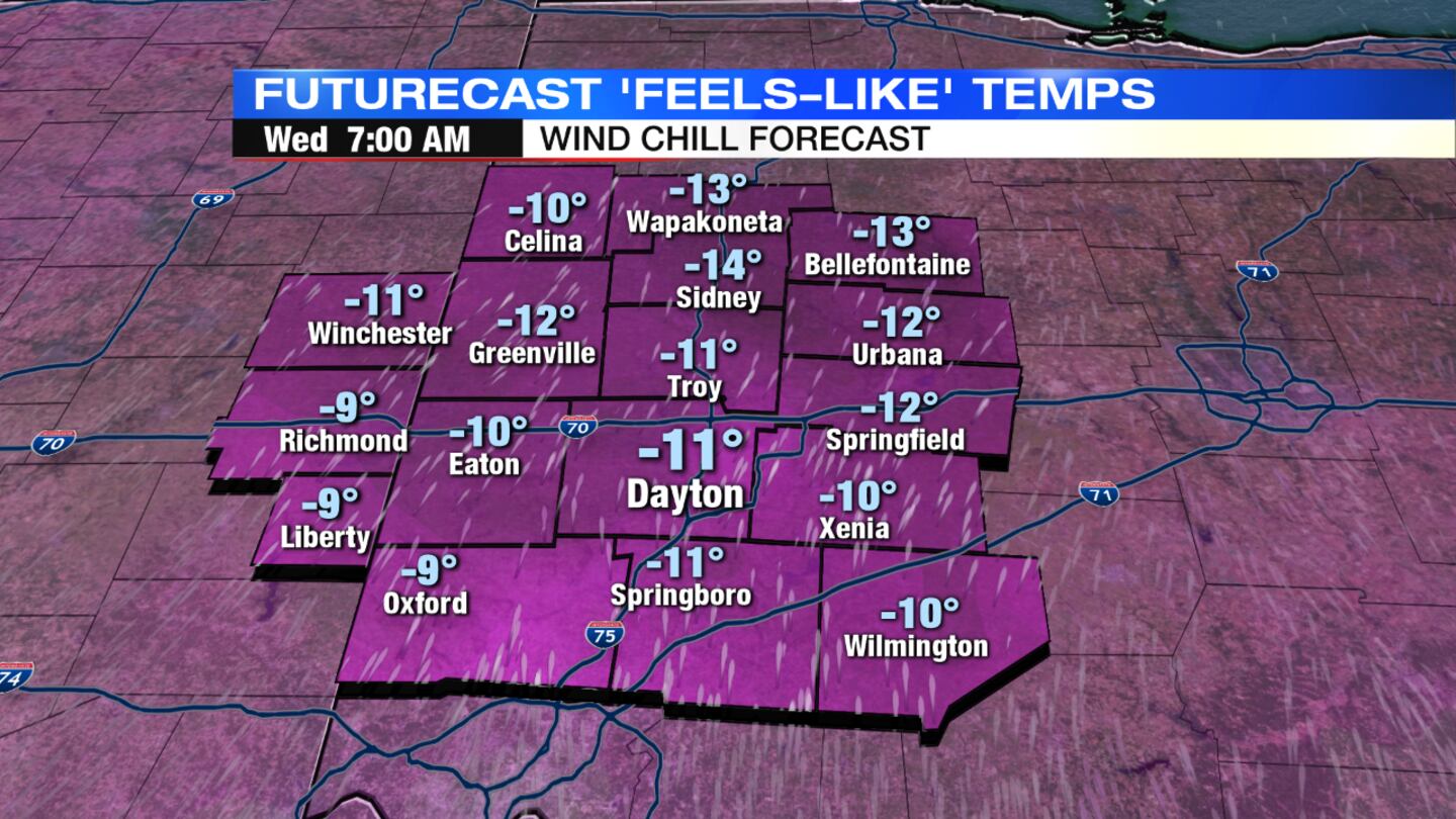
- Wind chills between minus 10 and minus 20 tonight
- Below freezing temperatures into the weekend
- Few flurries or snow showers Wednesday and Thursday evening
>> Download the WHIO Winter Weather App to track conditions on your mobile device
DETAILED FORECAST
WEDNESDAY: A frigid morning with temperatures near zero and wind chills ranging between 10 below zero and 20 below zero. Clouds are expected to gradually increase through the day as a cold front approaches from the north, Vrydaghs said. Temperatures will reach highs near 20 degrees but wind chills will make it feel like the single digits. A few passing snow flurries or snow showers are possible towards the late afternoon and evening. "We're not expected much more snow to stick than a possible dusting in some spots," Vrydaghs said. Overnight lows will fall back into the lower single digits but will feel close to zero.
RELATED: Tuesday’s low temperature shatters 120-year-old record
>> Lose power in the cold? Here’s what to do
THURSDAY: A cold start to the day once again with temperatures starting out in the single digits. Mostly cloudy skies are expected with a few passing lake-effect show snowers in the evening, mainly in northern counties. Highs for the day will be in the lower teens but will drop quickly into the night. Lows will be below zero by Friday morning.
PHOTOS: Cold weather blasts the Miami Valley
PHOTOS: Cold weather blasts the Miami Valley
FRIDAY: Sub-zero temperatures to start the day with wind chill values as cold as 15 below zero. Some sunshine during the day, but still a cold day with highs only in the upper single-digits.
>> Frostbite injuries reported as temperatures plummet
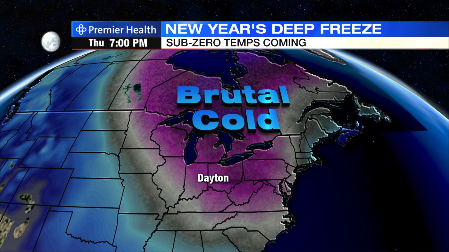
>> Record low temperatures continue to drop for the new year
SATURDAY: Mostly sunny skies and frigid temperatures. Temperatures will start around 7 below zero and only reach a daytime high in the lower teens.
SUNDAY: Mostly cloudy skies, finally with a break in the bitter cold. Highs will climb into the lower 30s as rain and snow showers develop into the evening.


