QUICK-LOOK FORECAST
- Snow developing overnight, messy roads by morning
- More accumulating snow tonight
- Temperatures slowly moderate by Friday
TRENDING: More rounds of snow, winter weather coming this week
UPDATE @ 12:10 a.m. (Jan. 6): The Auglaize County Sheriff's Office is advising people to drive cautiously as blowing and drifting snow has made some roadways hazardous.
DETAILED FORECAST
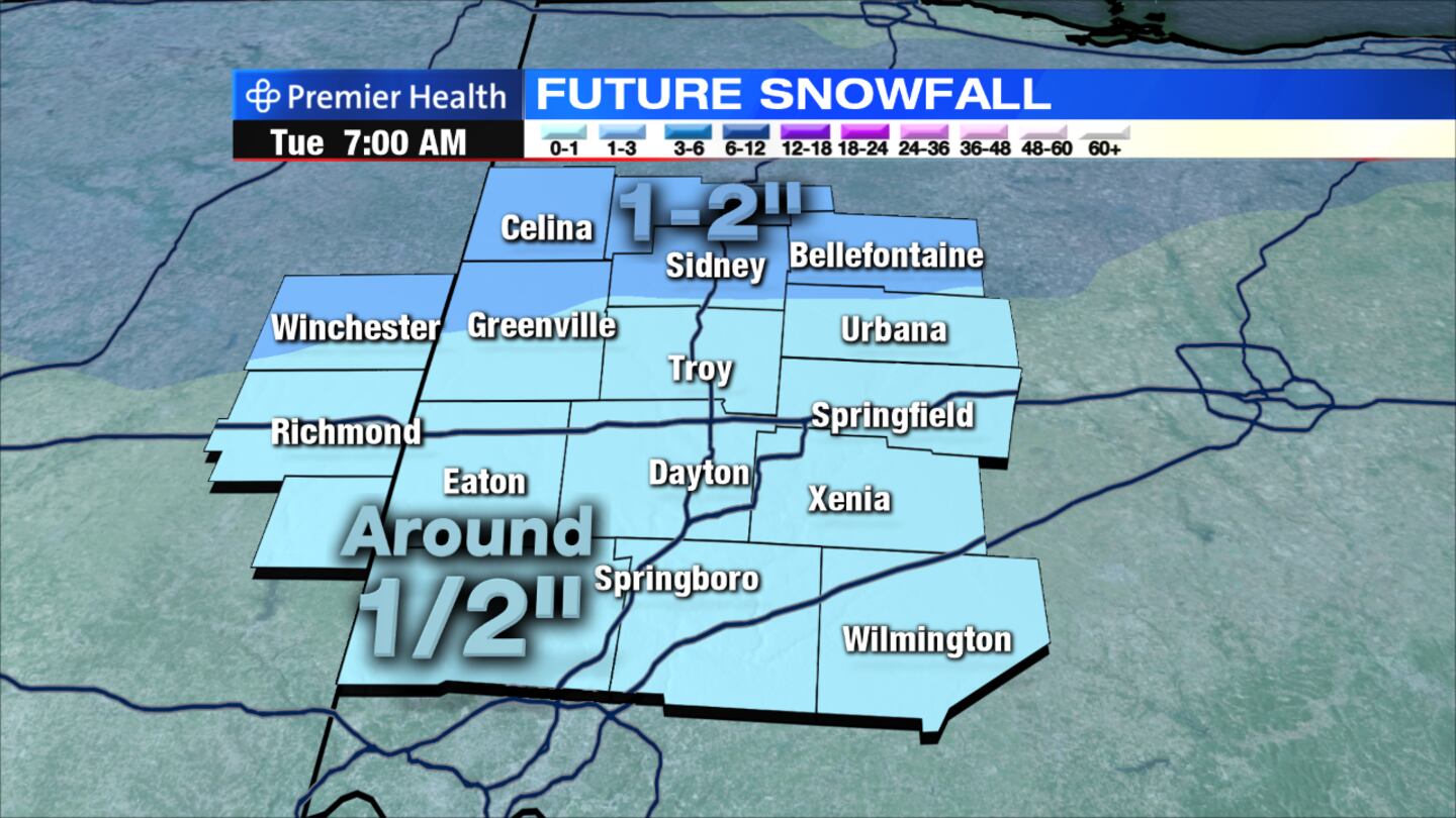
Overnight: Light now likely through pre-dawn. Snow accumulations of up to an inch will be possible for most -- more across northern Miami Valley. Temperatures will hold to about 20 degrees.
>> Winter Weather Awareness: How does salt help melt ice on roads?
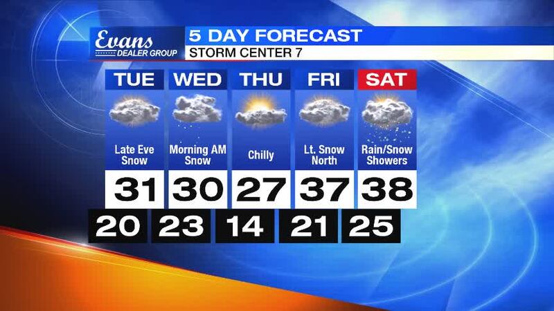
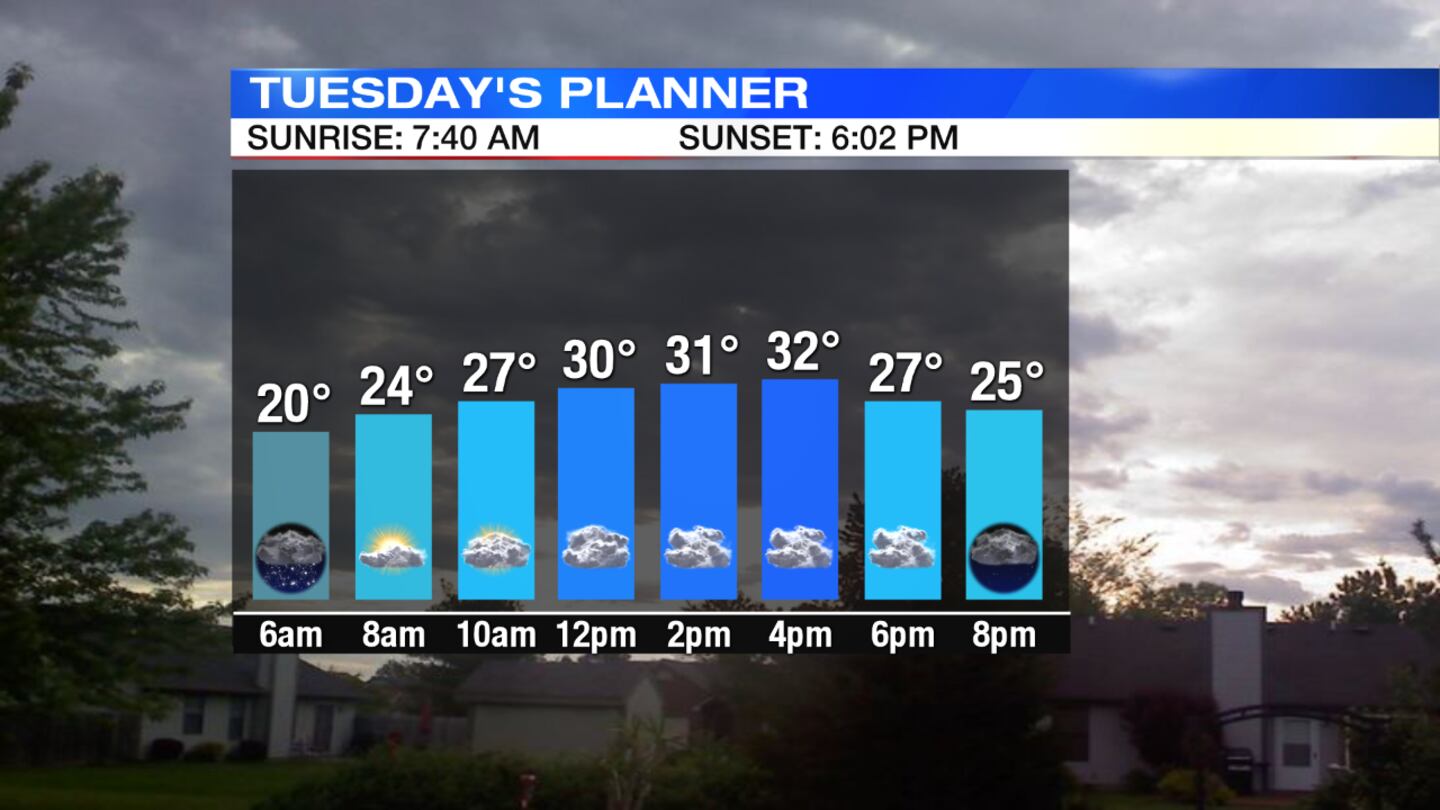
Today: Slick spots will be possible in the morning. Snow will be ending early. Skies will be mostly cloudy through the day. More snow expected to develop by late evening and continue into tonight. Temperatures will climb to near 30 degrees.
Download the WHIO Weather App
Wednesday: Snow will be likely in the morning with total accumulations of 1 to 3 inches. Skies will remain mostly cloudy with highs near 30 degrees.
>> School business closings & delays
Thursday: Expect a mix of sun and clouds with highs in the upper 20s.
Friday: Lots of clouds are expected with a chance for snow showers, mainly across the northern Miami Valley. Highs will be in the upper 30s.
Saturday: Mostly cloudy skies will start the weekend with a chance of rain or snow showers toward evening. Highs will be in the upper 30s.


