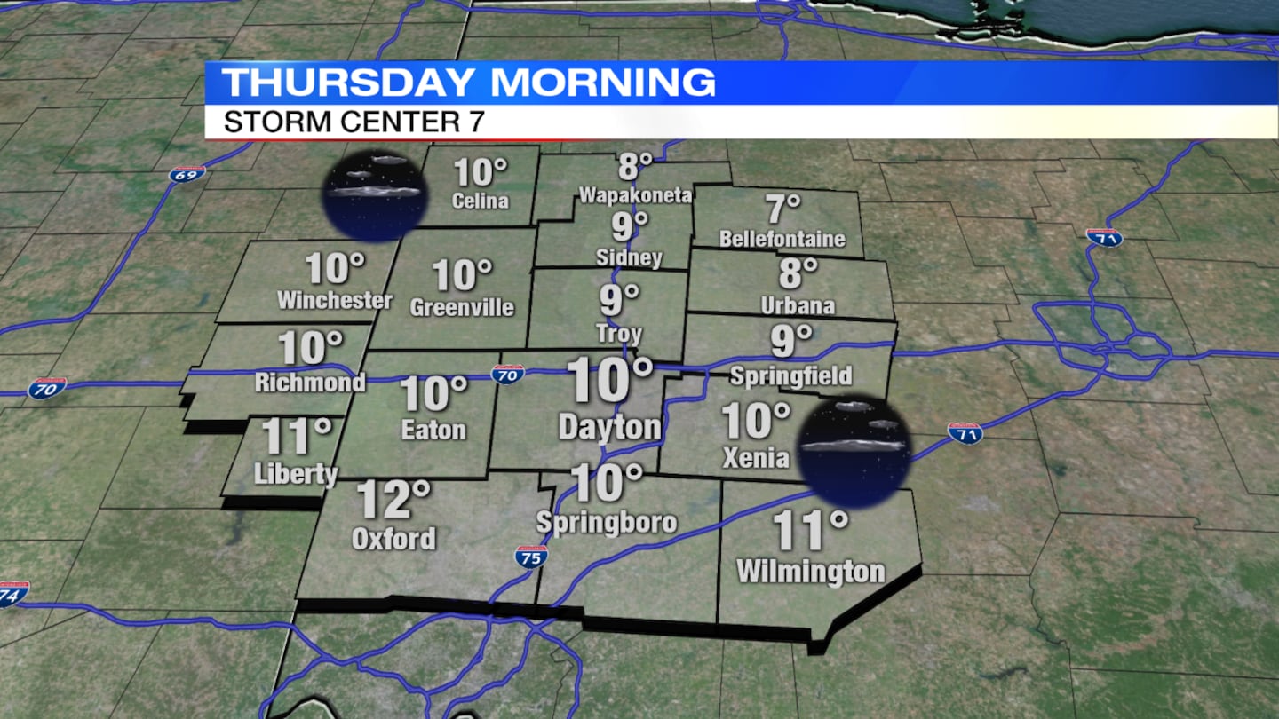
Wind chills will fall to around zero degrees under mainly clear skies overnight, Storm Center 7 Chief Meteorologist Eric Elwell said.
>> Another eclipse is on the way, featuring a ‘Blood Moon’
QUICK-LOOK FORECAST
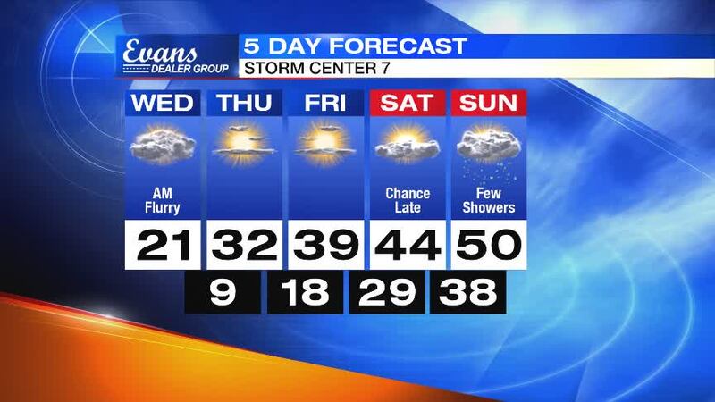
- Another cold night ahead
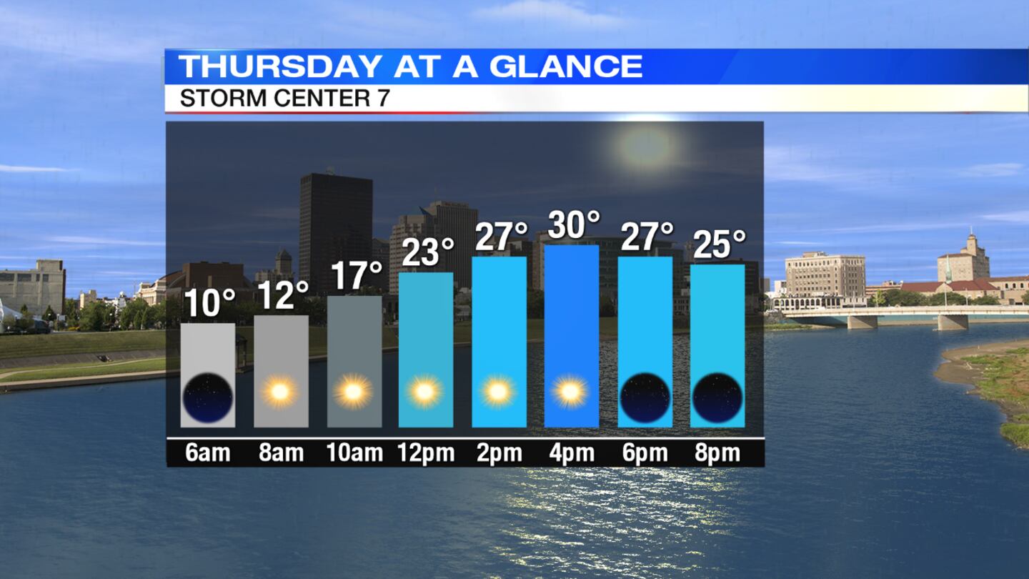
- Dry, temperatures approach freezing Thursday
- Warm-up continues, chance for rain this weekend
>> WHIO Doppler 7 HD Interactive Radar
DETAILED FORECAST
Thursday: Sunny skies return with a slow warm-up getting underway. Highs will be near 30 degrees by late afternoon.
>> WATCH: Meteor spotted in Ohio, Michigan, Canada
>> VIDEO: Mountains of thick ice pile along shores of Lake Erie
Friday: Mostly sunny and breezy at times with highs reaching the middle 30s.
>> 4 tricks to help avoid illness during big temperature changes
Saturday: Clouds increase through the day with temperatures in the lower 40s.
Sunday: Cloudy skies with a chance for rain showers. Highs will be above normal in the upper 40s.
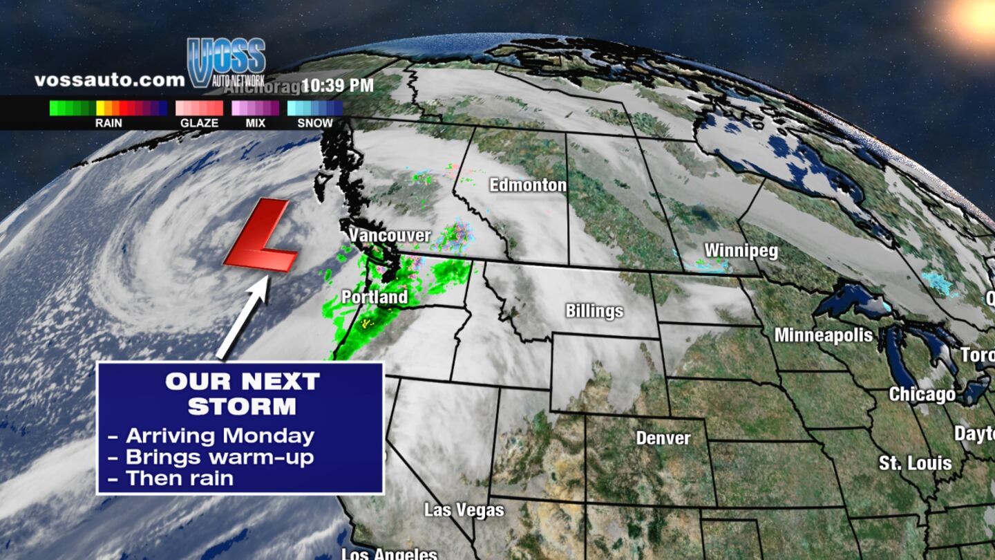
Monday: Cloudy skies, gusty winds, and rain showers during the day. Highs will reach near 50 degrees early, but will fall in the afternoon. Rain may mix with, or briefly change to snow, before tapering off Monday evening.