- A few showers, flurries tonight
- Much colder to end the week
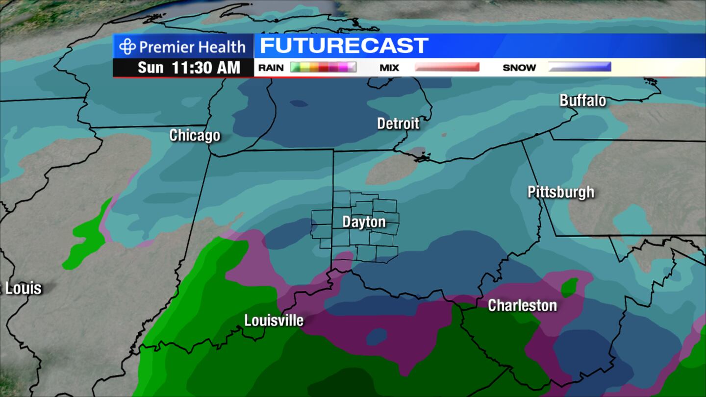
- Storm could bring accumulating snow this weekend
>> WHIO Doppler 7 Interactive Radar
DETAILED FORECAST
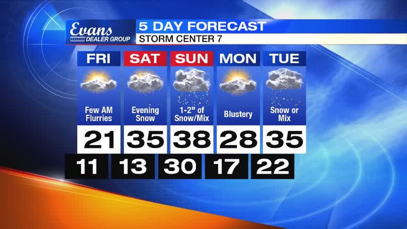
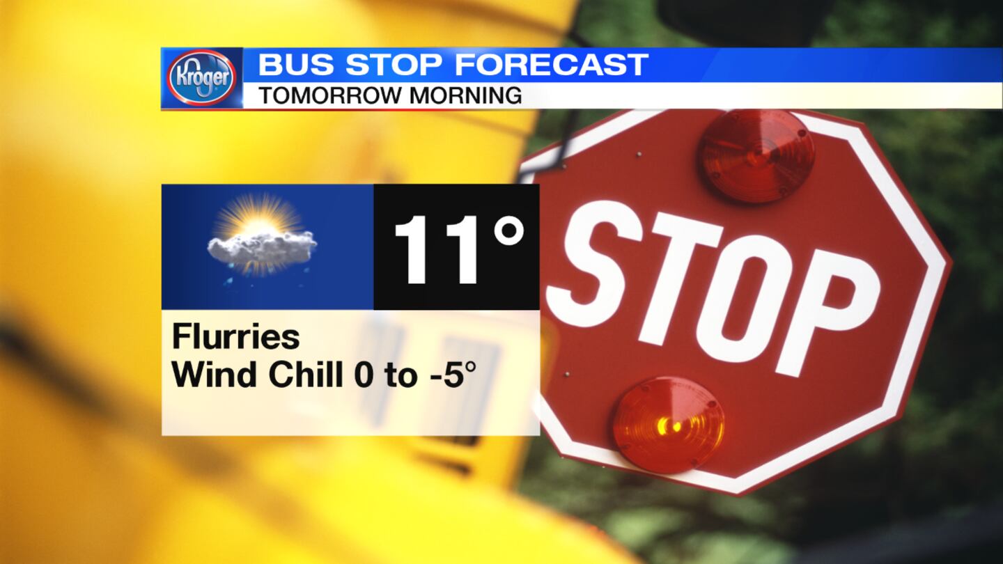
Tonight: Expect mostly cloudy skies with a chance of flurries developing after 3 a.m. It will turn much colder, with lows dropping into the lower teens and wind chills dipping below zero by morning.
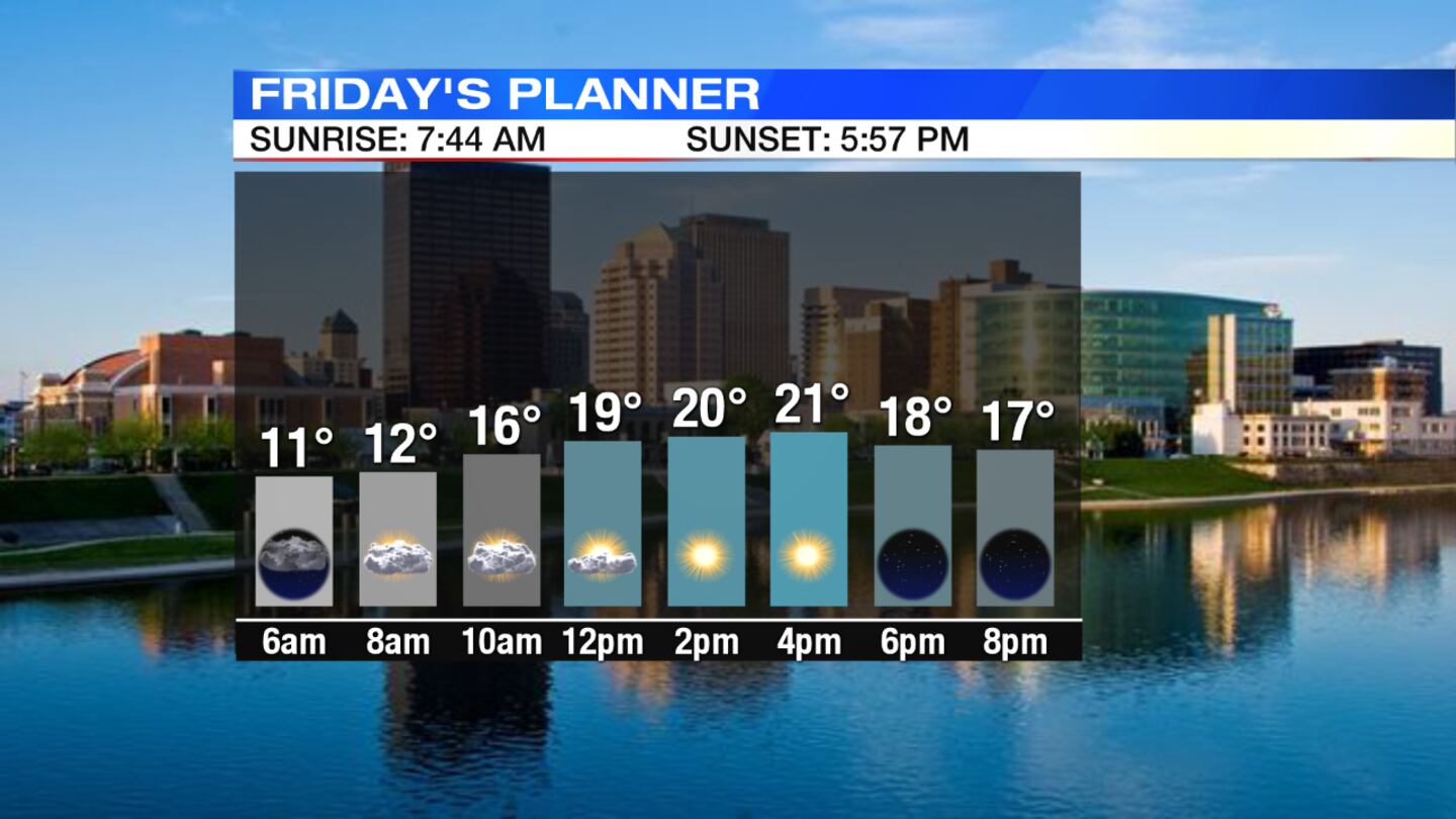
Friday: Some flurries will be possible in the morning with clouds breaking through in the afternoon. It will remain blustery and cold with highs only in the lower 20s.
Saturday: Clouds will thicken with snow developing in the evening. Snow accumulation will be possible at night. Temperatures will reach the middle 30s in the afternoon.
Sunday: Snow will be likely in the morning with some accumulation possible. Snow may mix with rain in the afternoon. Highs will reach the upper 30s.
Monday: Skies will be partly sunny with colder temperatures in the upper 20s. There is a chance for snow by late evening.
Tuesday: Snow showers will be likely. Snow may mix with rain south. Highs will be in the middle 30s.


