Skies will be mostly cloudy overnight. There is a chance for a few flurries or even a passing snow shower, mainly north. Temperatures will fall to around 10 degrees, Storm Center 7 Chief Meteorologist Eric Elwell said.
Track the latest conditions on your mobile device with the WHIO Weather App
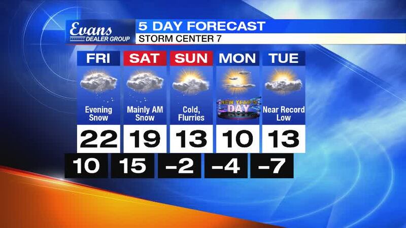
QUICK-LOOK FORECAST
- Chance for flurries north tonight
- Snow likely Friday night into Saturday morning
- Bitter cold to send temperatures below zero next week
>> Record-breaking low temps possible for New Year’s Eve
DETAILED FORECAST
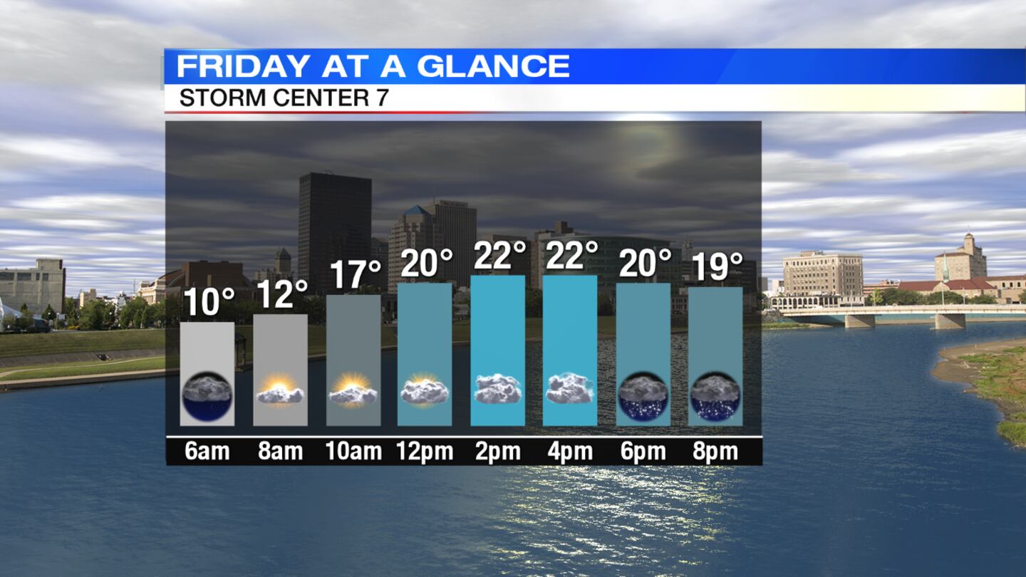
Friday: Mostly cloudy skies are expected with light snow developing toward evening. Due to the cold ground, snow will quickly accumulate. Around 1 to 2 inches of snow is expected through Friday night. High temperatures will climb into the lower 20s but fall into the teens Friday night.
>> Another blast of arctic air, snow on the way
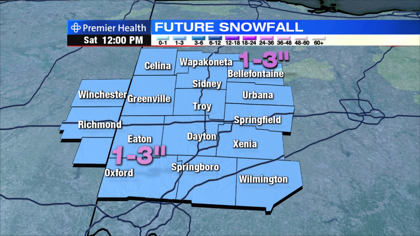
Saturday: It will be blustery and cold with snow showers likely, Elwell said, mainly the first half of the day. Total snow accumulations of 1 to 3 inches is expected. High temperatures will hit the upper teens but fall late in the day. Wind chills will drop below zero.
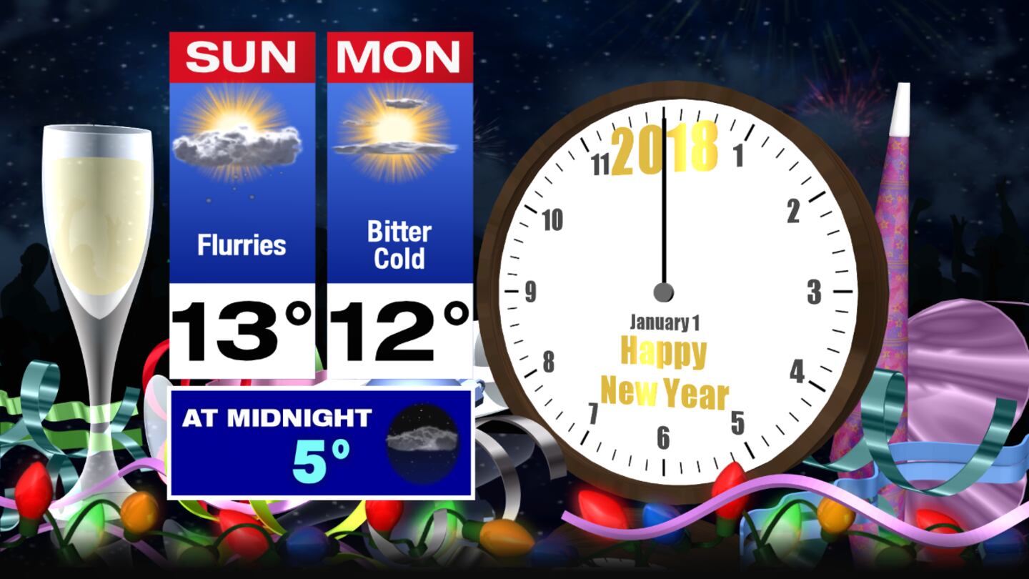
New Year's Eve: Expect a mix of sun and clouds and a chance for some passing flurries on Sunday. Temperatures will start the day near or below zero and climb to the lower teens for highs. Wind chills will be as cold as 10 to 15 degrees below zero.
>> Pets need protection from dangerously low temperatures, too

>> Is your car ready for the cold? Dead battery calls keep AAA crews busy
New Year's Day: Skies will be partly cloudy Monday but it will be bitter cold. The first day of 2018 will start with temperatures below zero and wind chills as cold as 15 degrees below zero. Highs will hold to near 10 degrees.
Tuesday: Mostly sunny and brutally cold to start the day with temperatures from 5 to 10 degrees below zero and wind chills as cold as 15 degrees below zero or colder. Highs will reach back into the lower to middle teens.


