
Clear skies and cold overnight with lows in the upper 20s, Storm Center 7 Meteorologist McCall Vrydaghs said. Areas of patchy fog and frost is expected, with light freezing fog in spots.
>> Freezing fog: What is it and how does it form?
QUICK-LOOK FORECAST
- Clear and cold overnight
- Dry and mild weekend
- Winter blast late next week
DETAILED FORECAST
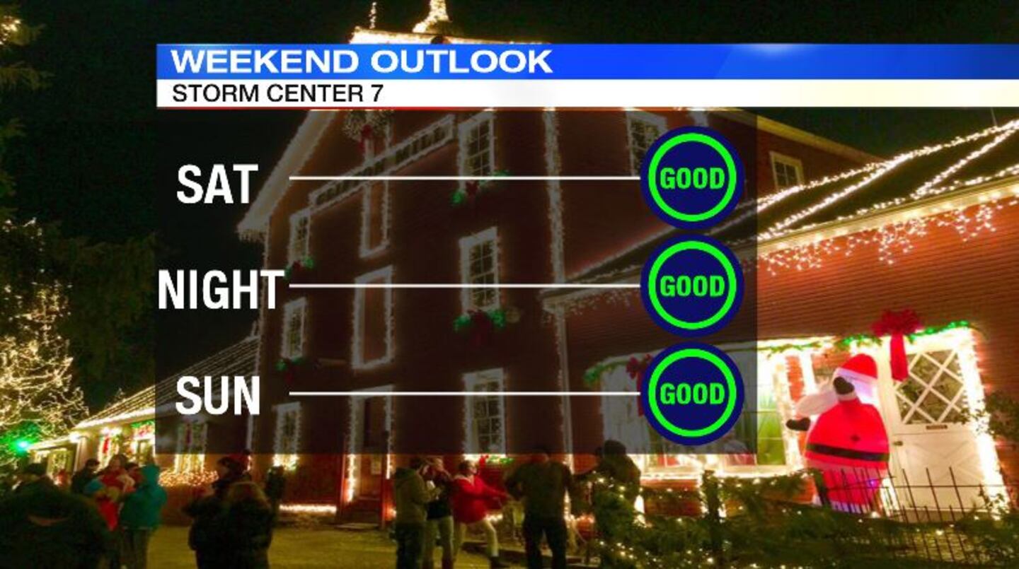
Saturday: Sun with a few scattered clouds during the day. A cold morning followed by a pleasant afternoon with highs around 50 degrees. Skies will clear out for Saturday night and cold again with lows in the lower 30s.
>> Brighter and larger supermoon to appear Sunday
Sunday: A beautiful day expected with lots of sun and highs in the lower 50s.
Monday: Sunshine gives way to clouds during the day. It becomes breezy, but winds out of the south will help to raise temperatures into the upper 50s for the afternoon. Showers arrive from the northwest into Monday night with a cold front.
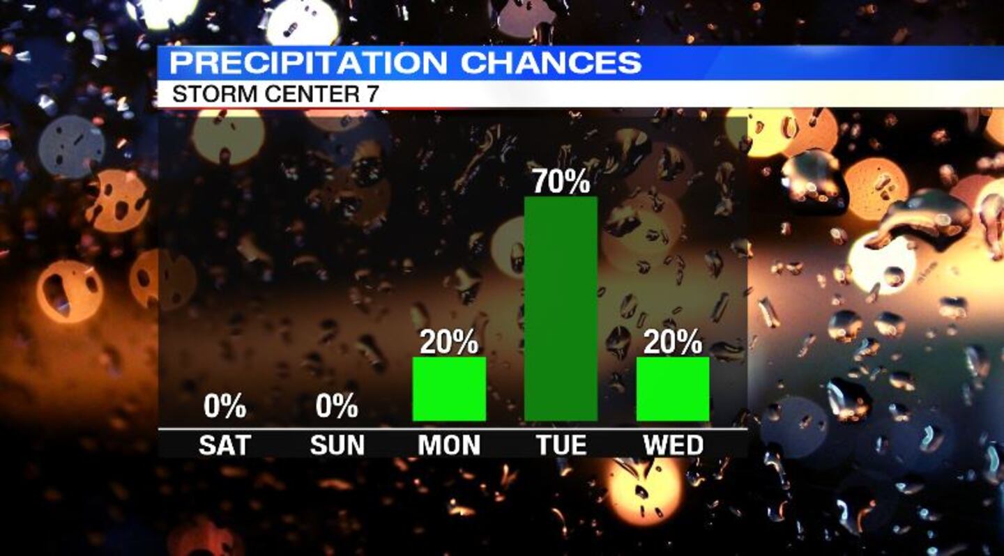
Tuesday: Showers likely, windy and turning chilly. Temperatures will start in the 50s, but fall into the afternoon as the front settles to the southeast. Rain may have a few pockets of moderate downpours. The timing of the front exiting and the cold air moving in is something to watch. There may be some changeover from rain to snow before the precipitation shuts off.
Wednesday: Mostly cloudy, breezy and much colder. Temperatures will range from the upper 20s early to the middle 30s for the afternoon. Wind chills will be in the teens and 20s.